


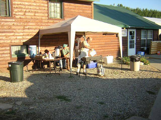
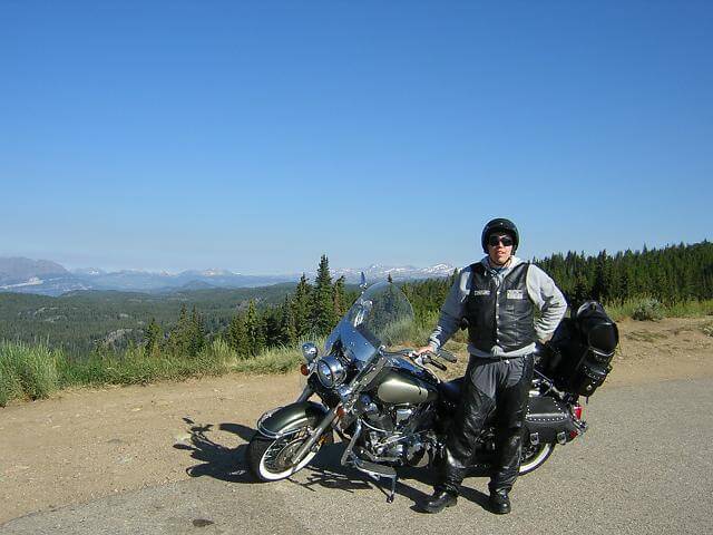
The next morning the alarm went off at 6:15. I prepared myself, packed up my luggage and got my bike ready to go. Larry, the owner of the hotel cooks breakfast every morning outside the hotel office. This morning he made pancakes and eggs, which were delicious and best of all, free!
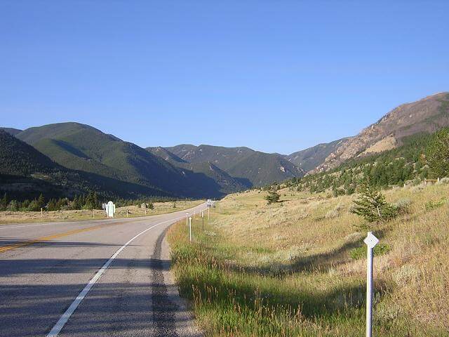
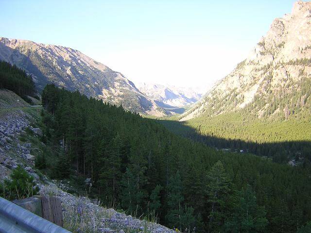
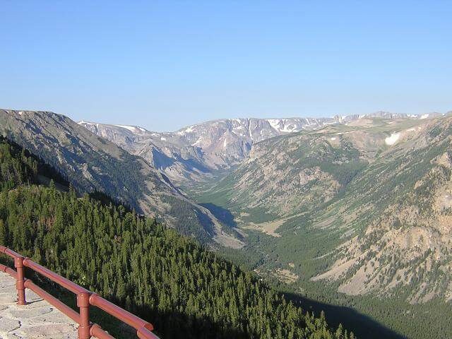
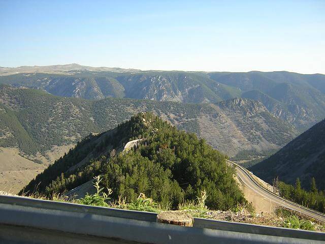
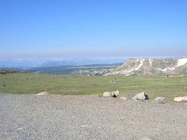
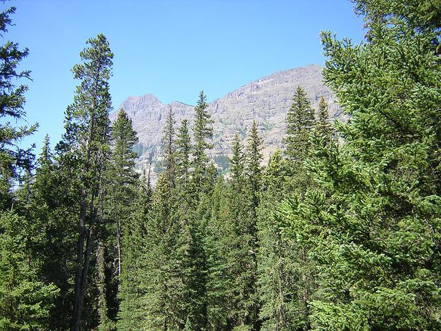
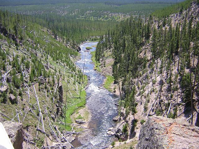
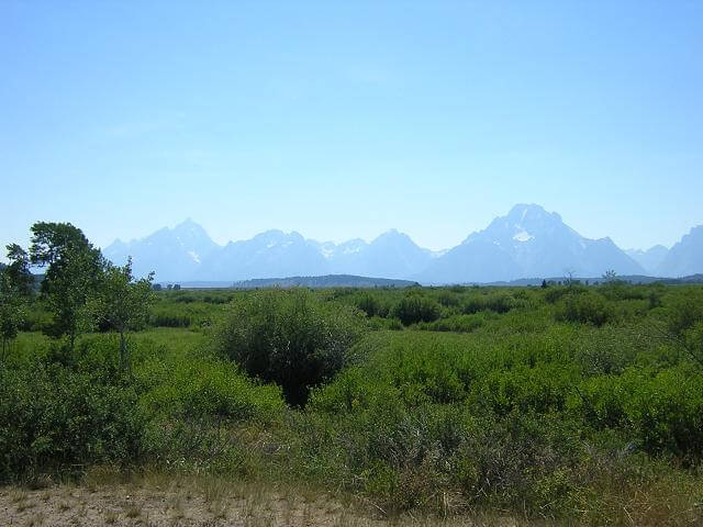
Now came the part of the trip to which I was most looking forward: the Beartooth Highway. This is a 60 mile stretch of highway 212 that heads south out of Red Lodge, climbs to 10000 feet, and travels from mountain peak to mountain peak. Charles Kuralt called this highway the most beautiful in the United States, and I think I have to concur with his opinion. This is the view of the valley leading to the highway.
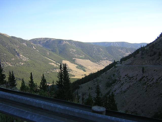
This was a great road. Lots of switchbacks which led to some great floorboard scraping riding. The views were absolutely stunning.
The night before I saw a shirt that read: "Beartooth Highway: real men don't need guardrails."
There were some guardrails, but I have to admit they were intermittent.
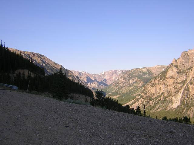
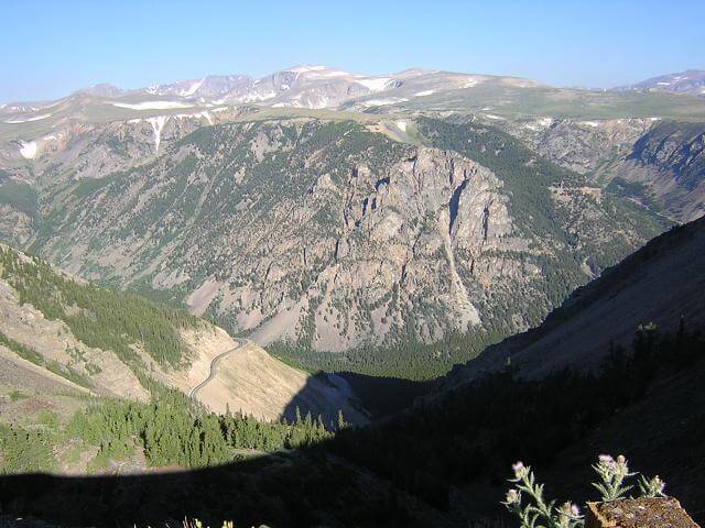
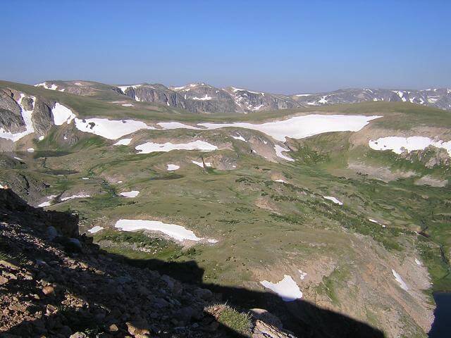
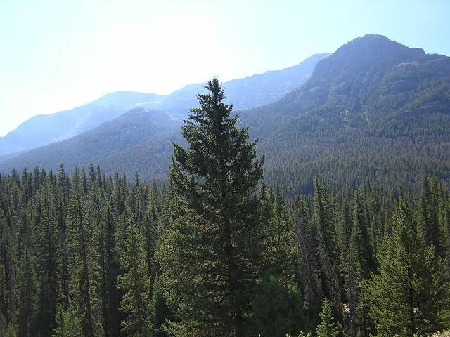
About two thousand feet from the peak there was a lookout point that gave a great view of the valley below.
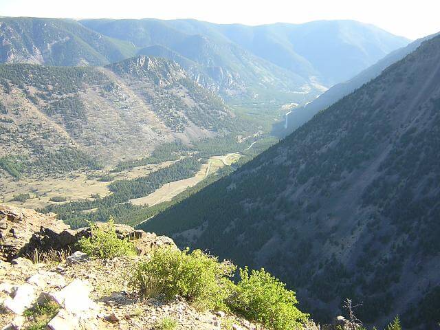
Here's a shot from farther up the mountain that shows the lookout point.
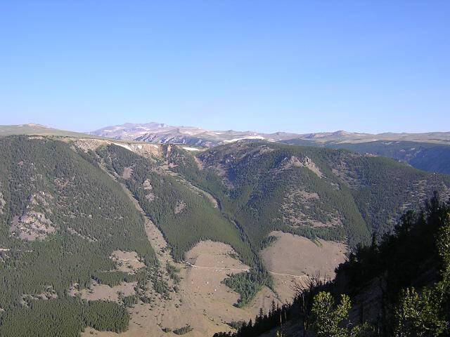
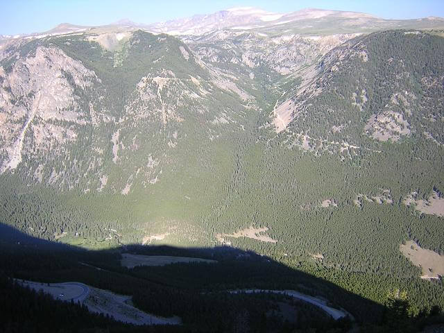
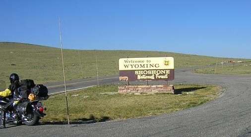
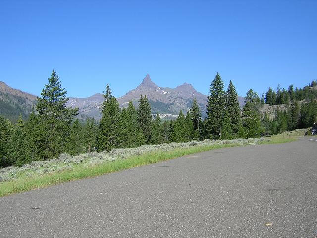
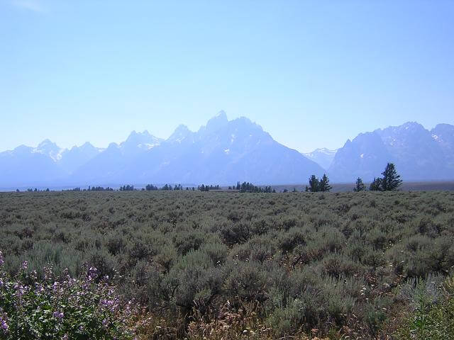
The road kept climbing up and up. Near the peak, is where you cross into Wyoming. I've never seen a mountain range like this one; the tops of the mountain peaks are so flat and green it looks like you could farm them. Not that I'd want to lug seed up this road...
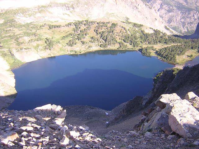
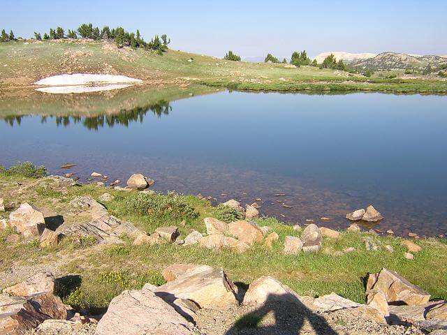
There was no snow the day I traveled on the highway, and the temp was in the upper 50s. According to the locals, it was an warm day for this road. The melting snow fed some of the clearest lakes I've ever seen.
I snapped plenty of pictures, as I knew it would be a while before I could return. I must say that the pictures don't do justice to seeing this highway in person. Pictures also don't let you experience the ride.
Coming down the far side of the Beartooth highway was the "Top Of The World Store". I had planned on stopping at this store when reading about the Beartooth highway, but I was disappointed to discover that it's near the base of the mountain, not at the top. I was so let down that I wound up just riding right on by.
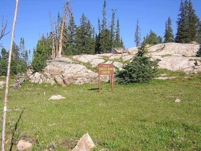
One of the things I had hoped to see on this trip was a grizzly bear (not too close, though!) My hopes were elevated when I saw this sign along the highway.
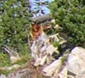
Alas, I never saw a grizzly, or a bear of any type on the whole trip. However, when I was reviewing the above picture after I returned home, I noticed an unusual brown object around the left area of this photo. This shade of brown is not found anywhere else in the photo, or any of my photos for that matter. It also happens to be the same shade of brown as a grizzly bear. I blew up this portion of the photo below, but it isn't clear enough to say for sure. Perhaps I did photograph a grizzly and didn't even know it? You be the judge. Or maybe it's just Bigfoot.
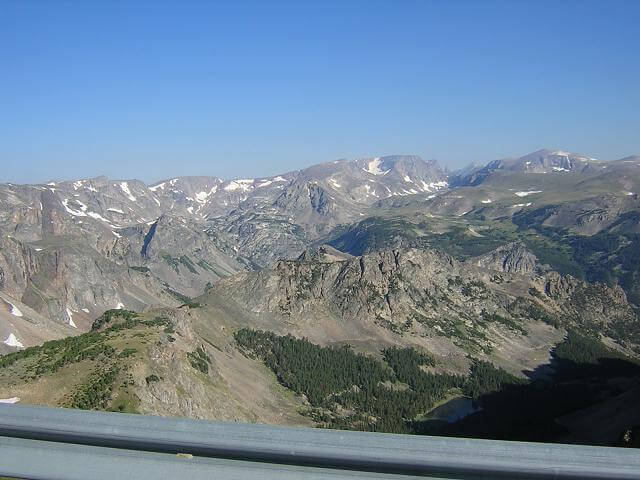
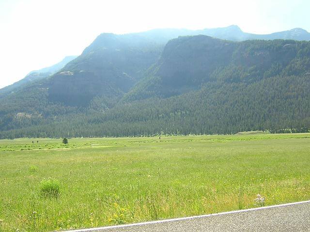
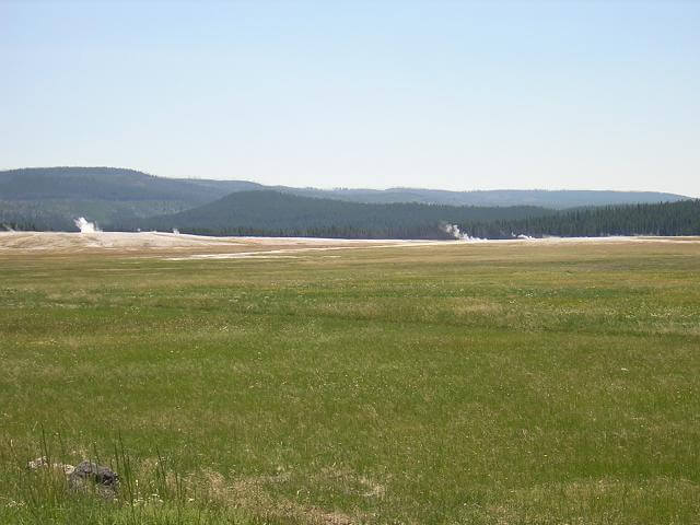
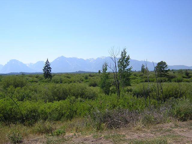
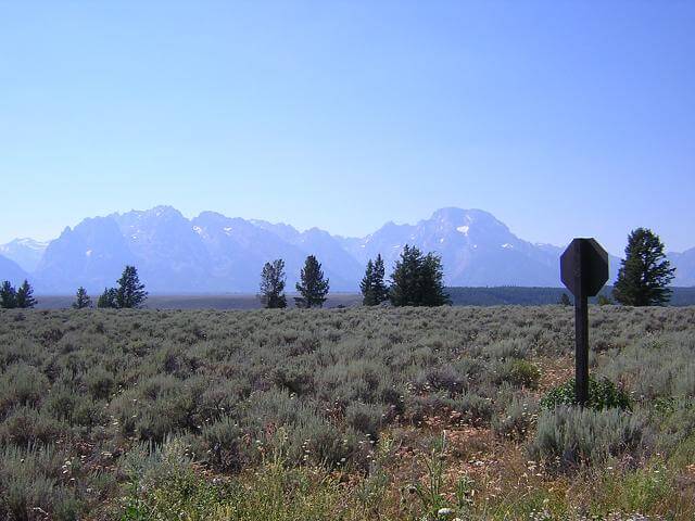
Coming out of the Beartooth highway, I stopped at a scenic lookout area. This gave me a distant view of the northeast entrance of Yellowstone park, where I was headed. At this point I was about 20 miles away.
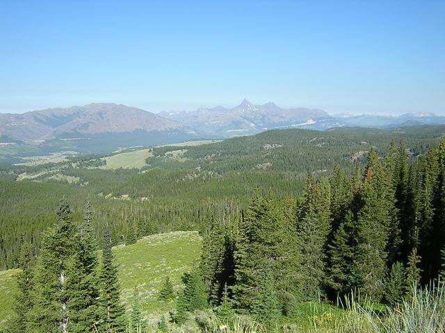
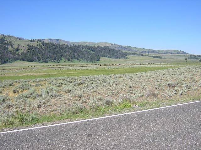
I could also see the area that made up the Chief Joseph Memorial Highway, which I was scheduled to ride the next morning.
I met another biker at this lookout. He took a picture of me with my camera, and I took a picture of him with his. He said he'd been out for a couple of weeks now. I met several other bikers that made similar comments. I've got to wonder what people do for a living that gives them the money and free time to just take off and ride for long stretches of time?
As I got closer to Cooke City, I ran into some major construction. There was a guy holding a stop sign, and the cars were lined up. We sat for at least 20 minutes until the pilot car returned. I munched on some beef jerky I had in my bag and talked to the sign man. Finally when it was our turn to go, we followed the pilot car through the construction. The road was pretty much gone, and what was there was covered in loose rock. It was very treacherous and the pilot car didn't break 10 mph for the three mile stretch.
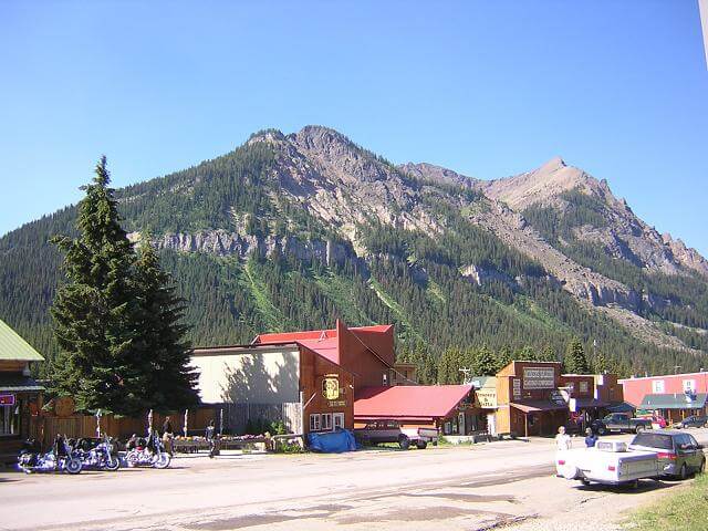
In Cooke City I stopped for a snack break and to stretch. It's a neat little town that is fairly isolated from everywhere. The only way in or out is through the Beartooth highway, Chief Joseph highway or Yellowstone park.
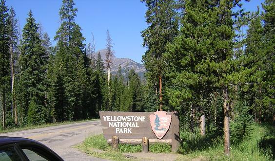
A few miles down the road I entered the northeast entrance of Yellowstone.
I'm not sure what I was expecting Yellowstone to look like, but it was much more mountainous than I had pictured.
I came across a herd of buffalo that I tried to catch with a picture, but I was too far off to really see anything.
But about a mile down the road there was a lone buffalo taking a nap.

Yellowstone was a lot bigger than I had expected. I'm used to the state parks around my area, which are maybe a couple miles long. Yellowstone is roughly the size of Connecticut. I drove and drove thinking I missed my next stop in Mammoth Springs, before I saw a sign stating that it was 30 miles further up the road.
This is where I encountered my first frustration with cages (cages are cars for you non-biker types.) I discovered there are two types of slow drivers: 1. those who are terrified of driving in the mountains, and shouldn't be out there in the first place, and 2. those that decide to drive 20 mph through the whole park so they don't have to stop and get out of the car to see any of the sights. There's no passing in much of the park, so the line of cars behind these idiots would grow longer and longer. I'm not sure which of these two we were behind, but it took us forever to get to Mammoth.
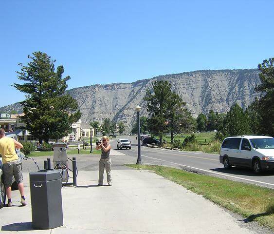
Once in Mammoth Springs, I had planned to eat lunch and gas up before heading south to see Old Faithful. I opened the door to the restaurant, and saw how long the wait would be for food. The whole town was packed full of people. I decided I wasn't that hungry, and opted instead to pick up a snack and a soda at the gas station. Here's a picture I snapped while filling my tank.
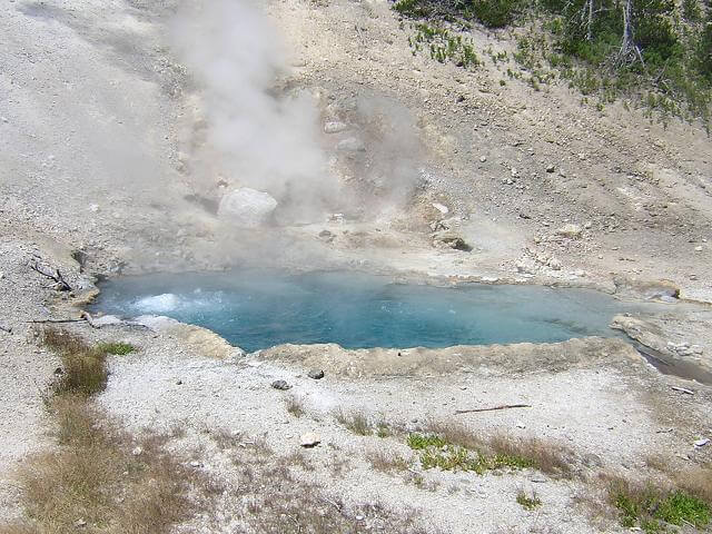
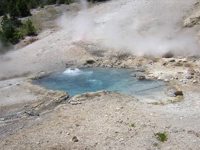
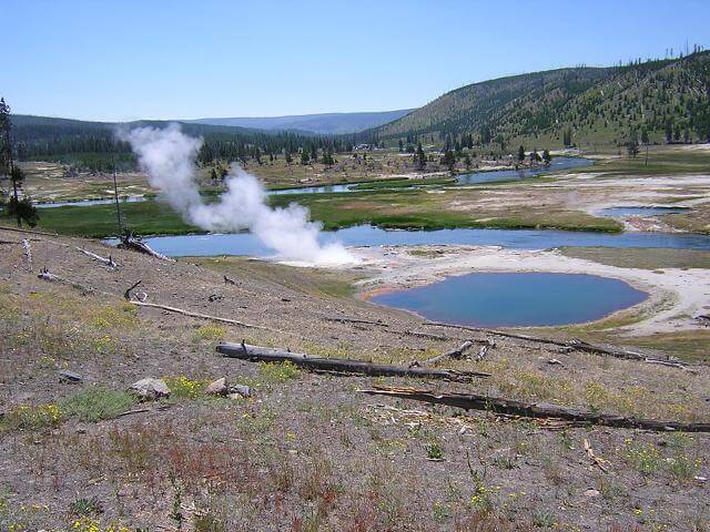
After getting gas, I headed south towards Old Faithful. Occasionally I would see something interesting that would warrant me stopping to take a picture. For example, here's a steam fed spring where the water constantly boils. The steam reeks of sulphur, but the water is as blue as I've ever seen. The rest of the park has a wonderful aroma of pine trees, but the steam pots and geysers stink.
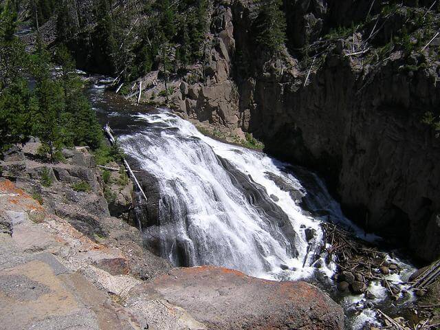
I passed a neat waterfall...
... and an awesome view. You can see how the forest is still somewhat decimated from the great fire in 1988. Nearly 20 years later much of the forest is still blackened from this fire.
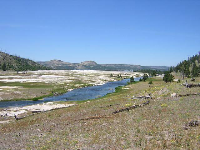
As you ride across the park, multiple geysers are visible. Yellowstone has around 1000 of them altogether.
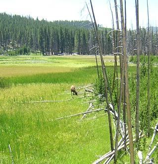
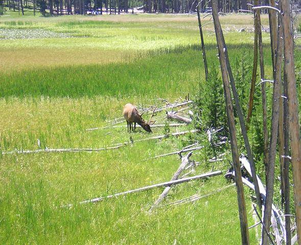
Lots of wildlife call the park their home. Here's some pictures of an elk I saw.
There's plenty to see in this park. Because my focus for this trip was to ride my motorcycle, I didn't stop and see anything off the main loops. I want to return in the future to spend more time and see some of the areas that are only accessible via hiking.
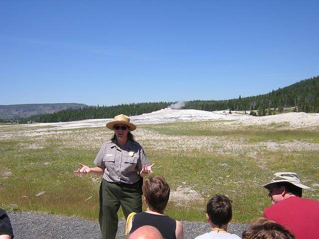
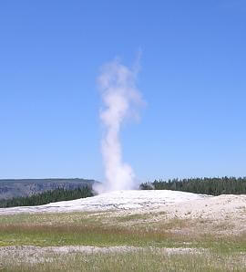
When I arrived at the site of Old Faithful, it had erupted not long before I got there. Since a major earthquake happened a few years back, Old Faithful isn't quite as faithful as she used to be. Now the eruptions are predicted about ever 70 minutes, give or take 10 minutes. I had some time to kill, so I listened to the Park Ranger's talk about geysers and geology. As she asked various questions from the audience, I was fairly impressed with the amount of geology knowledge that our youth have been taught. They were answering questions right and left while the adults in the audience just looked at each other and shrugged.
After her very interesting and informative presentation, we still had 30 minutes to wait for the next eruption. The temperature was now in the 90s, the sun was beating down on us and there was no shade out around Old Faithful, so I retreated back to the visitor's center. I browsed around, then found a hidden room in the back where a movie about Yellowstone was playing. It was cool and had chairs, and I bathed in this luxury for a while. The movie showed some clips of animals attacking people in the park, and was used to warn visitors of the dangers of approaching wildlife. I found them sickly amusing.
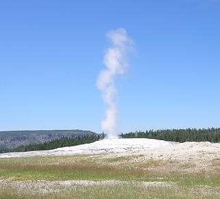
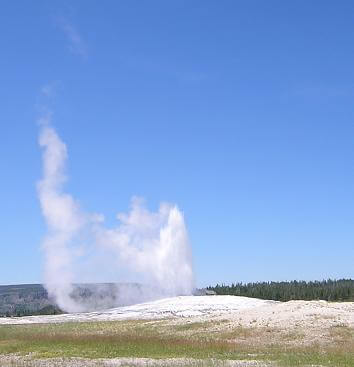
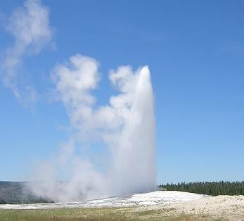
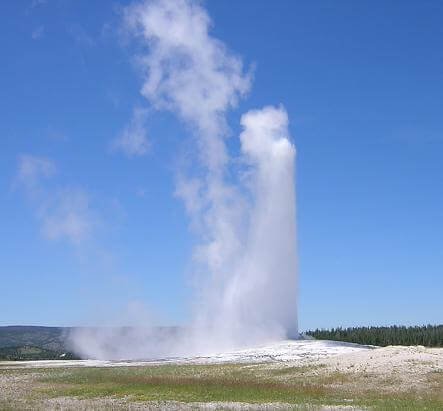
It was time for me to head back out and catch the next eruption. I couldn't have timed it any better. I got out to the site, found a spot on the bench and within 30 seconds she blew her top. The eruption lasted much longer than I expected, probably around 5 minutes. It's also amazing for the amount of water that comes out, the area around the geyser is dry. The water is so hot it vaporizes almost immediately.
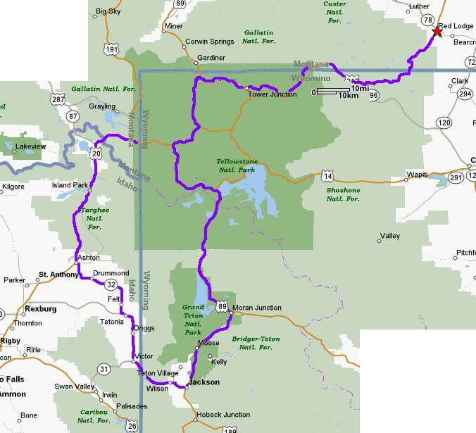
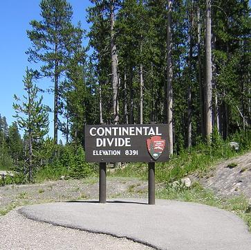
With this national landmark under my belt, it was time to head south out of the park and go see the Grand Teton national park. As I rode along, I crossed the continental divide. This seemed really cool until I gave it some thought, and came to realize that all this means is that the rivers on one side of the sign flow towards the Atlantic ocean, and the rivers on the other side flow towards the Pacific. Kind of a let down when you think about it that way.
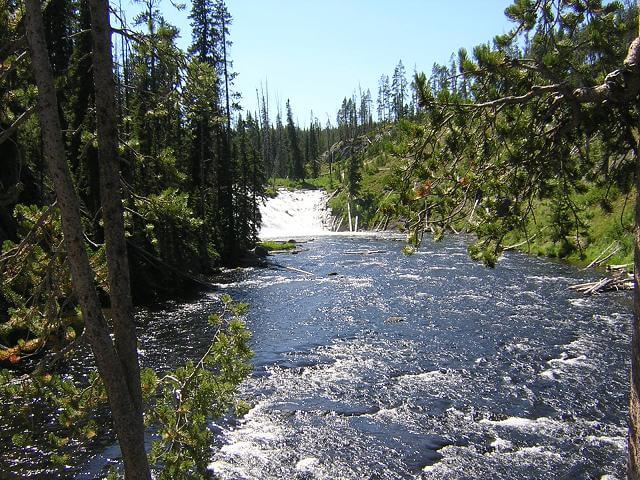
On the south side of the park I saw another cool waterfall.
As I was leaving the park, I came around a corner and had a wolf run out in front of me. I slowed down quickly and thought about trying to get a picture. However, the wolf was trotting down the road, so by the time I would get my camera out it would be a poor shot. Plus, where I was situated on the tail end of a blind curve, somebody could have come around and drilled me, which would have put quite a damper on my trip if not my life. I decided to speed back up and just savor the memory of the wolf.
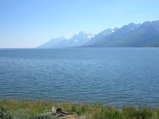
I left Yellowstone and rode into the Grand Teton national park. The Tetons are absolutely monstrous in size.
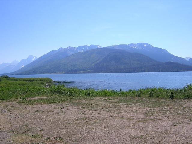
The highway takes you along the east side of the mountains. There is a huge lake that separates the mountains from the highway.
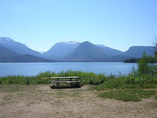
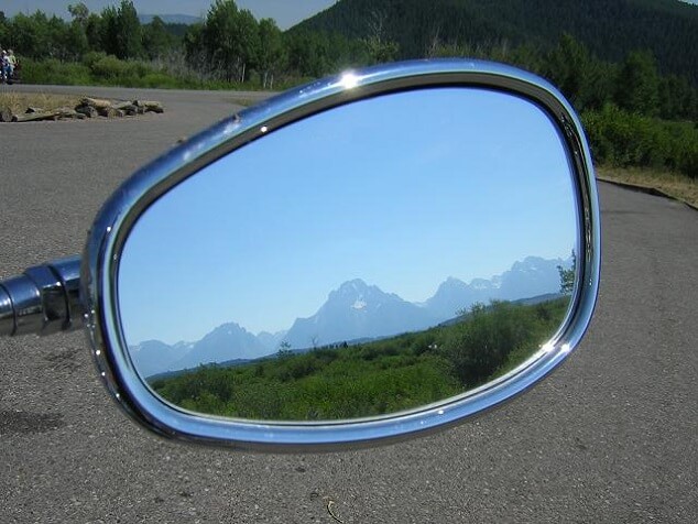
As the highway curved and swung eastward, I had a cool view in my mirrors. I tried to capture this with my camera, and I'm pretty happy with the way it turned out.
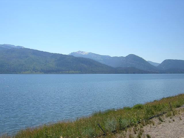
Farther south, the lake ends and the terrain turns to desert. The mountains are in the distance, but the area surrounding the highway is pretty barren save for small bushes and a few scrubby trees. The highway doesn't actually go through the Grand Teton mountains, so the riding wasn't all that exciting. I came to realize that visiting the Tetons on a motorcycle is like looking at a girl wearing a bikini at the pool. It's pretty cool at first, but after a while you realize you can't touch them so you lose interest. My wife wasn't impressed with this analogy.
At this point the heat and the length of the day were beginning to wear on me. My original plan was to stop in Jackson and have a meal. By the time I got to Jackson, I was aching pretty bad and was in somewhat of a foul mood. To top things off, Jackson was a madhouse and traffic was extremely thick. After I filled up with gas, I decided to skip supper and just press on to my hotel. I'd worry about eating something when I arrived back in West Yellowstone.
On the west side of Jackson you cross the lower portion of the Grand Tetons. I swear I could smell the brakes burning on every car coming down the mountain in the opposite lane. On this mountain we got behind a driver who was afraid to go faster than 25 mph both up and down both sides of the mountain. The curves weren't that sharp and would have easily handled 45 mph. Unfortunately, there was no passing for the entire section, so we were all at the mercy of this person. This didn't do much to improve my mood.
Finally, I crossed the state line into Idaho. Another state to add to my list!
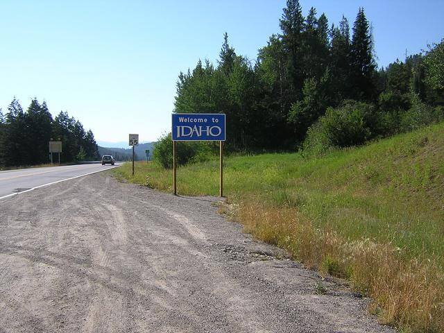
As it turned out, this was the only picture I took in Idaho. There just wasn't much to see, and I was trying to make time to my hotel.
Then, as I turned onto highway 32 going north out of Tetonia heading towards Ashton, I got one of the biggest surprises of my trip. This road was made for motorcycles. The traffic was almost nonexistent. The only cars I saw were coming from the other direction. The road had wonderful roller-coaster style hills with long sweeping curves and shorter slalom-like wiggles. The turns allowed for plenty of peg scraping, yet didn't require me to drop my speed below 45 mph. There wasn't much for scenery, but I was too busy enjoying the ride! This 30 mile stretch of road did wonders for my mood and completely rejuvenated me.
After I reached Ashton, it was another 50 miles to West Yellowstone. Highway 32 had lifted my spirits so much that it passed rather quickly.
Once in West Yellowstone I checked into my motel, called my family, showered and then went to eat. I found a local spot called the "Gusher" and had a cheeseburger with fries. Simple but tasty.
I slept well again this night.
Miles Logged: 400.5
Time In Saddle: 12.25 hours
Gallons of gas used: 7.528
Return To The Main Motorcycle Gallery
This page last updated on 06/28/2018