


Planning the route for this trip was, by far, the most time I've ever spent creating a route. And most of that planning time was spent specifically on the second day, which was the day I was planning on following Route 66.
Route 66 is an icon in the transportation history of the United States. There are songs written about the legendary highway. The nostalgic road sign is universally recognized. There are even people (some of whom I know) who have the Route 66 symbol tattooed on their body.
Personally, I am somewhat indifferent to it. I have no real fascination with the nostalgia of Route 66 itself. I grew up after the original highway system had been superseded by the more modern interstate system. Route 66 didn't have any sort of special draw or memory to me.
So why did I choose to try and retrace the original Route 66 route? Probably for the same reason people choose to climb Mount Everest: because it's there. I was looking for an excuse to go on a motorcycle ride, and following the path of old Route 66 seemed as good a reason as any other.
First off, the original Route 66 stretched from California all the way to Chicago. I wasn't going to try and retrace the entire length. For this trip, I would focus only on the section that crosses the state of Missouri. Perhaps in the future I will do other sections? I don't know, but maybe.
As I began my research into the old roads, I immediately noticed that retracing the original route isn't as cut-and-dried as you would think. Route 66 existed for about half a century (or more in spots), but during that time it was constantly being streamlined and improved upon. As a result, there are many places where you have to choose which era of the route to follow.
In my research as to what other people do, some people like to try and follow the earliest version of the road. Others actually try to retrace all versions of the roads, even if that means backtracking to make sure to cover every era.
I wasn't going to get that detailed. In the route I designed I utilized parts of all the eras. I picked roads that didn't involve backtracking, and when multiple options presented themselves, I just selected the road that looked more interesting. I was riding this route for fun, and getting too bogged down in the minutia wasn't my idea of fun.
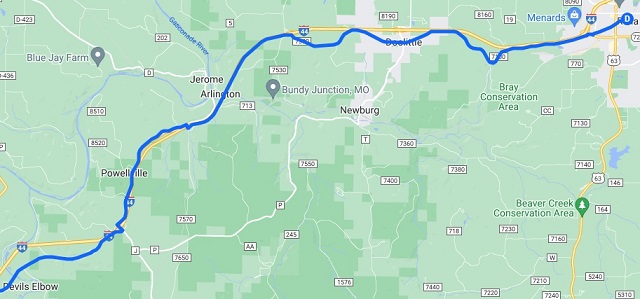
There also was the challenge that in certain spots, the original roads no longer exist regardless of the era. In those cases I had no choice but to improvise. I would try and take the shortest path from where the original Route 66 ended to where I could rejoin it. A good example of this is around Arlington, MO. The original route went through a river valley, and across a bridge that no longer exists. In this area I had no good option other than to get on Interstate 44 for about three miles, then exit and pick up the old road again.
It actually surprised me a bit that routes weren't easily available on the internet. I wish I was able to find a site that provided clearly defined maps all the way across Missouri. I learned that people arrange guided tours and sell maps for Route 66. Because of this, they don't want the information out there easily accessible. So that's why I had to do a lot of the research on my own.
To add to the amount of time I spent, once I determined a route I was still experimenting with the best mapping tool to use to get the routes into my Garmin Zumo XT GPS. I wound up building the routes at least five times using different software packages until I settled on one that worked acceptably. This sucked up a lot of time in itself.
So, here it is: The Route 66 route I came up with to cross Missouri, from Joplin, MO to St. Louis, MO. Yes, I know it doesn't take you completely to the Illinois border. The bridge over the Mississippi on the original Route 66 is now a walking-only bridge anyway, so it would have been impossible for me to ride it all regardless. I decided that I got close enough for my own satisfaction. If you want to extend my route another few miles to take you all the way to that bridge, be my guest.
I broke the map up into lots of images so that (hopefully) some of the nuanced detail is a little more noticeable. These images are also included on the story of Day 2 so you can see them there in context with my experience while traveling the route.
Part A - Joplin, MO to Carthage, MO.
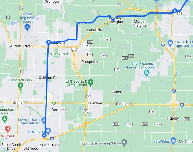
Part B - Carthage, MO to Avilla, MO.
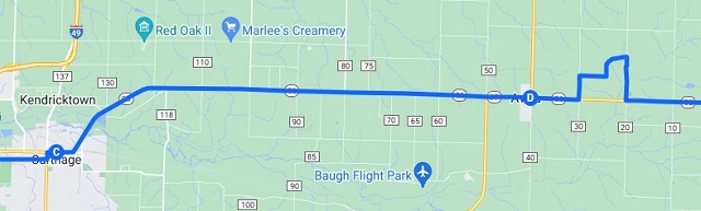
Part C - Avilla, MO to Springfield, MO.
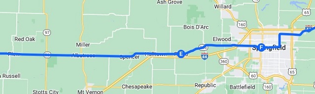
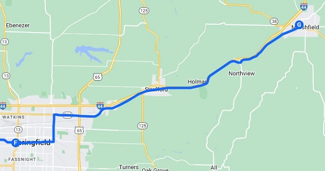
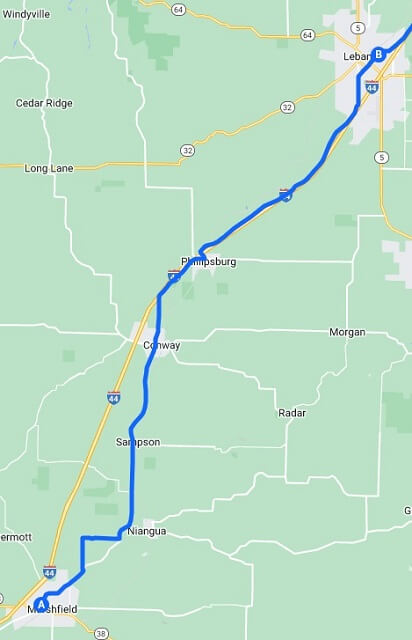
Part D - Springfield, MO to Marshfield, MO.
Part E - Marshfield, MO to Lebanon, MO.
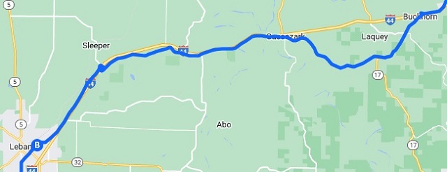
Part F - Lebanon, MO to Buckhorn, MO.
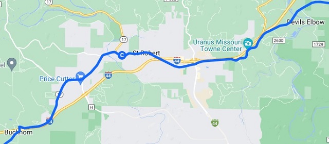
Part G - Buckhorn, MO to Devil's Elbow, MO.
Part H - Devil's Elbow, MO to Rolla, MO.
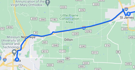
Part I - Rolla, MO to St. James, MO.
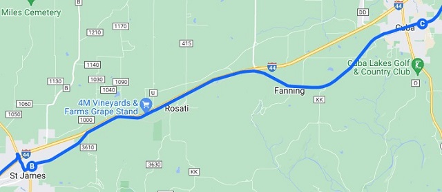
Part J - St. James, MO to Cuba, MO.
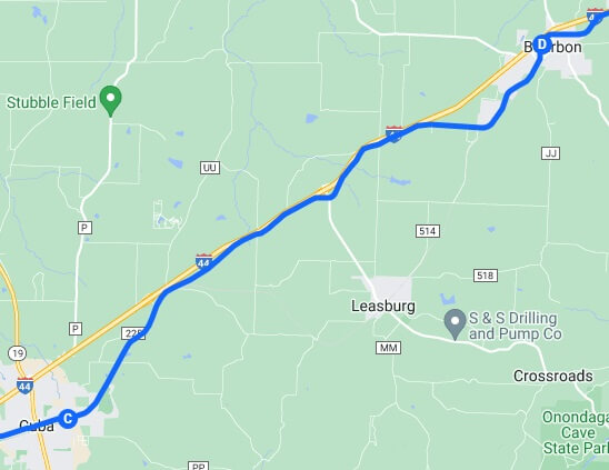
Part K - Cuba, MO to Bourbon, MO.
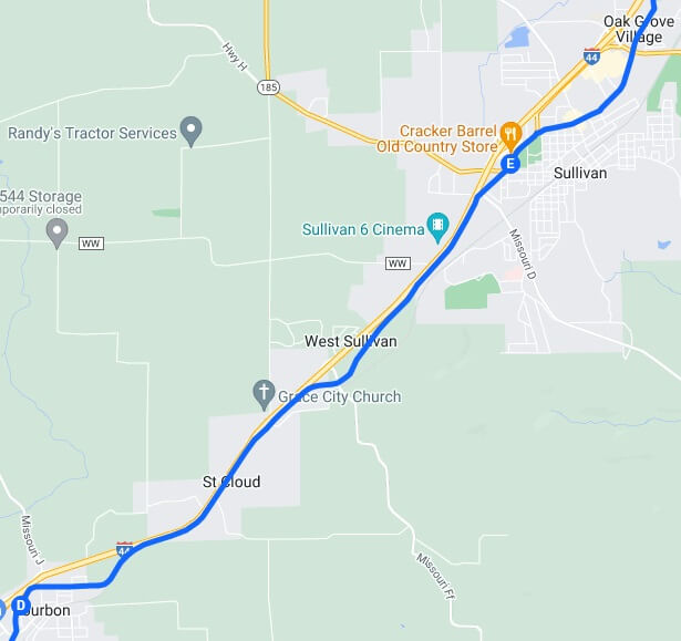
Part L - Bourbon, MO to Sullivan, MO.
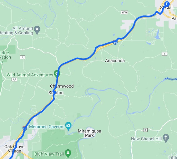
Part M - Sullivan, MO to St. Clair, MO.
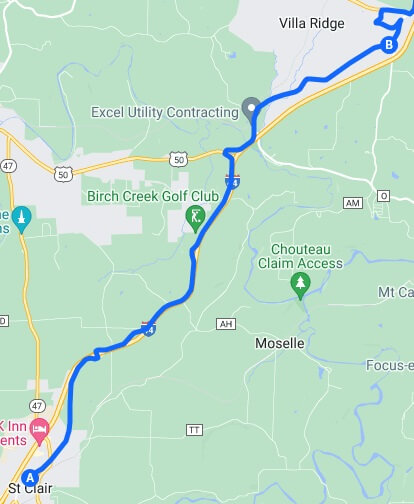
Part N - St. Clair, MO to Villa Ridge, MO.
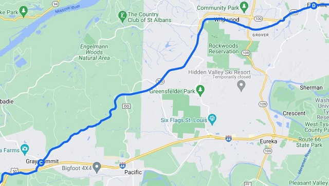
Part O - Villa Ridge, MO to Ellisville, MO
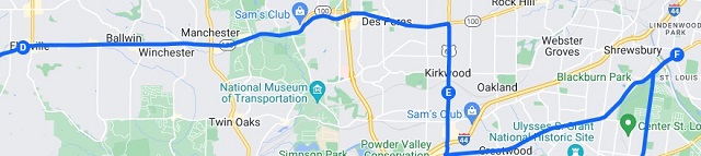
Part P - Ellisville, MO to Ted Drewes Frozen Custard in St. Louis, MO.
For a more interactive experience, here are the links to the route on Google My Maps. These are broken up into the four different pieces that I used to create my GPS route files.
For those of you who have a Garmin GPS, or any brand of GPS that has the ability to use KMZ files, here are the links to the route files I created. This should save you a ton of planning time should you want to ride the exact same route I did.
2022 Day 2 - Part A - Joplin MO to Marshfield MO.kmz
2022 Day 2 - Part B - Marshfield MO to Rolla MO.kmz
2022 Day 2 - Part C - Rolla MO to St Clair MO.kmz
2022 Day 2 - Part D - St Clair MO to Arnold MO.kmz
Return To The Main Motorcycle Gallery
This page last updated on 11/03/2022