


Despite the sunburn pain, I slept like a rock. I certainly was pretty exhausted from the previous day.
Before I went to bed I had reluctantly set my alarm for 6:30 AM. I say reluctantly because I really would have loved to sleep in. However, I knew the day was going to be a long one so I decided it would be best if I could be on the road by 8 AM.
An hour before my alarm went off I woke up. It was about 5:30 AM. I was still tired, but my brain "turned on" and once that happens it's pretty much a guarantee that I won't be going back to sleep for a while. This has been happening to me two or three times a week for almost five years now. With all the stressful circumstances going on in my life, if I wake up during the night it's really easy for my brain to start dwelling on them, and the next thing I know I'm wide awake. It's frustrating, but it is what it is.
So when I woke up and my brain turned on I didn't fight it too hard. I decided that at worst it would give me a head start on the day and get me to the hotel a little earlier that evening.
I didn't climb out of bed right away. Instead I grabbed my GPS and started reviewing the directions it had mapped out for today's ride, in the hope that I could avoid any routing snafus like the previous day.
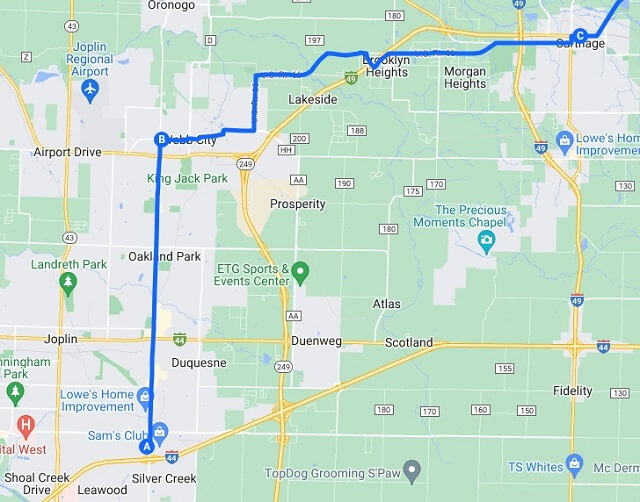
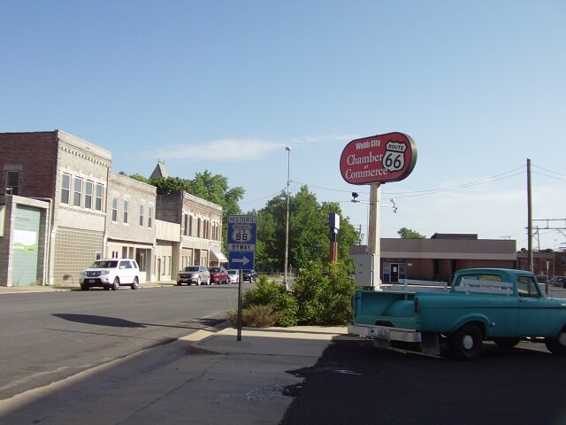
I did notice a few oddities in the route. On the north side of Joplin is a suburb called Webb City. My route had me going north through Webb City. For some reason rather than sticking to the main road through the city, the GPS calculated a route that looks more like stair steps.
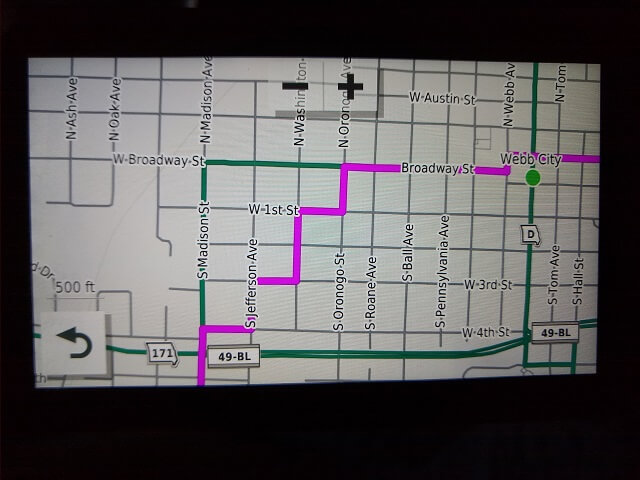
I made a note about this discrepancy and did my best to memorize the correct route to use once the GPS tries to tell me to go back and forth on the side streets.
I got up and got dressed, then decided to see if the hotel had breakfast. Their website said that they did, but many hotels had shut down breakfast during the COVID pandemic and never restarted them. I was skeptical that they would have any breakfast items, so I figured I would have to stop and grab something to eat after I hit the road. I brought my water bottle and if nothing else I hoped that I could find somewhere to fill it up. It was too large to fill in my bathroom sink.
Rather than ride the motorcycle around to the lobby area, I walked from building to building. The different buildings in this hotel are all connected by breezways, so it was possible to make it all the way to the front desk without going outside. It was a surprisingly long walk, going down long hallway after long hallway.
When I reached the lobby, much to my surprise it did look like they had some breakfast items out. There was cereal, bread/toast, yogurt and a pancake machine.
None of the cereals looked all that appetizing. I didn't see any toppings for the bread. And the yogurt looked suspect. Thankfully I love pancakes, so I hit the button numerous times on the pancake machine and made myself a bunch of them. I also poured myself some coffee. I haven't been consuming much caffeine since my open heart surgery in 2019, but decided I felt tired enough to allow myself to splurge.
I sat and ate my pancakes, and watched a very interesting show on the lobby TV that was tuned to the history channel. Speaking of interesting, the other guests in the breakfast area were also "interesting" from a people-watching perspective. You can probably form an image in your mind as to what I am referring to. Then again, they probably were thinking the same thing about me.
Once the pancakes were consumed, I drank a bunch of water to make sure I was good and hydrated, and then topped off my water bottle from the lobby dispenser. Then I made the long walk back down the hall.
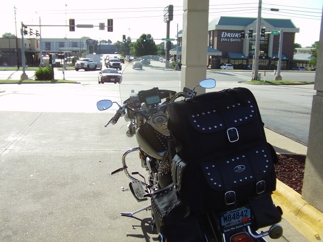
Before I went back up to my room I went outside and gave the bike a good cleaning so that it would be nice and shiny for the day's ride.
I noticed that the flatbed truck parked next to my bike the previous evening had already left. I'm assuming the guys sitting on the back during the night were the occupants of the truck. Given how late they had been up drinking, I can only guess that they were in pretty rough shape when they departed.
I went back up to my room and made sure to apply a good layer of sunscreen. I went thick, and I went extensive. I had enough of a sunburn and I didn't need to make it worse. Then I finished my packing and hauled everything down to the bike.
I rode around to the lobby and checked out. By the time I had done all this it was 8:28 AM. Despite waking up an hour early I was leaving a half hour late. I had lingered over breakfast a long time, and it took a lot longer to clean the motorcycle than I had anticipated, so those were the two big schedule offenders.
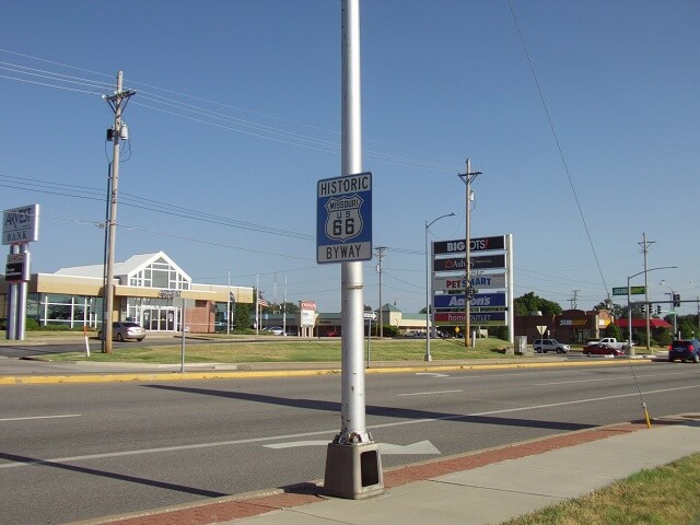
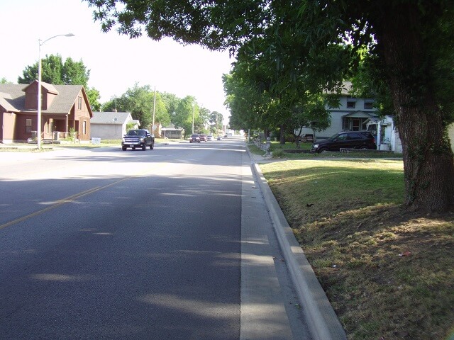
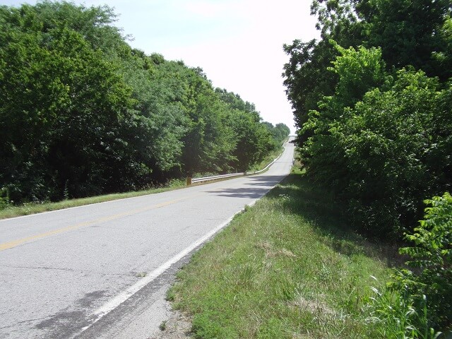
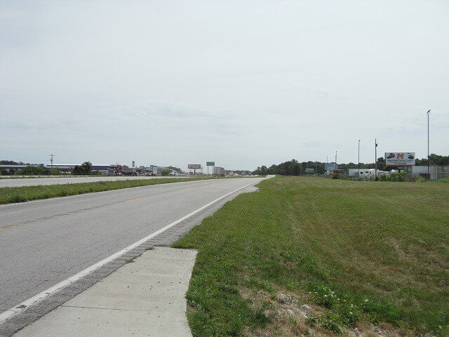
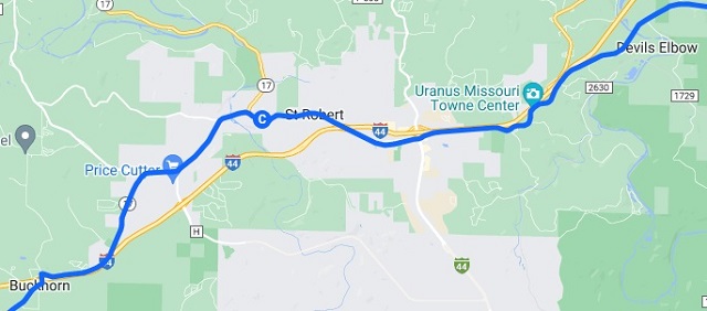
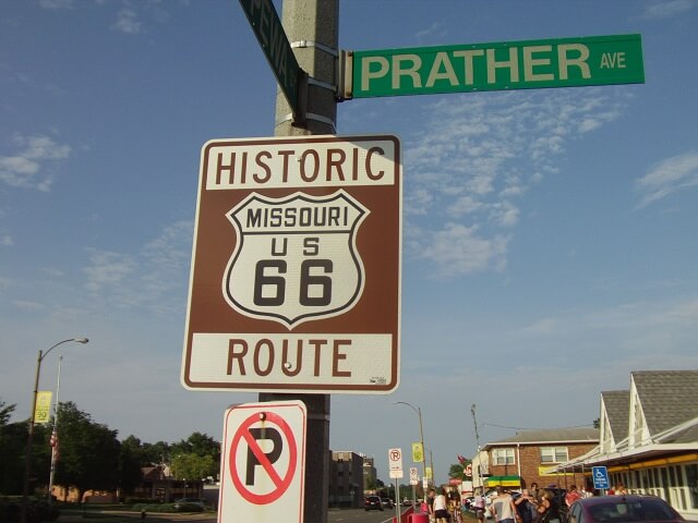
I turned north on Ridgeline Road, which would merge with Historic Route 66 about a mile down the road. As I rode along I noticed the GPS was adamant about me turning around. That was weird, as I knew for a fact that I was heading in the right direction.
I hoped that after a couple miles the GPS would figure things out. They often do. At one point I pulled over and restarted the trip hoping it would do better the second time around. It didn't. It kept trying to take me over to the interstate.
This was frustrating. I had spent good money on this GPS, and it's trying to take me in every direction but the one I want to go. I resigned myself to the idea that I may have to be riding today's route from memory, which would be a trick as it was a very technical route.
Because the GPS wasn't working, when I reached Webb City I turned right on a street that I believed to be correct. It wasn't.
About a mile down this street I figured out I had made an error, so I turned around. A few minutes later I was back on the right route, but then I missed another turn about a mile down that road. This was going to be a long day unless I came up with a solution to the GPS.
Once again I tried ending the trip in the GPS and restarting it. This actually made things worse. At times it would show a diagonal line across the screen where there wasn't even a road. Staring at this expensive but worthless piece of technology was making me angry.
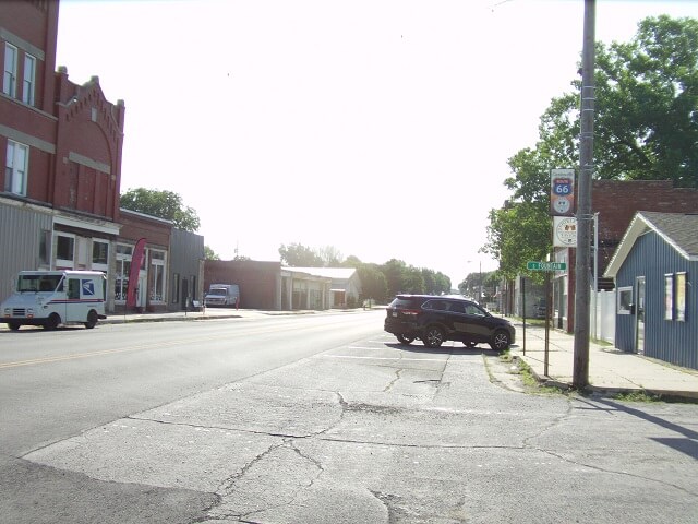
As I fumed, I rode through Webb City, MO.
The first part of my trip went from town to town without really getting out on the highway for too long. The next little town was Carterville.
Then about two miles down the road was Brooklyn Heights.
After another two miles I came to the city of Carthage. As I entered the town there was a railroad crossing several feet higher than the road, with a steep incline on either side. As I crossed the tracks I noticed how gouged and scraped up the pavement was on either side, where people had obviously hit the crossing way too fast and caught air with their vehicle, then bottomed out hard upon landing.
Carthage is notable for being the headquarters of the Precious Moments company who are well known for their art and figurines made up of cow-eyed children. Myself, I'm more of a Tragic Moments figurine kind of guy (for those of you who don't know, that was an MST3K reference.)
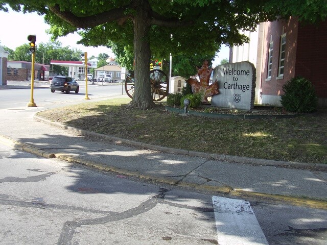
Once I got east of Carthage, I was done riding through towns for a little while, until I would reach Springfield.
In fact, from Carthage to Springfield would have been a complete straight line had there not been a bridge out.
I had known about this bridge being out, as I saw it on the Missouri DOT website when I was doing my route planning. And I had mapped out a simple detour that didn't take me too far out of the way. The only problem is, my GPS was still completely freaking out, showing lines all over the place. So I had to try and figure out the detour from memory.
I made the first turn on the detour OK. But then I must have ridden past the second turn. After a few minutes I thought to myself, "I've been riding north longer than I should have been." Rather than backtrack, I decided to take the next paved highway heading east, and from there take the next paved highway heading south until I got back to Route 66.
So I continued north until I reached a paved highway, then headed east. After I had ridden for a bit I was really starting to wonder how far out of the way I was going, so I pulled over to check the map on my phone. Which was annoying, because I had purposefully purchased a GPS so while riding I wouldn't have to pull over to check the map on my phone.
Once I got my bearings, I could see that it wasn't too much farther up the road until I would reach a paved highway that would take me back south. After a little bit I found my way back to old Route 66. I think the original detour I had planned was about three miles long. The detour I wound up taking was about seven miles long. Not a ridiculously huge amount of miles, but it was a bit aggravating as I had planned for the bridge closure and yet still failed.
I continued heading east towards Springfield, the whole time getting more and more upset about the GPS not working. I was really considering powering it down, putting it in my luggage and then seeing if I could return it for a refund when I got home.
I kept canceling my route and restarting it in the hope that the GPS would regain its sanity. Each time I restarted it my "estimated destination time" got later and later in the day. At this point it was saying I would arrive about three hours later than what I had originally planned. Because the route on the GPS kept pointing me in the wrong direction I knew that estimated time wasn't anywhere close to reality.
I'm nothing if not tenacious, so I kept fiddling with the GPS. One thing I noticed was when I would start my route it would give me a list of options for how I wanted to start it. I didn't know what any of the options meant, and they weren't really clear from just looking at them. The GPS didn't come with a physical manual, and I tried to look it up online but there wasn't any documentation I could find to explain what the different options meant.
All morning I had been selecting "nearest entry point" for how I wanted to begin the route. Like I said, I wasn't sure what that meant but it sounded like something I would want. That was also the option that was selected by default, so one would think that was the correct one to pick. Out of desperation I started restarting the route and trying some of the other options. None of them seemed to make any difference until I tried "via coordinates." Suddenly the GPS got its ducks in a row, the route ahead of me was heading in the right direction and the estimated arrival time matched what I thought it should be.
Hooray! I'm not 100% sure what "via coordinates" means, but apparently that's what you want to pick when it asks you how you want to enter the route. For the rest of the day (and really the rest of the trip except for one other instance that I will explain later) the GPS worked near flawless. I guess there's just a learning curve.
With that frustration gone, I felt like I could relax and enjoy the ride a bit more than I had so far this morning. I was putting along and starting to appreciate the scenery. I suddenly saw a turtle trying to cross directly in my path. I swerved and missed it. I'm glad too, because had I hit the turtle it probably would have ruined both of our days.
Then in the space of about five miles I had two close calls with drivers. The first was a guy coming off of a side road to my right. He was turning left to head west, while I was approaching heading east. The highway I was on had the right-of-way. He sat stopped at the intersection, until the last second when suddenly he decided to gun his engine to make the turn, and pulled out directly in front of me. I slammed on my brakes as hard as a 1999 Yamaha will stop without locking up the tires. He had waited so long to pull out that there was no way for me to come to a complete stop in time, but thankfully I was able to scrub enough speed so he got out far enough and I was able to pass behind his truck with no impact. That close call really woke me up, though, and for a few minutes I was tempted to turn around, catch the guy and wring his neck.
I would never actually do that. Partially because I'm a nice guy, and partially because I probably would get my butt kicked and I'm a bleeder.
Then, while I was still recovering from the first incident, it nearly happened again. Once again a lady coming off a side road from my right was stopped. She began to pull out as she turned to her right heading east, going in the same direction I was going. Once again I jammed on my brakes. She suddenly saw me bearing down on her, and slammed on her brakes as well and came to a stop before she was fully out on the road in front of me.
I saw that she had stopped, so I let off my brakes and proceeded to continue on my path. A split second later I realized that she had reconsidered stopping, and again began moving forward into my path. Once again I jammed on my brakes. And once again she decided she couldn't make it in time and slammed on her brakes to bring herself back to a stop.
By this time I was only going about 20 mph. There was no traffic coming in the oncoming lane, so I pulled into the left lane as I went by. I didn't want to risk having her pull out in front of me a third time.
The adrenaline hadn't worn off from the guy in the truck, and now I had just gotten a second dose. Needless to say, I was now on high alert, and hyper-aware of my surroundings for a few minutes.
One thing I noticed throughout this trip was the tendency for drivers perpendicularly approaching intersections from the direction I was traveling, to wait until the last possible second to slow down and come to a stop. I lost count of how many times I would see a car to my right or left that looked like they were going to blow the stop sign and enter the intersection directly in my path, only for them to brake aggressively and come to a sudden stop. Of course, as a defensive motorcycle rider I wasn't going to just assume that they would stop, so I would react to the possibility of them ignoring their stop sign. I would begin taking evasive maneuvers only to find they did indeed decide to stop. I don't know if this type of driving is common for the region, or if it was coincidental. I don't recall seeing this behavior from drivers the previous time I rode through Missouri, so maybe it was just the luck of the draw.
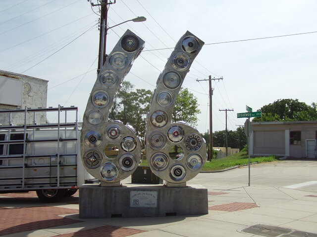
I reached the city of Springfield. The metro area of Springfield is currently just a hair under 500k, so it's a fairly sizable city. The quickest way around Springfield is to take the interstate to avoid the downtown and residential areas. However, I was trying to ride as much of Historic Route 66 as I could, which went straight through the middle of town.
Springfield had a bunch of road art on display along old 66. I didn't take a picture of all of them, but I did snap a photo of this one:
Riding through town was slow going. The day was getting really warm, and I noticed quite a bit of heat coming from my motorcycle's engine. I've ridden during countless hot weather days and the bike has never had an issue, although it does get a bit uncomfortable at times sitting on top of that hot engine, especially when waiting at stoplights.
Throughout the day I noticed that quite a bit of old Route 66 followed the Cherokee branch of the northernmost part of the Trail of Tears. This was a regrettable moment in our nation's history when the indingenous people were forced off their land so that settlers could claim it for themselves, hence the name. At many points during the day's ride I would see signs indicating the road was currently sharing the same path of the Trail of Tears. One of these signs was in downtown Springfield.
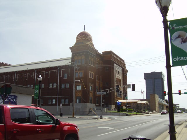
Riding through town I saw an interesting looking building, so I pulled over and tried to get a photo. The picture wasn't all that great, so I apologize. Later I looked on the map and saw that it was a Shriner's Mosque.
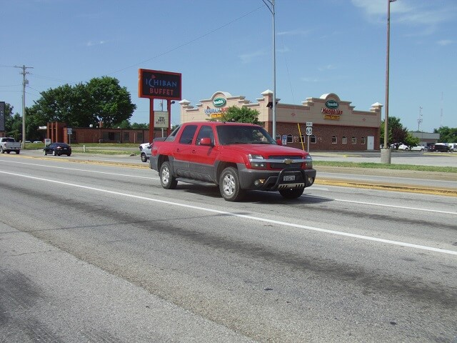
On the east side of Springfield I was stopped at a light when I looked over and saw the "Ichiban Buffet". Ichiban means "number one" in Japanese. That word makes me laugh because it makes me think of the episode of Friends where Joey does a Japanese commercial for "Ichiban - Lipstick For Men."
It took about a half an hour to ride through the middle of Springfield. It was nice to get out of the city and back on the highway, if for no other reason than to get more air flowing over the cooling fins on the motorcycle engine.
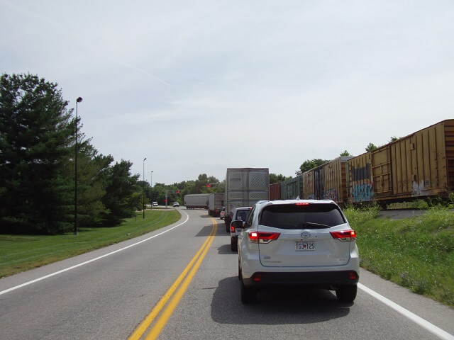
About a mile outside of Springfield I got stopped for a train.
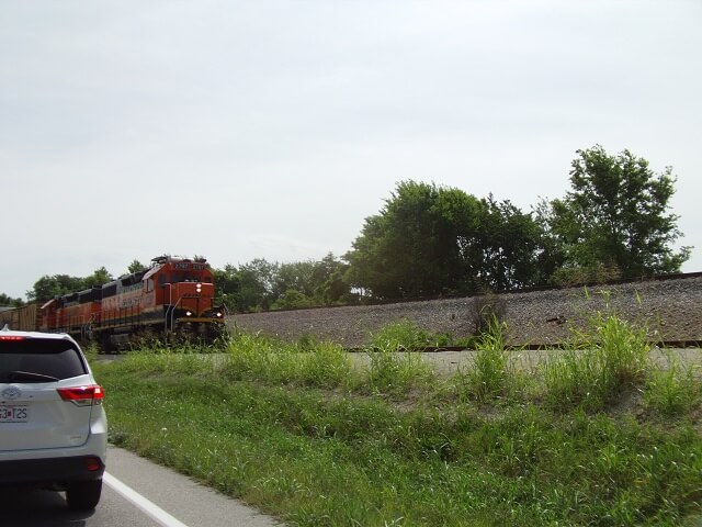
Thankfully it wasn't a long train so I didn't have to sit there for too long. I snapped another photo while I was waiting.
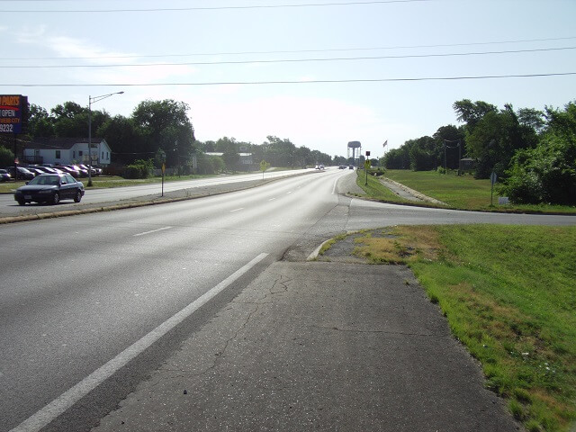
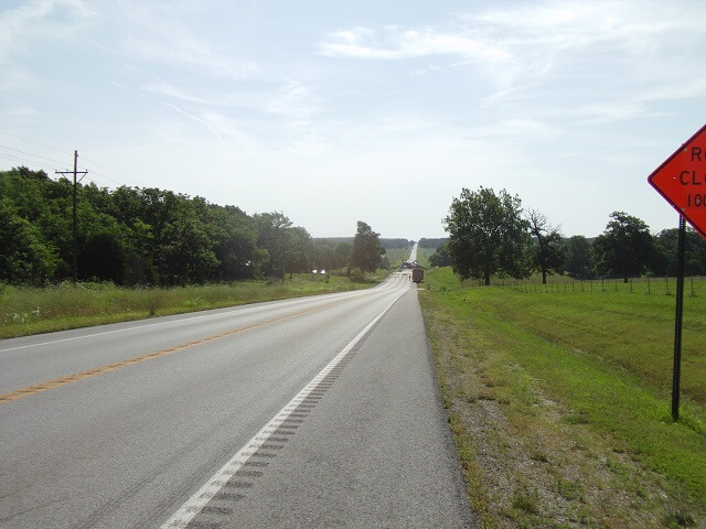
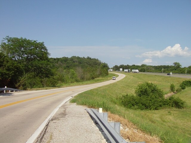
Much of Historic Route 66 through Missouri is now the service road on either side of the interstate. Frequently throughout the day I would find myself riding right next to the Interstate.
When I reached the town of Marshfield, my first route file on the GPS ended. I needed to load the next route file, and was in need of a rest break as well, so I pulled over in a parking lot. It felt good to get off the bike and stretch for a few minutes. It also felt good to remove my leather vest and let some air hit my sweaty shirt.
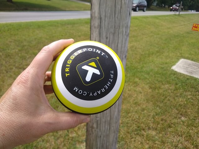
So far today my shoulder was hurting, but the pain level was maintaining in the "annoying but not agonizing" range. While I was stopped I decided it would be good to use my therapy ball to roll my shoulder. The Chiropractor had recommended that I roll my shoulder throughout the day while on my trip. I discovered it's not always easy to find a good place to do this.
There was a telephone pole nearby, so I did the best I could to put the ball against the pole and roll out the muscles in my shoulder the best I could. I'm sure the people looking out the windows of the nearby businesses were wondering what the heck this weird dude was doing.
After about a 15 minute break I got back on the motorcycle. I noticed I was getting hungry. The pancakes hadn't stuck with me very long today. I decided to push on a little further before I started thinking about lunch.
Northeast of Marshfield, MO, I hit another detour. Once again, I knew about this one from my route planning. When I was mapping out the route Google was even kind enough to show me the detour to take. How kind!
Except once I turned onto this detour I discovered it was loose gravel. Yuck. I don't like riding on gravel. For one, it makes the tires slide around. For two, it covers the bike in a layer of dust and dirt that I have to dig out of every nook and cranny.
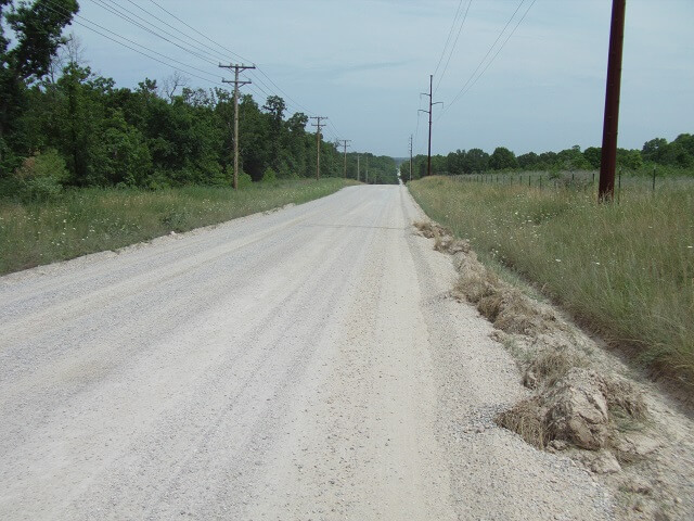
I hoped that the detour wouldn't be long. Maybe it would even turn back into pavement at some point? No such luck. In fact the gravel seemed to get looser the further down the road I went. It was especially treacherous towards the edges of the road, so I had to slowly ride near the center. Unfortunately there were lots of cars taking this detour as well, which meant when they would come in the opposite direction I had to move over into the loose material. Also these cars would create a ginormous cloud of dust as they passed, covering me in a grayish/tan layer of filth.
After about three miles (but what felt like 15) I got off the gravel detour and back on the pavement to resume my journey.
At times old Route 66 is to the south of the interstate, and at times it is to the north. I wound up crossing back and forth throughout the day. At one point I was crossing over and noticed that the interstate was completely gridlocked. There must have been an accident. In any event, I was glad I was moving freely and not sitting still like they were.
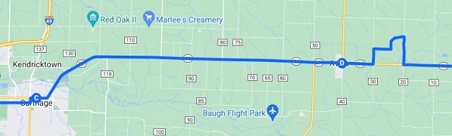
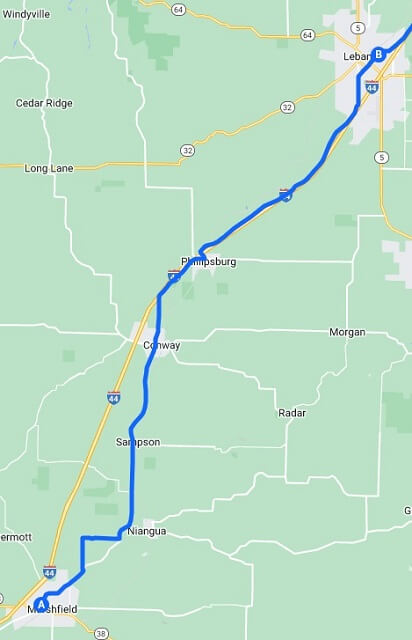
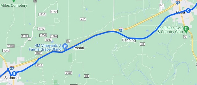
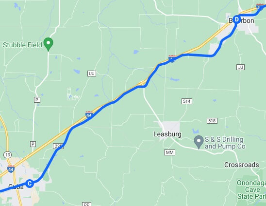
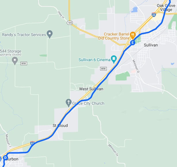
I tried to break down the day's journey into a lot of smaller detailed maps rather than one map for the entire day that really wouldn't accurately portray the squiggly route I actually rode.
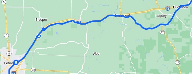
A few minutes past noon I reached Lebanon, MO. I had actually ridden through Lebanon back in 2008, but don't remember much about it other than I stopped and defiled a McDonald's bathroom.
I was getting hungry. As I've previously mentioned in the stories about my other journeys, during my motorcycle trips I generally like to eat local, or at least eat somewhere different from what's normally available to me back in Sioux Falls. Frankly, during this year's trip I failed spectacularly on both fronts.
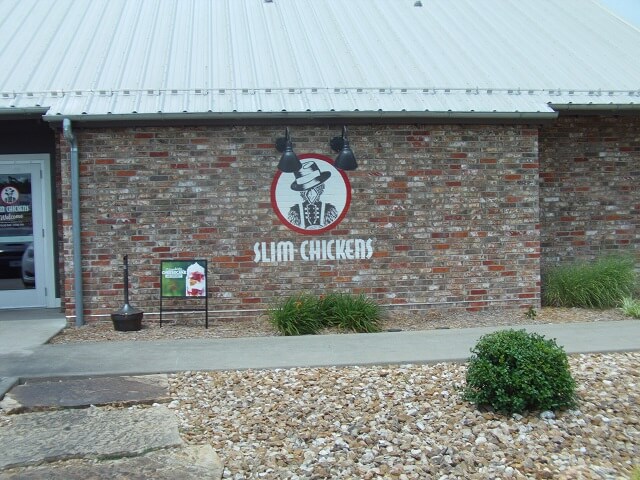
On the southwest edge of Lebanon I came across a Slim Chickens restaurant. For those of you unfamiliar with this chain, their specialty is chicken strips. I believe it's similar to the Raising Cane's chain of restaurants, although I've never actually eaten at a Raising Cane's to compare the two.
Slim Chickens opened its first location in Fayetteville, AR in 2003. I suppose being less than 200 miles from where I was currently in Lebanon, one could argue that it's kind of a local restaurant. However, seeing that they've opened over 100 locations worldwide, one could also argue that it's no longer a local restaurant.
In any event, I was tired and hungry enough to decide that Slim Chickens would make a good place to stop even if it wasn't local. I pulled in and found a parking spot. The lot was pretty full, which isn't an unusual situation at the locations back home as well. It seems to be a popular place to eat. I parked and went inside.
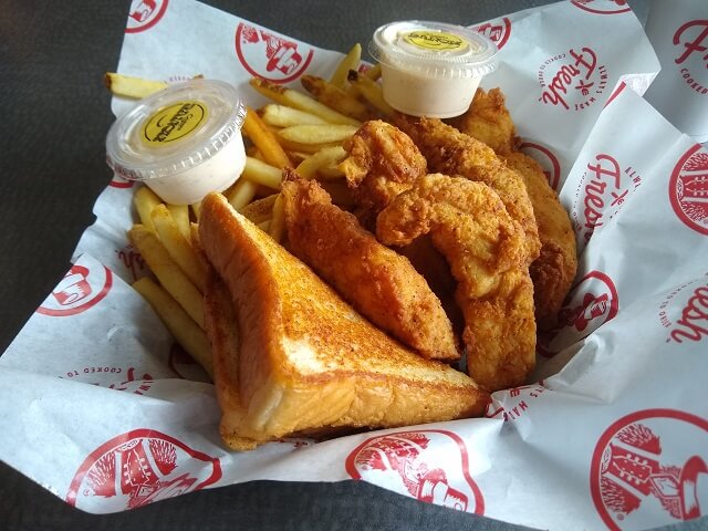
I didn't get too adventurous with my order: chicken strips plate with fries and a drink. I also really like their cayenne ranch dipping sauce, so that's what I selected to accompany my meal. I plopped my stuff down in a booth, then went and filled my glass with iced tea. I was really thirsty, and quickly downed the tea, requiring a second trip to the drink station for a refill. The food was good, and I relaxed for a while. As a bonus, there was a baseball game on the TV in front of where I was sitting. I like baseball.
After I had finished eating and recharged my metaphorical batteries a little, I went into the bathroom and slathered on another layer of sunscreen. This got me a few odd looks from other patrons, but I'm kind of used to odd looks. Today was extremely hot outside, and with the sun I didn't want to turn myself into a fried egg and suffer for it later.
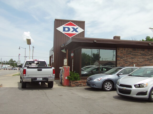
Back on the motorcycle, I proceeded down old Route 66. About halfway through Lebanon I came across Weaver Auto Sales, which in itself isn't notable. What caught my eye though, was they had an old restored DX service station on the corner of their lot. That was pretty cool, so I had to stop and snap a photo.
Again, for the unaware, the DX brand of gas stations could be found sprinkled throughout the midwest states up through the 1970s. At some point they were bought by Sunoco and their familiar signs were no longer seen. I remember them from when I was a kid and we would travel through Iowa to visit my grandparents, so seeing the sign again brought back memories.
I continued my journey down Historic Route 66.
Stopping for a lunch break helped, but my shoulder was still really hurting. Like before, it wasn't agony, but the pain level was enough where it was constantly on my mind.
Route 66 continued to alternate between the north and south side of Interstate 44. Every 5 to 10 miles it would cross over to the other side.
Because of all of the back and forth, and the little towns the highway would pass through, my speed was constantly varying. As a result I didn't use my throttle lock all day. This also meant that by the end of the day my hand was a bit tired.
One of the main reasons I've been considering a new (to me) motorcycle is to be able to have electronic cruise control. A throttle lock is better than nothing, but it doesn't account for terrain. If I set it for 65 mph on flat ground I find myself going 50 mph uphill and 80 mph downhill. If other vehicles are around this often means I'm constantly passing the same cars going downhill, then getting passed by those cars uphill. This is annoying for me, and I can only imagine it's even more annoying for the drivers of those vehicles.
I've looked into adding cruise control to my Road Star, but it's just not available. Most cruise control systems for carburetors rely on vacuum pressure to operate, and the Road Star engine does not use a vacuum system, so this isn't available. I did find one guy who modified a cruise control system from a car to put on his Road Star, and actually got it working. However, the system required a lot of fabrication I wasn't interested in doing, and also wasn't waterproof in case of rain.
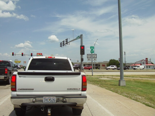
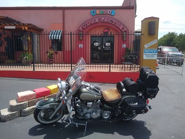
As I passed by the little town of Uranus, I caught sight of the "Uranus Fudge Factory." That is either the most unfortunate name for a business, or the most brilliant name. I haven't quite decided which.
Next to the front entrance was this important notice:
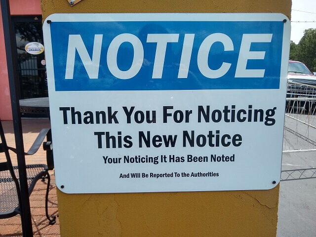
The town took full advantage of their name. For example, nearby was an arrowed sign that read, "Additional parking in Uranus."
I thought about going inside, but the afternoon was starting to disappear and I still had a lot of miles in front of me.
I only stopped for a few minutes, then I was back on the bike putting miles behind me.
A little bit past the town of Devil's Elbow, there is a section where none of old Route 66 exists any longer. In this stretch I had no choice but to hop on Interstate 44 for about three miles, then I could get back off and find the old road again.
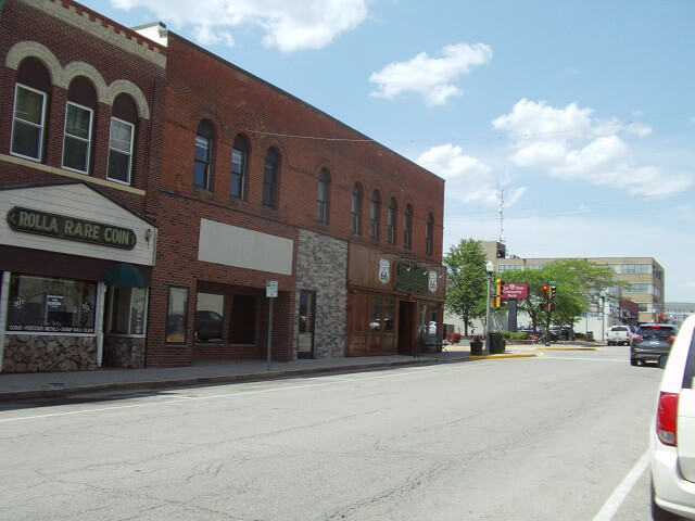
About 2:45 PM I arrived in Rolla, MO. I had ridden 211 miles since I left the hotel that morning, and I was due to make a gas stop. I hadn't yet hit reserve on my tank, so I was getting some impressive mileage at almost 51 mpg. I guess my motorcycle doesn't mind the heat as much as I do.
I found a gas station in Rolla, and pulled in. It was pretty busy, and minutes after I pulled in there were cars waiting for pumps. One guy in a truck was wedged at an angle next to me trying to be next in line for the pump adjacent to mine, where that driver looked like he was finishing up. After he filled his tank and got in his car, apparently he wasn't moving fast enough for the guy waiting who proceeded to honk his horn.
I noticed some aggressive behavior from other drivers trying to fill up their car as well. I wanted to go inside and use the restroom, but decided to go ahead and move my bike to an empty parking spot by the building and try to get out of the way of the impatient people.
I went inside and used the restroom, and hardly anything came out. Throughout this day I drank over 3 gallons of liquid, yet passed little urine. I think I was sweating out the liquid as fast as I could take it in.
I bought a large bottle of iced tea, and then stood in the corner of the store drinking it and enjoying the air conditioning. After a few minutes of the clerk giving me odd glances like I was casing the joint, I decided to head on outside.
I got out my cleaning supplies and gave the motorcycle a light scrubbing. Really it wasn't too bad, as I hadn't hit a whole lot of bugs. I then stood in the shade and caught up on correspondence with people who had been texting me while I was riding.
My gas and rest break was about 1/2 an hour long. Then I was back on the bike, as I still had 130 miles to go until I reached the hotel that night.
I noticed I was taking fewer pictures than I had been earlier in the day. This isn't uncommon, as once I get more tired I'll start to focus on making it to my destination more than I will focus on capturing the moments photographically.
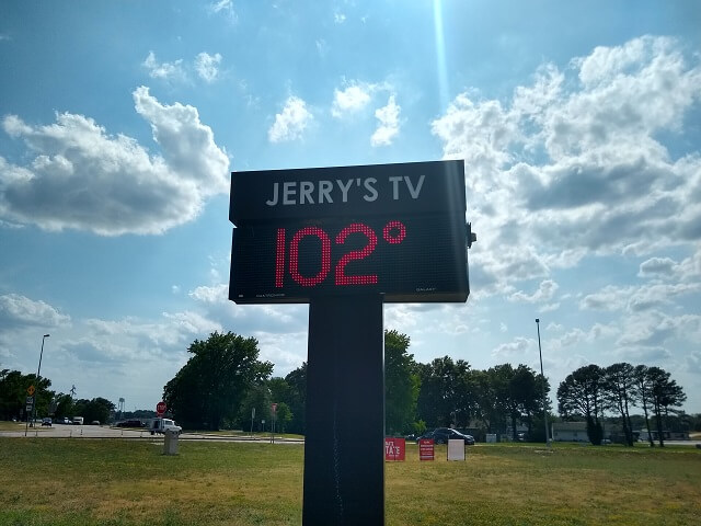
As I came through Sullivan, MO, I saw a sign that said it was 102°F. From the way things felt I believe it was close to accurate. I snapped a photo and texted it to my wife. She thinks I'm crazy for riding my motorcycle this far on a nice day, let alone during a heat wave.
I passed by a park and saw kids up on top of a waterslide waiting their turn to go down. It's weird how our brains work, as when I saw this I was instantly transported back to 1983. I remembered playing at the Sioux River Waterslide on a hot day, and how the cool water felt great as I sat down in the jets at the top of the slide waiting for my turn. I could even smell the chlorine in my memory, and hear the music playing on the PA. The reminiscence was unusually vivid, and I relished in it for many miles while I rode.
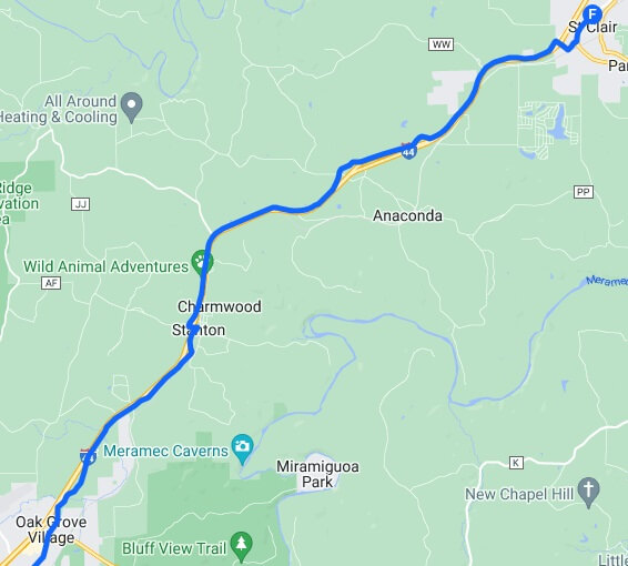
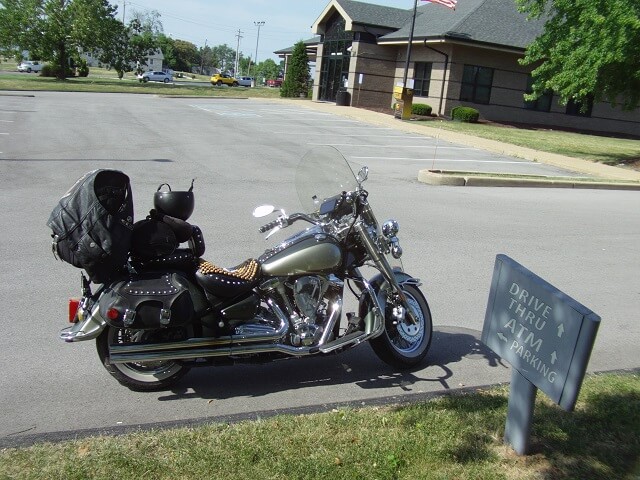
Around 4:30 PM my shoulder was really starting to complain, and I decided even though I was running behind schedule that I needed a break. I was looking for somewhere with a wall or object suitable to use to roll out my shoulder with the therapy ball. The best I could find was a bank parking lot in St. Clair, MO that had a big old oak tree nearby.
I took about a 10 minute break. I tried to use the tree to roll my shoulder, but the bark didn't make for a very smooth rolling surface. And bank employees were starting to give me looks. So I got back on the bike and continued the journey.
Now that it was late afternoon, I decided to just buckle down and try to get to my next planned stop, which was Ted Drewes Frozen Custard in St. Louis. This diem wasn't going to carpe itself, so I was going to have to dig deep and put in some effort.
Around Villa Ridge, both Google Maps and the GPS had a weird little detour calculated. In looking at the map, it appeared that I could just ride straight through on the road for a couple blocks, but the route had me going a couple of blocks out of the way and then coming back and joining up with the main road again. I've already shown a few examples of the GPS exhibiting this odd behavior, but it was weird that Google Maps was also doing it so I assumed it was due to road construction.
Well, I was riding along kind of zoning out and I happened to just stay on the main road without noticing I missed that little detour until I was already past it. There was no road construction or any other reason I could see that both mapping devices would take me off the main road. Sometimes technology isn't quite fully developed I guess.
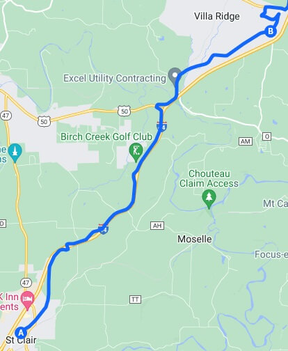
Just past Villa Ridge, south of Gray Summit my route had me crossing to the north side of the interstate and heading northeast. However, there was a sign that indicated that old Route 66 continued straight on Osage Street (business 40.) Confused, I pulled over in a gas station parking lot to give it some thought.
After a moment of deliberation I decided to follow the street sign. However, about two miles down the road I realized that my GPS was probably correct, so I turned around and headed back, then proceeded on the original route.
Pondering the situation, I think what happened is this is a spot where the old Route 66 itself had changed over the years. I believe the route I had planned out was the original path, but the road sign indicated a newer path. Don't quote me on this, there's a good chance it is the other way around.
In any event, either road probably would have kept me on a version of Historic Route 66. However, it was easier for me to stick with my original plan rather than trying to improvise.
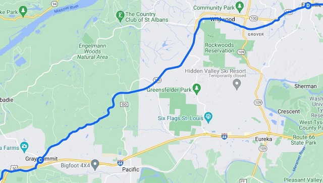
As I approached Wildwood, MO, the highway bypassed the town on the north side. Old Route 66 used to pass through the town itself. So I got off the main highway and took this side street.
When I first turned onto this street I wondered if I should have just taken the bypass. It would be faster, and really probably would be "close enough" to the original Route 66. Something inside of me told me to just continue down this side road.
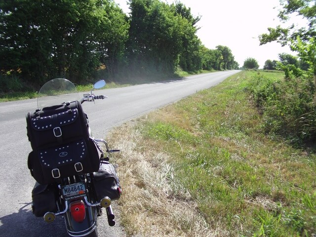
What a good decision that turned out to be. This little side road, while low speed and about 6 miles long, wound up being probably the most scenic riding I had all day. The entire road was under a canopy of trees and traffic was light. It was a very pleasant little section of road.
Back on the "main" highway 100, I noticed traffic was picking up. I was reaching the edge of the St. Louis suburbs, and it was now rush hour. Thankfully more of the traffic seemed to be going in the opposite direction as people were leaving the city at the end of the day.
Around the suburb of Manchester I found myself in a very urbanized area of the city, riding past shopping centers, grocery stores, restaurants and gas stations. The next eight miles was stop and go traffic, with speeds rarely exceeding 30 mph. I took solace in the fact that I was now close enough to St. Louis that the end of the journey was in sight.
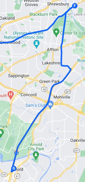
Highway 100 intersected with highway 61, where I would head south (although both being low speed city streets it's difficult to call them "highways.") Looking at the map it was just a simple right turn to move from one highway to the next. However the GPS did another one of those weird routing things:
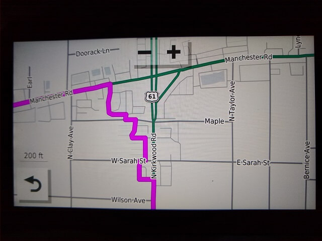
Thankfully I had noticed this weird routing path earlier that morning so I had anticipated the situation. I ignored the GPS's advice to start riding through little residential side streets and instead just stayed on the main route and made a simple right turn.
Heading south on 61, I was in a familiar area. I had ridden this same street the previous year on my Mark Twain trip.. I passed familiar landmarks such as the Kirkwood City Hall and the Magic House Children's Museum (an excellent place to spend a day with your family if you've never been there.)
At highway 366 I headed west. However the way the GPS routed me through the intersection seemed really weird, so I thought it was freaking out again. As it turned out, the GPS was spot-on, the intersection is just odd. Thankfully the GPS did its job, recalculated and directed me back on the correct path without too much fuss.
I was definitely on the home stretch now. Just a few more miles. Well, seven more miles technically, and because it was urban streets it took about 20 more minutes. But eventually I reached the end of my Route 66 journey.
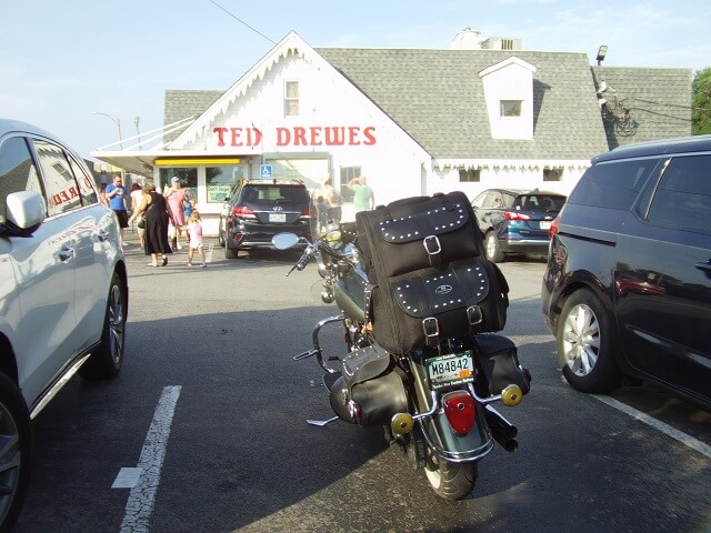
Old Route 66 continues on a few more miles through downtown St. Louis. For my own purposes I had deemed this spot "close enough" to the end. I had picked legendary "Ted Drews Frozen Custard" as my end point of retracing old Route 66.
I don't remember where I originally heard about Ted Drews. I just knew it was custard and it was located on the far east side of Historic Route 66 in Missouri. Knowing that it was going to be a hot day, it was easy to make this my endpoint destination.
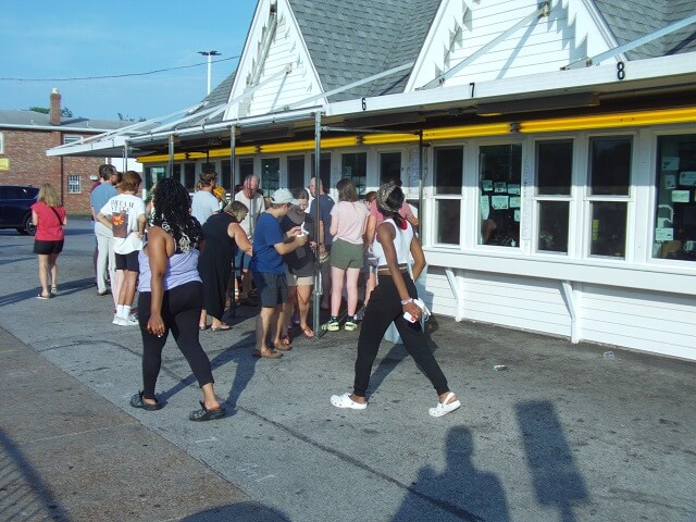
When I pulled into the parking lot the place was packed. Thankfully a car pulled out right when I pulled in, and I was able to immediately snag that spot.
I had assumed this was a typical drive-in ice cream place, so I figured in addition to some frozen custard I could also maybe grab a simple supper like a chili dog and some fries. I walked over to the menu board on the side of the building and was surprised to see that all they sold was frozen custard.
I was pretty hungry, and was wanting more than just custard. After deliberating for a minute I decided I would have custard now, and then grab some "real" food later. Basically I would just eat dessert first.
I also was extremely thirsty. Much to my delight they had a water cooler available. I started there and chugged three glasses of water, then filled up my water bottle to drink while I was waiting in line. The water was cold and glorious tasting.
They had three or four windows open, and each window had a line about ten people deep. I picked one of the lines and waited in the queue. As I was standing there I noticed a guy was looking at my motorcycle with another woman standing near him. And when I say "looking", I mean he wasn't just staring at it but was walking all around and pointing at different things.
My radar went on full alert. I stared at the eagle-eyed in case he started to open my luggage, or make a move like he was going to grab something off the bike and run. I would have just gone over immediately and asked him what he was doing, except that I was already about halfway through my wait at the custard counter. I figured I would wait until he proved himself nefarious before I gave up my spot in line.
The woman with the guy glanced over and saw me watching like a hawk. I was at least 50 yards away and standing in the middle of a crowd, but I must have stood out like a sore thumb because she immediately recognized me as the owner of the motorcycle. She pointed at the bike, then gave me a smile and a thumbs up. Apparently the guy just liked my bike and was checking it out. I gave her a smile and a wave back, but I still kept my eye on them just in case that was a decoy. After a minute they left.
When I reached my turn at the window, I ordered a large "Muddy Mississippi" concrete. The concrete is pretty much the Ted Drews version of a DQ Blizzard. This flavor consisted of peanut butter, chocolate chips, and sugar cone pieces mixed into vanilla frozen custard. I originally was going to just order a small or a medium size, but at the last second I thought "why not?" and the word "large" came out of my mouth.
It took a few minutes for them to make it. I was unsure of the proper place to stand while my order was prepared, so I just kind of hung out near the ordering window. I was hoping that there wasn't a "pick up your order here" window around the corner. Much to my relief, in about five minutes a kid inside the stand stuck his hand out the window with my custard.
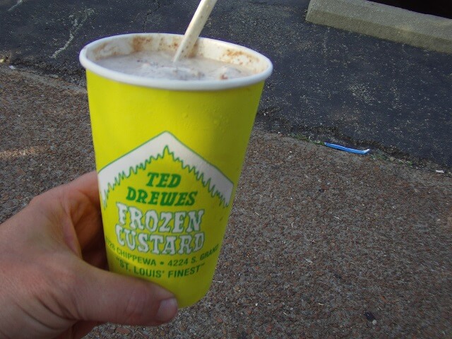
There was a row of park benches over along the street, near where I had parked. I walked over and found an empty spot on a bench where I could sit and eat my custard. Well, kind of sort of. The heat of the day was so intense that within five minutes of receiving my treat it had turned runny enough to drink. So I wound up drinking my custard and then eating all the mix-ins with a spoon.
It wasn't bad custard (is there ever bad custard?) However I didn't see the fuss that would cause people to line up for it the way they were. The whole time I sat at the bench there were constantly cars pulling into the lot and people getting in line. Frankly, I think Culver's frozen custard is better even though it's not as iconic.
I'm not sure if the bench was uncomfortable, or if I was really sore. Probably a combination of both. Either way, after I had finished my custard I had no desire to sit and linger. I got back on my bike and started to head towards my hotel.
My hotel was actually in a suburb called Arnold on the south side of St. Louis. It was about 14 miles from Ted Drews.
The first half of the ride to the hotel was through mostly residential backstreets. As I putted along I saw a building with very interesting architecture. I pulled over and snapped a photo.
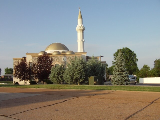
There were no obvious signs stating what this building was, so I looked it up later. Turns out it is the "St. Louis Islamic Center". I decided I don't necessarily have to agree with their beliefs to appreciate the aesthetic design of their building.
The last half of the trip to the hotel was down interstate 55. I had actually sought out a non-interstate route to the hotel, but didn't find a satisfactory one. I decided that eight miles of interstate at the end of a long, hot day wasn't the end of the world.
I got off at the designated exit and found the hotel. I then decided that rather than checking in and then going to find food, I would get something to eat now and then check in later. I knew once I made it to my room that I would be "done" for the day. Even though I had the large custard I was still hungry for something with a little more substance.
A few blocks from the hotel I came across a Lee's chicken. This is a chain chicken restaurant, but it's a chain that doesn't have a location anywhere near South Dakota. In my frazzled state I decided that was close enough to eating local, and chicken sounded good so I pulled in.
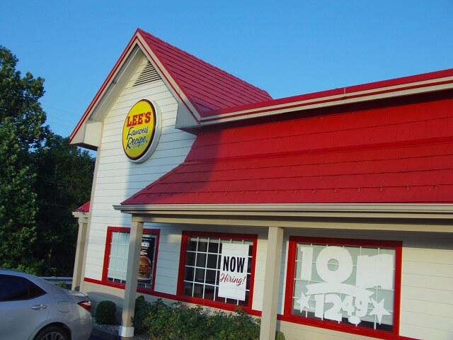
I went inside to order. I selected a two piece meal with slaw, fries and a biscuit. I must have looked like I was in some sort of distress, because the kid behind the counter started asking me questions about how far I had ridden in the heat. He was really encouraging me to sit in the air conditioning to eat my food rather than taking it to go. I thought it was peculiar how interested he was in not wanting me to go back out into the heat.
I knew I was close to my endurance limit for the day, but I also knew that I had enough juice in my tank to make it back to the hotel. I replied that at this point I just wanted to get to my hotel room and crash. I thanked him for his concern and took my food.
Heading back to the hotel I decided to stop and top off the gas tank so I wouldn't have to worry about it in the morning. I really didn't feel like taking the extra time, but I knew that the next day I would be glad I did. There was a gas station between Lee's and the hotel so I pulled in and tried to make the gas stop as fast as possible.
With the bike tank full, I rode another couple blocks to the Pear Tree Inn.
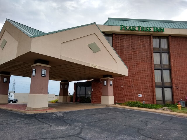
I went inside to check in. I could see the lady running the front desk in a side room attending to something else. The air conditioning in the lobby felt glorious, and there was an air duct directly above where I was standing so I didn't mind the wait.
After a couple minutes the lady saw me standing there and apologized for not seeing me earlier. I told her I didn't mind as I was enjoying the cool air. She turned out to be extremely friendly. We had a good conversation as she checked me into the hotel, and she was especially fascinated with my South Dakota driver's license as it has a holographic state seal in the background, which I assume is to make it more difficult to counterfeit.
She gave me my room key and told me where to park. I got back on the bike and rode around to the back side of the hotel, then grabbed all of my gear. Like the previous night I decided to try and take it all in one trip. Only this time I had my chicken dinner I was also trying to carry.
I took the elevator up to my floor, and found my hotel room all the way at the end.

The first thing I noticed was that the room was kind of warm. The thermostat said 76°F. Although this was cooler than the outdoor temp I had been in all day, it wasn't as cool as I had hoped it would be. I turned the setting down and hoped that the A/C unit would kick on. The unit ran all night but the temp never dropped below 74°F. That was disappointing.
On the way to the hotel I had thought about going for a swim. I knew the hotel had a pool, and I had packed my suit. I figured a dip in the pool would feel good. However, once I got to the hotel I saw the pool was outside. Quite frankly, I was done with being outside for the day and going back out even to swim was unappealing to me.
Instead I decided to let my chicken sit for a bit and I took a cold shower. It felt great to let the cool water flow all over my skin and drop my body temperature back down to safe levels. It also felt good to scrub the layer of road filth off my body.
Once I was out of the shower I decided I wanted some ice to cool down the drinks (sparkling water) I had brought with me. I didn't bother putting shoes on as I assumed the ice machine was just down the hall. I walked up and down the hall on the whole floor not finding a machine. Then I took the elevator downstairs and found the ice machine over by the lobby. I probably should have worn shoes.
About an hour after I had bought the chicken I finally ate it. It was still tasty. Mr Lee cooks a good chicken.
I found a baseball game on TV and called home. This day's events at home were less traumatic than the previous day's, with no tornadoes or power outages. After talking to my wife for a bit, I told her goodnight and crawled in bed. For only having ridden a little more than 300 miles I was completely wiped out. I think it was the heat.
Return To The Main Motorcycle Gallery
This page last updated on 11/03/2022