


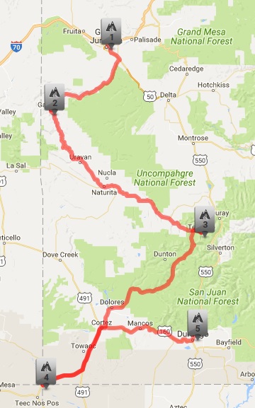
Mileage wise, this day was going to be the shortest day of the whole trip. Part of that was by design, as when planning I knew we would be riding two consecutive days over 500 miles and figured we'd need a bit of a "recovery" day. The other part was simple coincidence that the route lent itself to a shorter day as trying to add more miles wouldn't have put us in a convenient place to stop for the night.
Because this was a shorter day, we didn't bother trying to get up early. I had set my alarm for 7 AM, which according to our bodies still on Central Time was 8 AM. We got up and started stirring, and I gave Jon a good razzing that only a true friend can do about mistaking thunder for my motorcycle starting up.
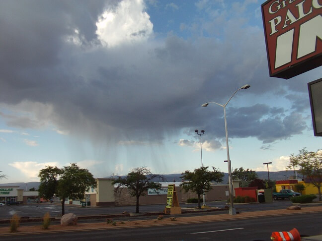
However, speaking of thunder, we could still see the remnants of the storm on the east side of town. The roads were quite wet and an occasional sprinkle was still falling. I checked radar and it looked as though once this system finished passing through we would be clear for a while, so we just took our time getting ready.
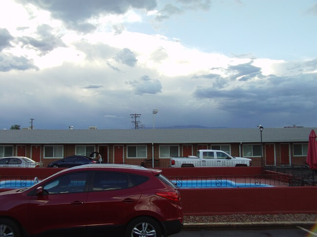
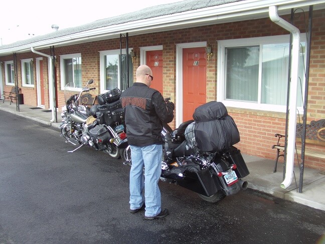
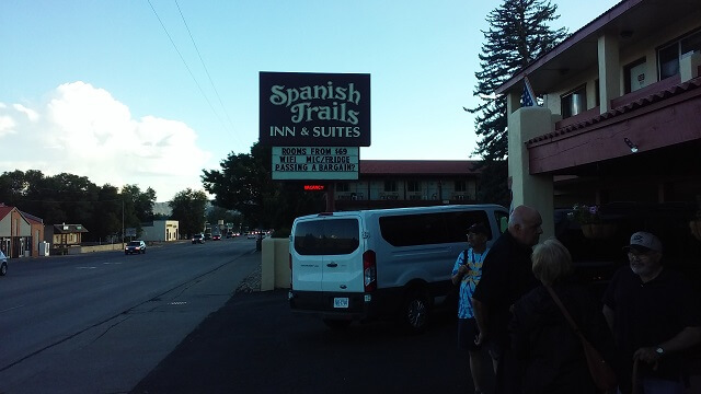
I went down to the lobby and was pleasantly surprised with an excellent breakfast setup. In fact, I had a hard time choosing what I wanted to eat because there were so many options. I ate my breakfast and studied the maps. Jon, not being a big breakfast guy, remained back at the room and loaded up his bike.
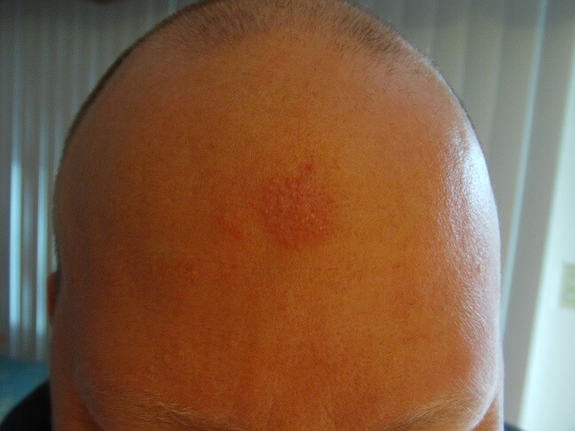
By the way, if you followed any of my two previous trip blogs, Jon has had an ongoing problem with a spot on his forehead getting rubbed raw by his helmet. He's tried lots of different things: swapping helmets, bandannas, roll-on body glide, etc. Nothing seems to prevent it. He's decided it must just be the shape of his head. I named the spot the "cyclops." Once again it made its presence known on this trip. I decided to take a picture of it each day to document its progress. However, after snapping this one picture it really didn't get any worse for him this year, so I kind of forgot about any further photos.
After I finished eating I checked out what the sky looked like. There were still a few remnants of rain in the direction we were planning to head, but it was much clearer than it had been when we first woke up. I figured by the time we actually head out of town this little bit of rain would pass through.
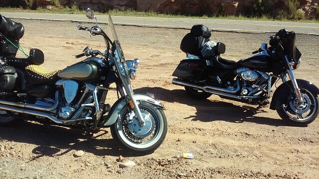
I went back to the room and packed up my gear. We had parked at the end of the lot, and Jon had hauled all his luggage down to the bike. Me being the lazy type, I went down and moved my bike up to the door of the room so I didn't have to carry everything as far. Because that's the kind of guy I am. Jon also pulled up, but was pretty much ready to go.
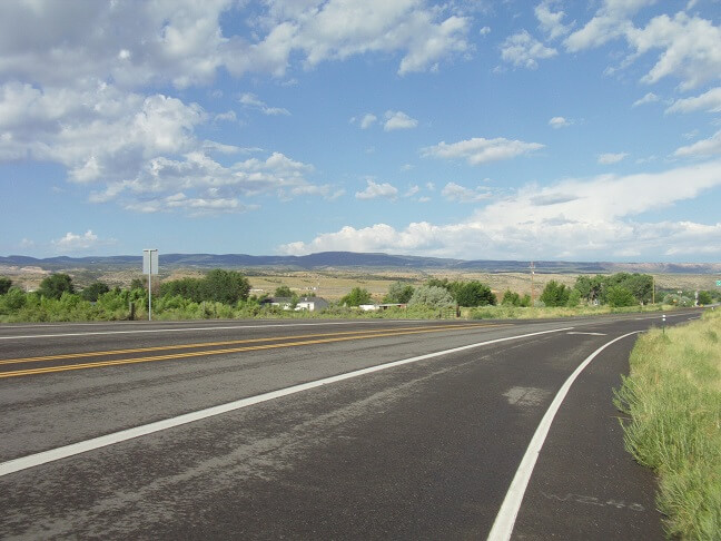
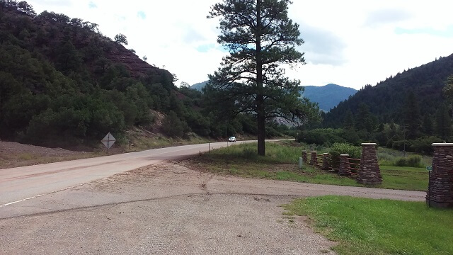
I went and checked out of our hotel room, then we hit the road. The rain was pretty much gone now and the only thing left was a bit of wet pavement.
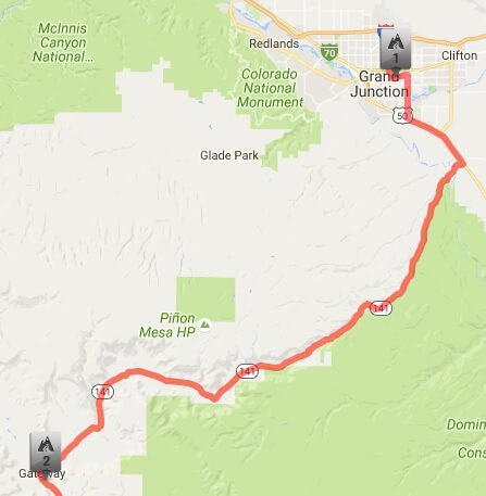
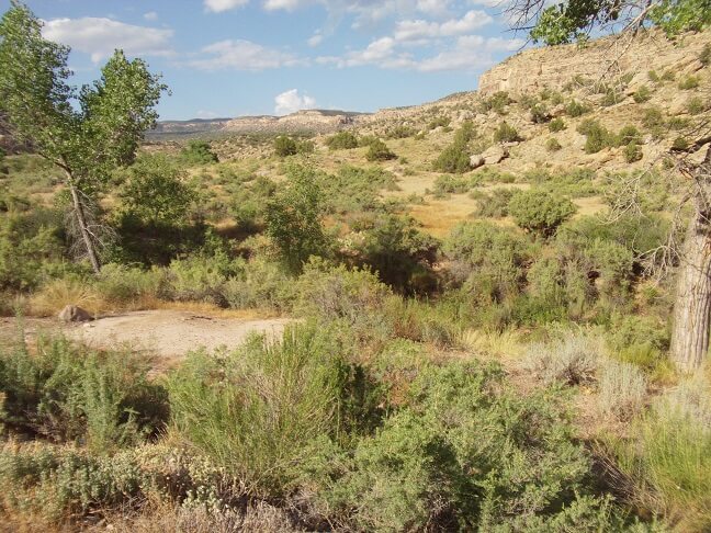
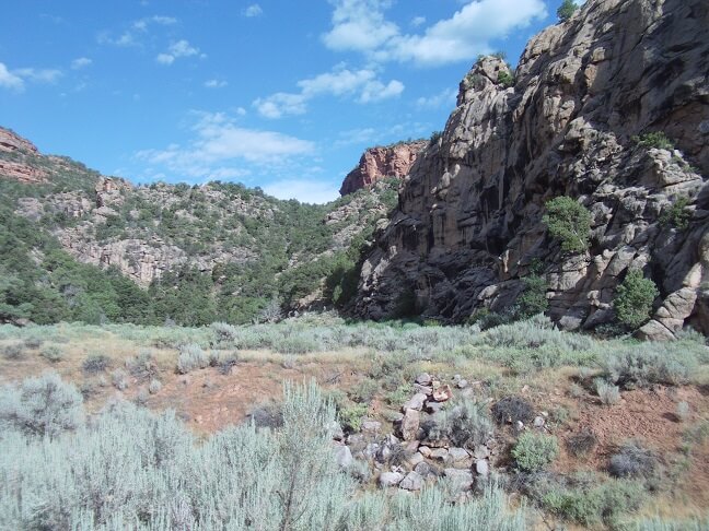
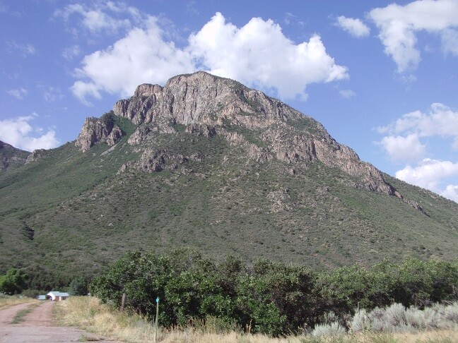
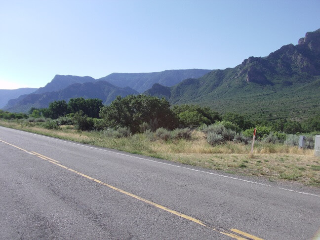
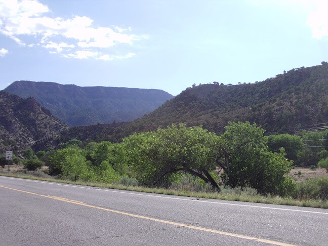
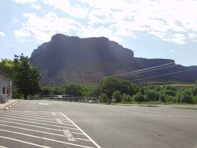
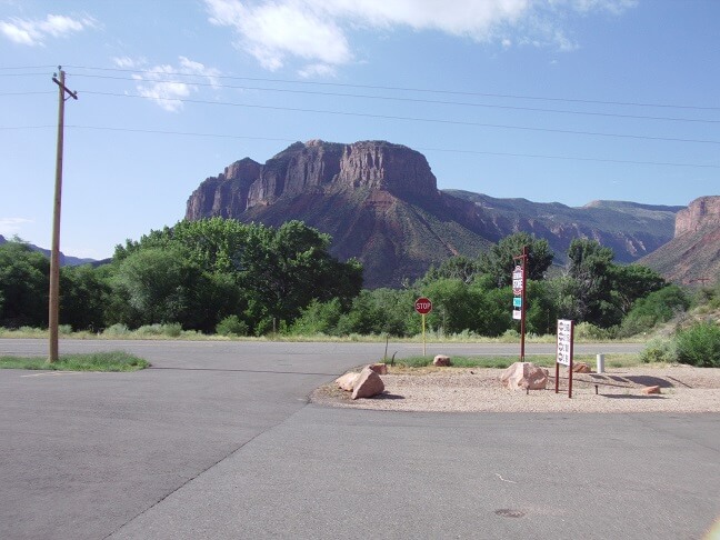
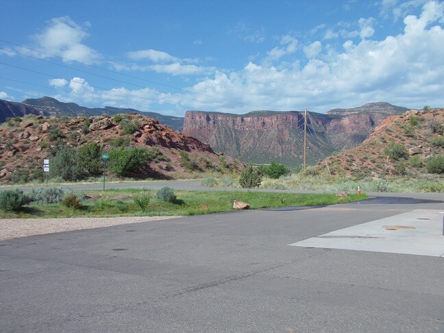
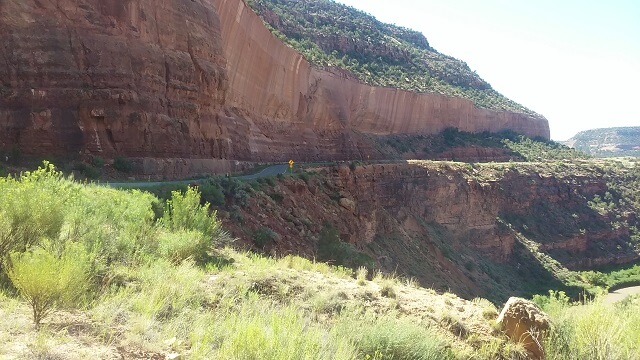
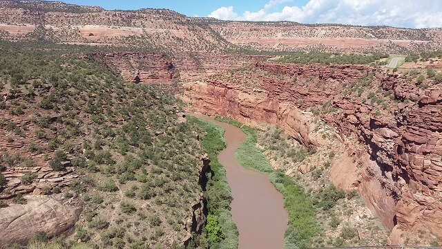
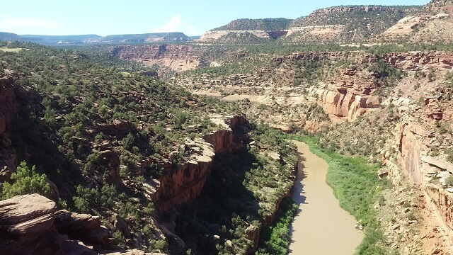
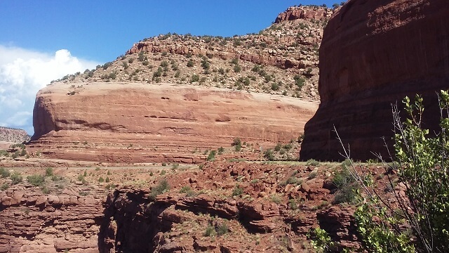
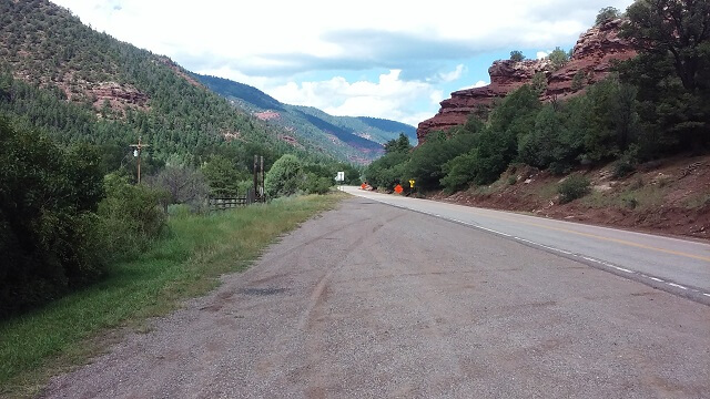
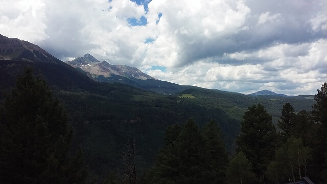
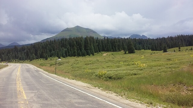
Our first leg of today's journey took us down highway 141 which is also known as the Unaweep Tabeguache Scenic Road. I had this highway on my "must ride" list for a few years now because of the book "Ghost Rider: Travels on the Healing Road" by Neil Peart. Basically it documents an extended road trip he took after losing both his wife and his daughter within a close period of time. The book is an interesting read, although it's not written in a traditional manor as much of it is made up of copies of letters he wrote to various people along the way. Anyway, at one point Peart wrote about his journey down highway 141 and remarked that it was among the more scenic roads in all of his travels, so I made sure to make this highway part of our route.
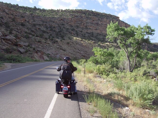
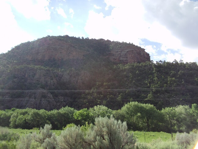
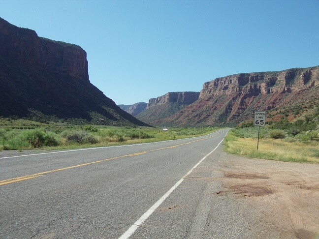
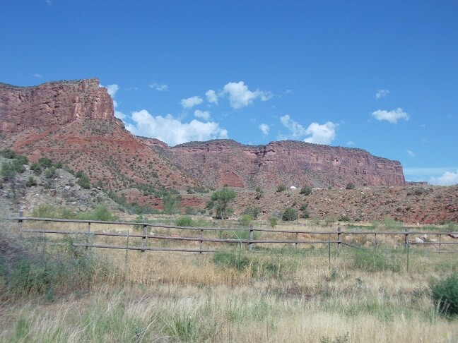
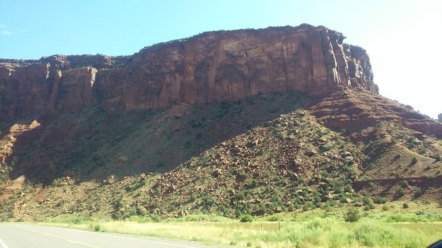
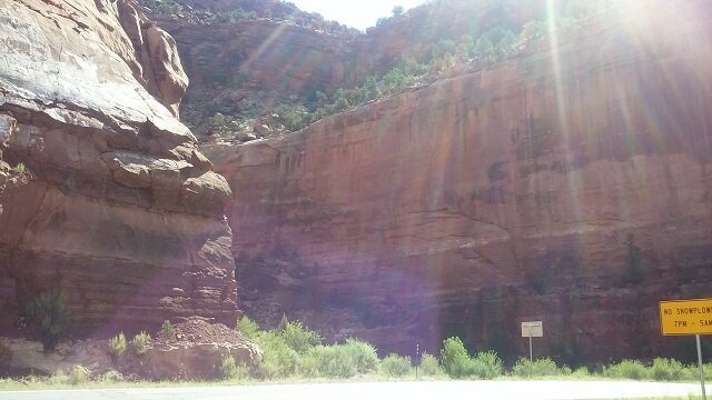
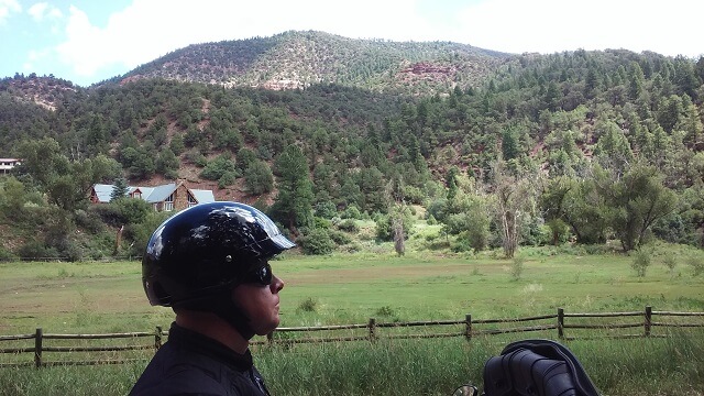
This highway certainly didn't disappoint. It was simply incredible. We stopped and snapped a lot of pictures, but there was no way we could capture everything we saw. Also, in looking at the pictures I took, none of them seem to do justice to the beautiful scenery.
At one of our frequent picture stops I remarked to Jon how awesome this road was. He responded in complete agreement.
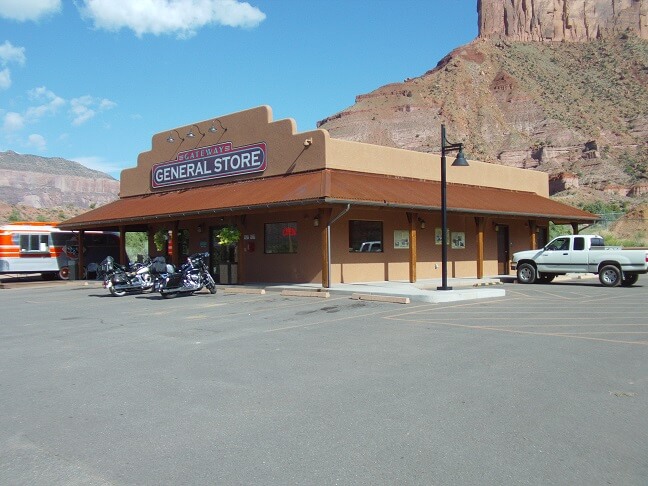
At the town of Gateway, we stopped for a stretch break. I went in the store and bought a soda. Jon used the restroom and then came in as well. We spent a few minutes talking to the girl behind the counter about the area. She told us about a resort just down the road that had one of the best car museums in the country. Jon asked her about a cliff walkway called the Hanging Flume he saw advertised on a bulletin board. She gave us an idea on where we would find it further down the highway.
After our break, we continued down the road, heading toward Telluride, CO.
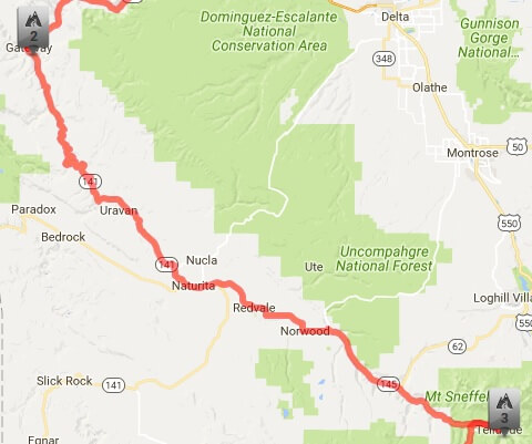
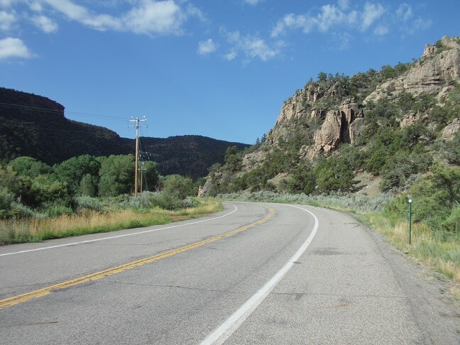
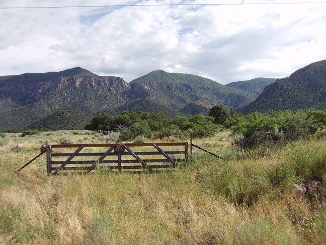
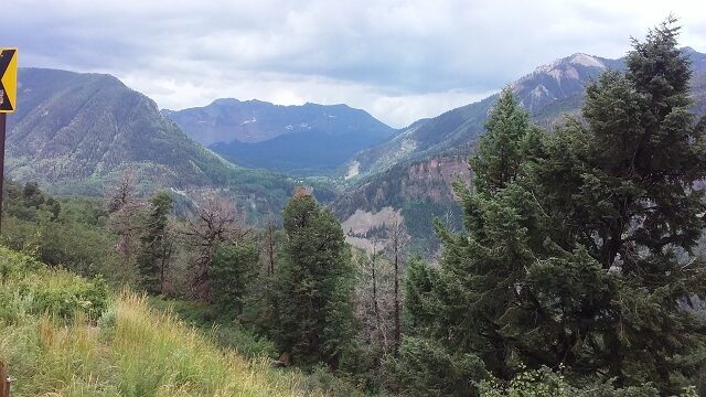
As pretty as the ride to Gateway had been, little did we realize that the most scenic part of highway 141 was yet to come.
During one of our "pull over and get a picture of this" instances, my camera battery died. I had charged it before I left home, and usually it's good for an entire trip. However, the battery didn't look fully charged when we left, so I had thrown it on the charger again overnight in Grand Junction. Obviously, it wasn't charging correctly. Losing my camera would have been a major bummer when trying to photo-journal a motorcycle trip. Thankfully, just a couple months prior I had upgraded my old flip-style cell phone to one of those newfangled smart phones. So I inadvertently had a backup camera along with me on the ride. The rest of the photos on this day were taken with my cell phone camera.
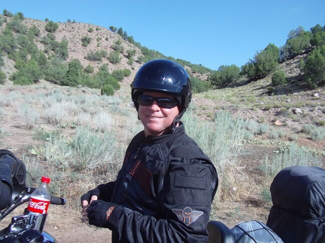
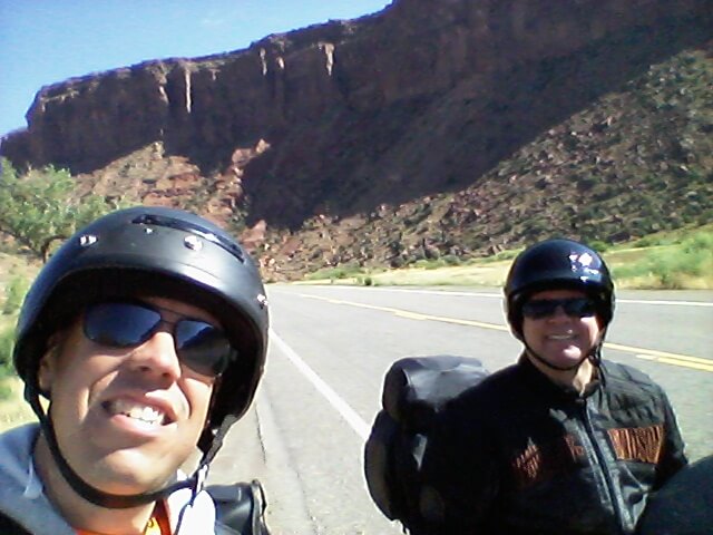
The first picture I took when switching to the phone was a selfie of Jon and me in the canyon.
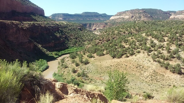
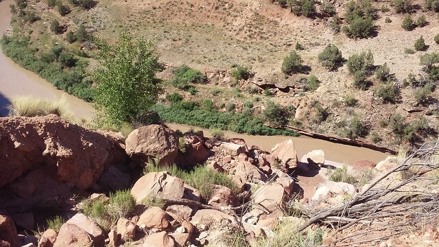
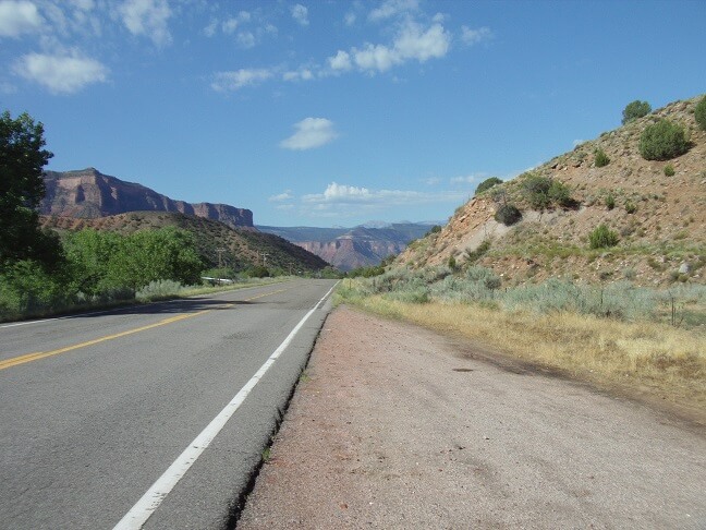
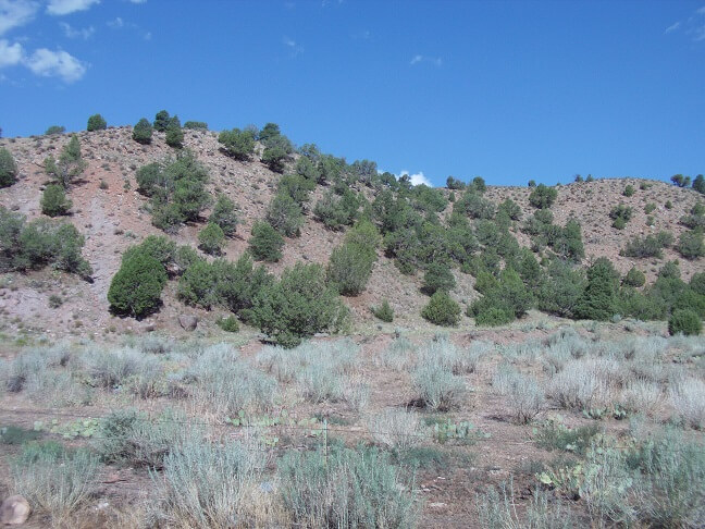
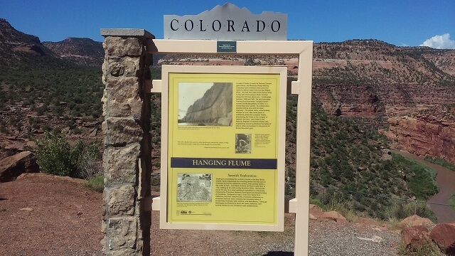
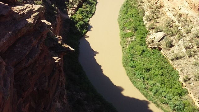
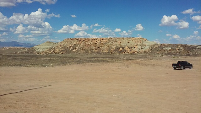
We found the Hanging Flume that Jon had seen advertised. This was an open water chute built along the canyon wall back during the gold rush of the 1880s. The original flume was 12 miles long, but much of it has deteriorated over time. There was a way to go down a road and take a closer tour, but we opted just to take pictures from the top of the ridge.
It's kind of hard to see, but some of the remnants of the flume can be seen in the lower right side of this photo. In fact, it wasn't until after I took the picture that Jon pointed out the remains. I hadn't even noticed them when I was staring right at it.
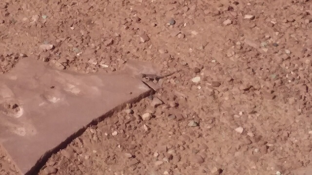
Speaking of hard to see, there were tons of little lizards all along this canyon. They would scurry across the road in front of our bikes. Thankfully I don't think I ran any of them over. I tried to take a picture of one but it was very successful in blending in with the rock on which it was sitting. It can be (barely) seen directly in the center of this picture.
You always see beer commercials displaying crystal clear mountain water and implying that they pull water out of a river versus getting it from the municipal water supply (which is what the municipal water supplies also do.) Well, I noticed they don't show the Dolores River in their commercials. This river looked like it flowed nothing but mud. You certainly wouldn't want to brew beer with this river water.
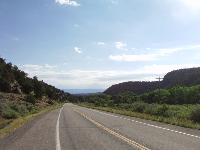
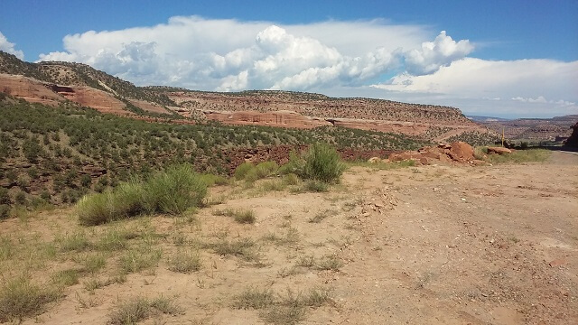
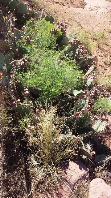
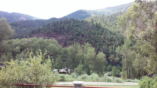
We continued down the road. Lots of scenery.
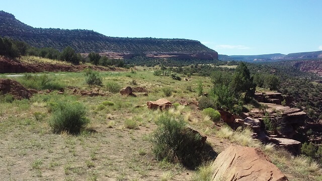
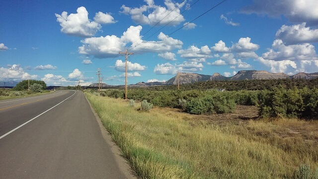
At the town of Naturita the road junctioned with highway 145, which we followed heading east. We came up a hill and the scenery changed from mountainous canyons to rural farmland.
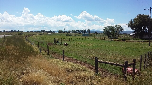
In fact, the scenery change was so drastic that I pulled over to double check my map and made sure I didn't take a wrong turn. All signs pointed to the fact that we were heading in the right direction, so we continued on. I was a little bummed that the scenery had ended. Not knowing what to expect I thought maybe it would be like this the remainder of the way to Telluride.
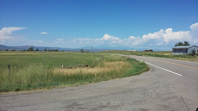
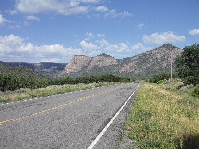
The scenery looked like this for about 20 miles. Then suddenly east of Norwood, it changed again. And when I say suddenly, I'm not exaggerating. The terrain looked flat, with the mountains off in the distance. Then there was a left turn and we descended into a canyon that wasn't visible before we entered it. It was an extremely dramatic change.
And again, we were back to breathtakingly beautiful. I wanted to get some pictures as we descended into the canyon but there just weren't any good spots to pull over where it was safe to do so. Instead, Jon and I just enjoyed the ride.
Along this route we went through a very small town that I can't even find on the map. I saw an amusing sign. It stated that the town was known for "Free gas, free beer and false advertising."
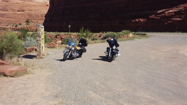
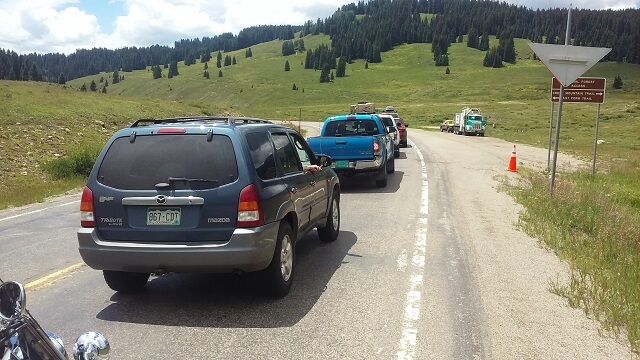
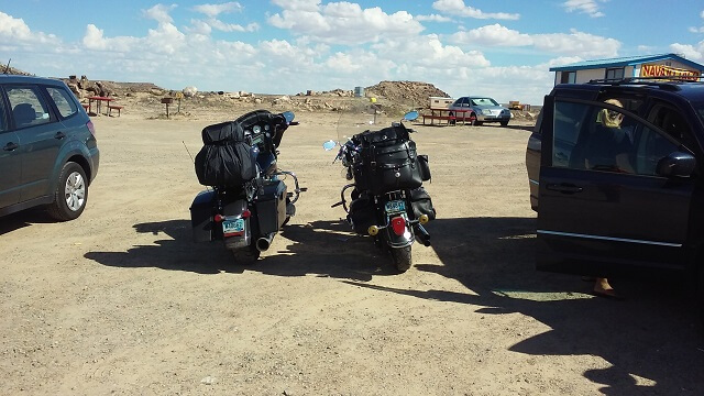
Around Placerville, we hit road construction. This was the first of several times on this trip we would be stopped waiting for a pilot car. In this instance, we were about 20 cars from the worker manning the stop sign. I shut off the bike and got off to stretch my legs. While I was waiting I snapped a few pictures.
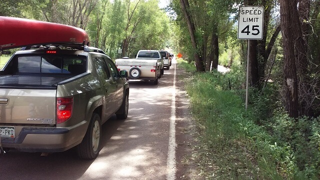
We wound up standing there for at least 20 minutes before the pilot car returned. I started to speculate how far traffic must have backed up behind us. It easily could have been miles, as this seemed like a heavily traveled road. The worst part is the people way in the back would have no idea why traffic was stopped. At least where we were sitting we could see the reason.
Finally the pilot car arrived and we watched traffic coming through the construction heading in the opposite direction from us. It took quite a while for the line of cars to finish coming through. At last it was our turn. We followed the pilot car through a couple of miles of construction. The road surface was questionable at best, but we made it.
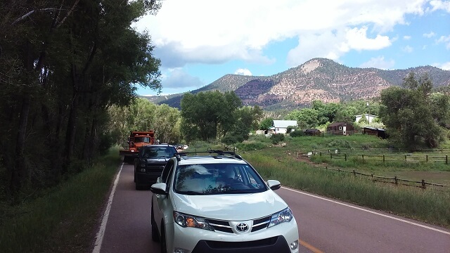
Once we were through the construction we were back on our way. Before we hit the construction we were running behind schedule, so now we were much farther behind. Thankfully I had eaten a huge breakfast and wasn't starving. I could only imagine Jon was getting pretty hungry, though. Our plans were to stop in Telluride for some lunch. Thankfully we only had about 10 miles left to get there.
However, we ran into two minor hindrances. The first was a guy in an RV that had no clue how to drive. I've ranted about RV drivers in the mountains before; too many times people rent/buy one of these things with the idealistic notion that they'll take the family on a relaxing tour of the mountains. Then they get in winding mountain roads and discover that they're either too afraid to drive at a reasonable pace, or simply not skilled enough to do so. Traffic which had already been backed up due to the construction was now stuck behind this guy. I'm not expecting anyone to drive like they're trying to win the Daytona 500, but at the same time you should be able to either keep a reasonable pace, or recognize that you can't and pull over occasionally to let traffic pass.
I suppose it's kind of like George Carlin used to say: "Anyone who drives slower than you is a moron, and anyone who drives faster is a maniac."
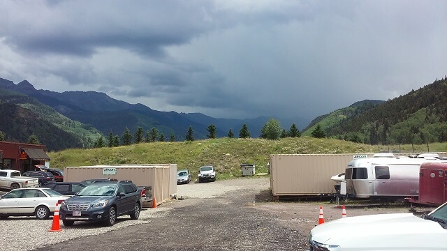
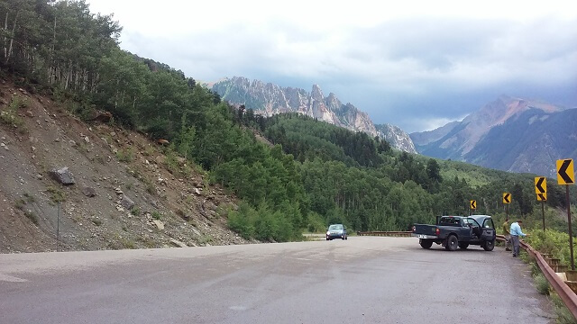
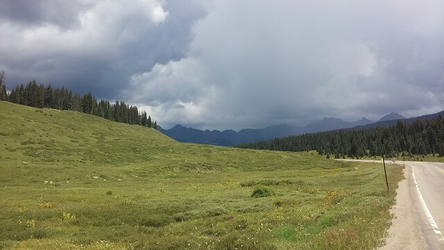
The other hindrance we encountered was an approaching storm. I had been watching it develop for quite a while, but wasn't sure which direction the clouds and we were heading. In the winding mountain roads it's easy to lose your bearings. By the time we were nearly in Telluride, though, it was apparent that we were heading right into it. The clouds were dark and there was plenty of lighting. It didn't look fun.
As I mentioned, our original plan was to eat lunch in Telluride. Highway 145 which we were to take south after lunch branched off just to the west of town. We would have ridden into Telluride, eaten, and then backtracked a couple miles to the junction.
As we passed the junction I noticed a gas station. I weighed the fact that we were going to have to backtrack, our schedule, and the pending storm and made a split decision to pull into the station. We were going to need gas soon anyway, so why not just do it now. Then Jon and I could discuss our lunch plans. The weather was looking pretty dark and ominous now.
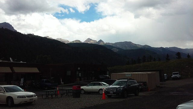
While we were gassing up I started chatting with a guy at the pump next to me. He was checking the weather on his phone. It looked like things were going to be stormy for about 20 miles in the direction we were heading, but then clear up.
Rather than continuing into Telluride, Jon and I decided to just grab some quick lunch right there at the gas station. We went inside. I had a giant slice of pizza, a Reuben sandwich and a soda. As it turned out I didn't need either the Reuben or the pizza as I was still pretty full from lunch. But I'm a pig so I ate both anyway.
While we were eating I texted my wife. That morning my son had gone through his first of three days of tryouts for the high school golf team. He was only going into the eighth grade, but in our home town middle school students are allowed to try out for high school sports if their middle school doesn't offer the same sport. He actually had made the team the previous year as a 7th grader, however there were limited spots available on the team so every player has to try out every year.
I got the update that his first day of tryouts went quite well. That was a relief, as I know how heartbroken the Tundra Boy would be if he doesn't make the team. Only two more tryout days to go.
After we finished eating we prepared to hit the road. I had hoped maybe the rain would have arrived while we were eating and then been done by the time we finished, but no such luck. It wasn't yet raining at the gas station, but the clouds still looked pretty bad. So Jon and I debated about whether or not we should put on our rain gear now, or wait. My rain gear isn't very comfortable or easy to put on, so I tend to lean toward the "let's wait and make sure we need it" approach. Jon's gear is more comfortable and easier to don, so he's more on the "let's wear it now just in case" side of things. This time around my approach won. I was really hoping that enough time had passed that we could skirt the edge of the storm and at worse get some sprinkles. Maybe we could avoid it altogether?
We hit the road. I am not lying when I say we made it less than 1/4 mile before the rain hit. At first it was just sprinkles and I remained optimistic. In less than a mile, though, it was a complete downpour to the point where I could barely see. Unfortunately we were heading up a winding mountain road, and between the curves and the reduced visibility from the weather there wasn't much for safe places to pull over. We continued on for a couple miles before we finally found a spot where we could stop.
It wasn't the best place to stop, but it was on a short straight section of road where we could be seen by traffic coming from both directions. There wasn't much for a shoulder, but the rain was coming down hard and it would have to make due. We put on our rain gear as fast as possible, although by this point we were drenched so it really was a futile effort.
To add to the futility, once we got our rain gear on and we were back on the road, I am once again not lying to say we made it about 1/4 mile further when the rain stopped. Great.
I suppose having the rain stop was better than riding through a monsoon for hours, but it was a bit of a kick in the teeth. We were already drenched so had we just pushed on through a little further we could have saved ourselves the time and hassle of putting on the rain gear.
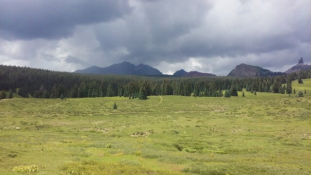
Nothing we could do about it now, however. We continued down highway 145. The roads were still quite wet from the storms, with some deep puddles here and there. Neither Jon nor I had great amounts of tread left on our tires, so we took it pretty easy around the curves on the wet pavement. The good news was that the area was very scenic.
Continuing down 145 the road slowly dried out, and the sun started to peek through.
About 20 miles south of where we stopped to put on our rain gear we once again hit road construction. Traffic came to a stop while we waited for a pilot vehicle.
As we waited, two things became evident to me. First, was that I was in need of a restroom. Unfortunately there wasn't one, and we were in an open area that provided no cover to form a makeshift toilet. Thankfully it wasn't so bad that I had to resort to drastic measures.
The other thing was that it was getting warmer. We were still wearing our rain gear. I decided that while we could still see dark clouds in the distance, it looked like we would remain mostly dry from this point on. Well, not counting the fact that we were still soaked from the previous storm. As long as we were stopped we removed our rain cover. I left my jacket on though, as some of the mountain passes could still get a bit chilly.
This construction stop wasn't as long as the one we'd experienced before lunch, and only delayed us about 15 minutes. Soon we were back on the road heading toward Cortez.
We had about 50 miles of riding until Cortez. The road was scenic and twisty, but despite the traffic moved along without too much need for passing or getting passed. We could still see rain clouds off in the distance but never felt any precipitation for the rest of the day.
This stretch of road started to feel a bit long. Some of it was due to my need for a restroom, some of it was due to the increasing temperatures, and some of it was just due to us being over 1,000 miles from home. While it only took a little more than an hour to get from the construction stop to Cortez, it seemed like about three.
I thought about finding a spot in Cortez to stop and use the restroom. However at this point I was torn. We were going to make a stop at the Four Corners monument, and I decided that I would tough it out and just keep rolling. I was reaching that point in the day where I just wanted to be done. The heat was really becoming a factor in our weariness.
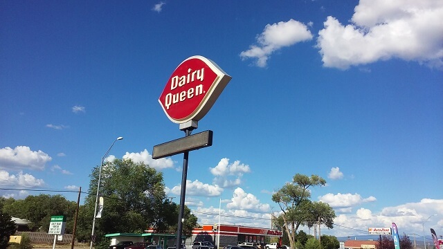
While we were rolling through town on highway 160, Jon pulled up next to me and stated, "I'm never coming on another motorcycle trip with you!"
This caught me off guard, so I responded with a puzzled, "What?"
He then grinned and said, "Because you just rode by a Dairy Queen without stopping." Apparently Jon wanted ice cream. We agreed that we would stop for ice cream on our way back through Cortez after visiting the Four Corners. After all the monument was "only" 40 miles away.
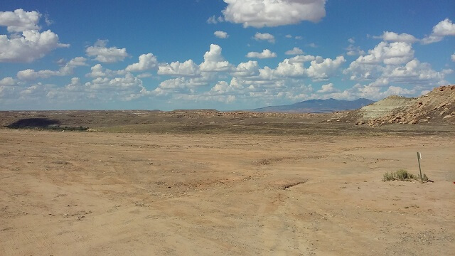
South of Cortez there was an abrupt shift in terrain. North of Cortez was winding mountain roads with lots of trees. South of Cortez was straight highway through desert with buttes poking up all around.
We followed highway 160 all the way to the monument, which seemed a lot farther away than 40 miles. It didn't help that the temp was now well above 100 degrees and that we still had our jackets on. The wind was blowing pretty hard, but it was a hot wind that merely annoyed without providing any cooling. This stretch of highway just felt brutal.
We crossed into New Mexico. We didn't have far to go now!
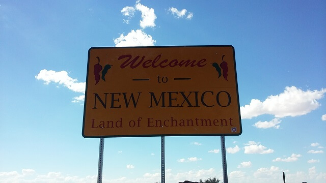
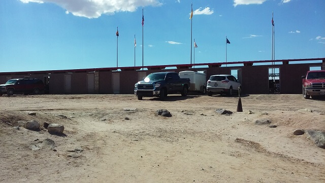
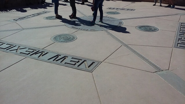
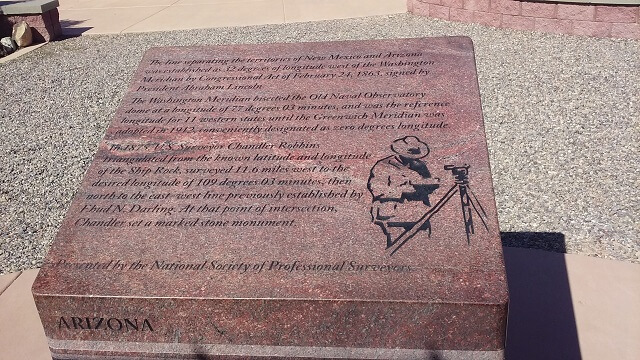
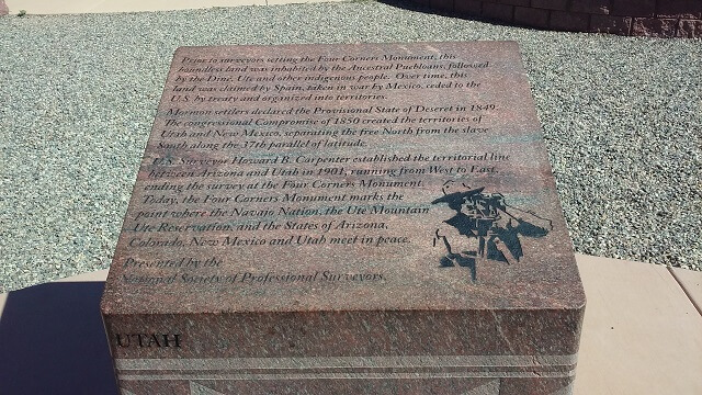
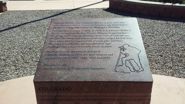
At long last we rolled into the Four Corners monument. The first thing that struck me was that this wasn't a "monument" like I had pictured in my mind. I guess I had assumed that this was a national monument, run and managed by the US federal government. It isn't. We discovered it's just a local attraction run by the Navajo tribe. As a result, it has a much lower standard of maintenance than that which I expected to see.
Before we arrived I decided that the first thing I would do was to ride around the parking lot on all sides of the monument. This would mean that we would have ridden our motorcycles in all four states. Well, we did just that. However the "parking lot" as shown on the map really was just a big patch of unmaintained dirt. In fact, at one point we had to ride through a big crevice that accidentally bottomed out our bikes. This "parking lot" was really in rough shape.
After circling the monument we found a place to park the bikes. First things first, I stripped off the layer of excess clothing I had been wearing. The heat was extreme and I couldn't take wearing my jacket and gloves any longer.
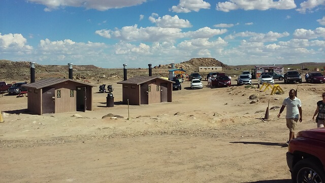
The next thing I did was run to the restroom. There were outhouses 100 yards or so from the bikes. I had been holding it in for a couple hours now and I was in need of relief.
The outhouses didn't look too bad from the outside, but from the inside it was apparent they'd seen as much maintenance as the parking lot. No running water or plumbing. Just a hole over a pit that looks like it hadn't been pumped out since Sir Alexander Mackenzie first crossed the Rocky Mountains in 1793. Seriously, it made portable chemical toilets look pretty nice.
After that septic adventure I returned to the bikes. Jon was still disrobing and packing his gear. I downed some ibuprofen and polished off the last of my water which I'd filled at our lunch stop, and at this point was quite warm. I think we both were glad to be off the bikes for a little bit.
We walked across the dirt clearing to the monument. I'm not sure what I was expecting to see, but whatever I had envisioned this didn't live up to it.
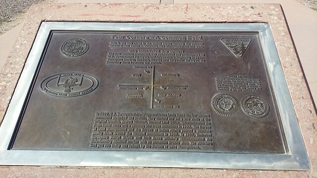
Inside there was a small amphitheater-like area with the center being the spot where the four states come together. In reality, GPS locates the states converging at a point about 30 yards to the north-east of the emblem, but for the sake of argument we'll just pretend that this was the spot.
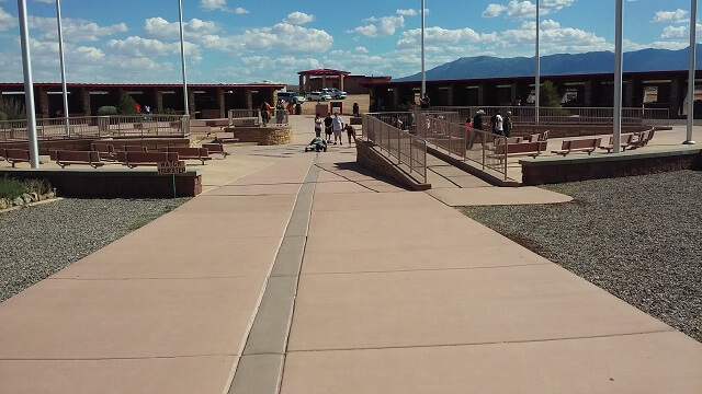
Around the outside of this amphitheater were booths where local tribe members were selling memorabilia and Native American crafts. They weren't permanent shops and it looked more like a "whoever showed up that day to sell their junk" kind of situation. Also not what I expected to see.
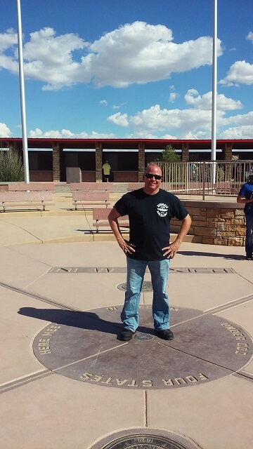
First, we walked to the center. There was an informal line of people taking turns having their picture taken on the emblem.
Most people would just stand in the center as their friends or family snapped their picture. I decided I needed to do one better. When it was our turn, I decided that I was going to lay down in the center and put a limb in each state. The only problem was this emblem was made out of a stone tile, it was 100+ degrees out and the sun was beating down. I think you could have cooked eggs on it.
Not letting 2nd degree burns deter me, I laid down and immediately pleaded with Jon to snap the picture as fast as possible. I don't know if I could actually hear my flesh sizzling or if that was just in my mind, but in any event I could feel the searing heat. The others in the crowd reacted in amazement that I would do such a thing. As per my usual personality, I'll do anything for a laugh.
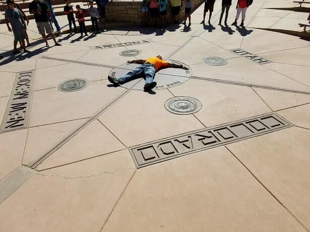
I tried to get Jon to do the same, but had to settle for him just standing on the emblem.
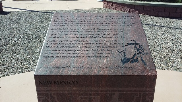
After taking our photos in the center we took a lap around the pavilion. There were small monuments to each of the four states, along with a plaque in the ground for the entire monument.
In literature there is a device called a MacGuffin. It is the motivating element that drives the plot despite lacking intrinsic importance. After visiting the Four Corners Monument, we decided that it was the MacGuffin for this trip. Once we saw the monument itself we both agreed that this trip was more about the journey than the destination.
And speaking of journey, the day's journey was not yet over. We still had 85 miles left on the day's journey before we could rest in Durango for the evening. Hot, tired and weary, we climbed back on the bikes and headed back out on the highway. At least we could look forward to a rest stop in Cortez and cool off with some ice cream.
Somehow in planning for this trip I managed to overlook the fact that this area of the country is a desert. I just wasn't prepared for how barren it really was.
The forty miles back to Cortez were tough. I kept my sanity by counting the percentage of the trip as every mile marker passed. Each mile would account for 2.5% more of this stretch and I would audibly speak each increment. It was something to occupy my mind.
We finally reached Cortez and found our way back to the Dairy Queen. It had air conditioning and running water. I ordered a salted caramel blizzard and we sat for about 1/2 an hour just relaxing in the cool comfort.
Reluctantly, we hit the road again for the last 45 miles or so to get to Durango. Heading east we went back into the mountains, and the temps cooled slightly which was a welcomed change. The road was scenic, but traffic moved fairly quickly.
As we rode on this stretch I thought of an old acquaintance who had moved to Durango several years ago, and about how I had heard that earlier this year he was involved in a serious motorcycle accident. He survived, but was going to require a lot of rehabilitation. It made me wonder where it happened, and could I be riding on the same road? It was a good reminder to stay vigilant.
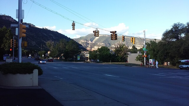
We reached Durango. I had written down my directions, but they weren't as clear as they should have been. Well, maybe that's not true. Perhaps the directions were clear but the street sign wasn't as visible as it should have been. In any event, I missed a left turn and pretty soon we found ourselves on the south side of town. However never having been here before I didn't know if we were on the wrong side of town or not. So I finally pulled over in an attempt to access a map and figure out where we were going.
For some reason the internet on my phone wouldn't work. It hadn't worked since we left South Dakota. When we were in remote areas I just wrote it off to lack of coverage. However Durango is a pretty populated town. Surely they would have adequate cell coverage.
So Jon pulled out his phone and we looked up the hotel on Google maps. I then was able to see where we zigged instead of zagged when we came into town. We had to backtrack a few miles, but eventually made it to the hotel which was on the north side of the city.
We checked into our room and got settled. The first thing I noticed was that our room was on the end of the building right next to the highway. Trucks coming down from the mountains would rumble by and be very audible. But we were tired and it probably wasn't going to be a big deal.
We relaxed for a few minutes. Jon called his family and I attempted to call mine, but they were out (at the county fair I would later learn.) Having just eaten ice cream, neither one of us were extremely hungry. I think Jon was still dealing with his sleep schedule being all out of whack and he probably would have been fine with skipping supper and staying in the room for the evening. I wanted to eat a little something though. Plus we wanted to gas up for the morning. So we decided to run and get gas and then hit the Taco Bell a few blocks down the road.
The gas station was farther down the street than I remember it being. Nevertheless we found it and topped off our tanks. Then we swung by Taco Bell and got our orders to go. I found it interesting that the prices in Durango were higher than they normally were back home.
We hauled our food back to the room. Jon ate his, but my wife returned my call before I had a chance to eat. So I spent some time talking to her, and then spent more time talking to my son who described his golf tryout in great detail.
Once I hung up I ate my food. Unsurprisingly I ordered too much again. I then showered off and got ready for bed. The previous two hotel rooms had insane amounts of water pressure. This hotel things went the other direction and the water barely trickled out of the shower head.
Jon fell asleep while I stayed up a little later watching a baseball game on TV and mapping out the next day's route. I also discovered that rebooting my phone fixed my internet connection problem. So that was nice.
Before I went to bed I got my regular digital camera charging by using my cell phone charge cable. I was hoping I could get it going again and that the camera wasn't a lost cause.
With the lights out I fell asleep. Several times throughout the night I woke up due to the paper thin walls. But I was so tired I would always go right back to sleep.
Return To The Main Motorcycle Gallery
This page last updated on 06/28/2018