


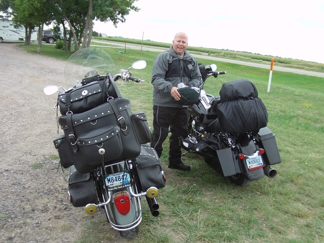
My alarm went off at 5:30 AM. Jon and I were planning to leave around 7, so I figured I'd have to be rolling from my house at 6:45. I had an hour and fifteen minutes to get ready, which was plenty of time.
I had set my coffee pot timer to start brewing at 5:15. The first thing I did when I got up was pour myself a large cup to let it start cooling to a drinkable temperature while I was making other preparations.
I dressed and did my final packing. I had a checklist of items to be packed, most of which I had crossed off the previous night. There were a few things, like my toothbrush, that I couldn't pack until I had a chance to use them in the morning. Also I had put my camera on the charger the night before so that was on the list too. Definitely don't want to forget that!
I made myself some oatmeal for breakfast, and relaxed for a few minutes while I ate and drank my coffee. Did a final map/weather/news check before I left. Then I applied a layer of sunscreen so I wouldn't have to worry about it later. With everything packed, I rolled out of the garage precisely at 6:45 as planned.
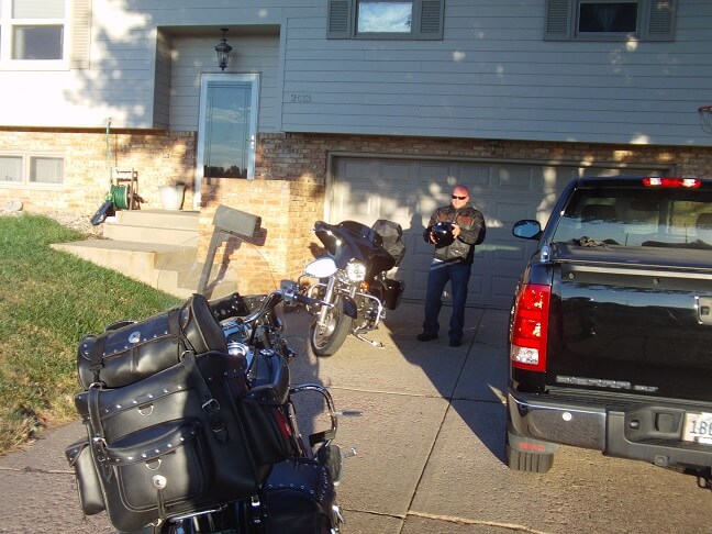
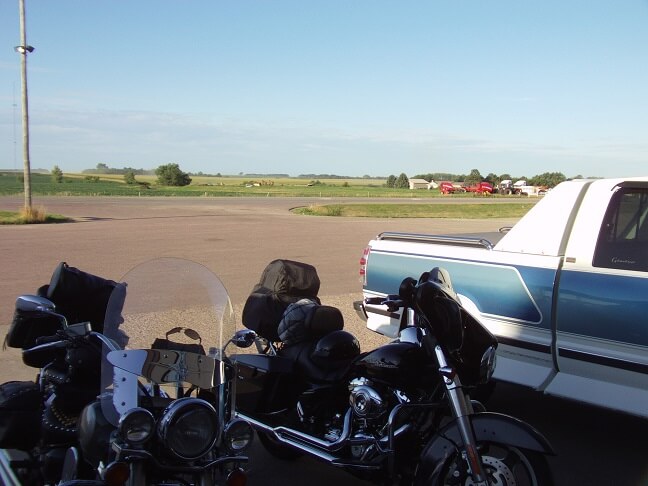
The city was quiet as I rolled through town. The temp was in the 60s, but the wind was yet calm. I made it to Jon's house right at 7 AM on the nose. He was in his driveway making final preparations.
As it turns out, I had arrived just a few minutes too late to catch some excitement. A woman had pulled up asking Jon where his neighbor was because she claimed the neighbor had her phone. Jon started to explain that he doesn't keep track of his neighbor's whereabouts. She wouldn't relent, so Jon called the neighbor.
The neighbor was out of town for a few days. Even if he did have the phone as the woman claimed, he wouldn't be back for a while. The lady started talking more and more nonsense, starting to go on and on about voices that were communicating with her and entities that were keeping tabs on her whereabouts. At this point Jon realized he had encountered this woman before on police calls (he's a cop.) He called the woman by name, which really freaked her out.
He firmly instructed her to leave his property and not return, a request to which she complied. However he didn't want her to return after we had ridden off and harass his family, so he made a call to another officer who was patrolling the neighborhood and asked that officer to keep an eye out for the lady.
So I missed that fun. Or maybe I didn't miss it, but just wasn't there to witness it.
Jon was pretty much ready to go, so we chatted about our route and then hit the road at 7:10. Having just drank a half pot of coffee, I was pretty sure I would need the restroom in about 30 miles. Plus history would suggest that's normal for me when I first start traveling in the mornings.
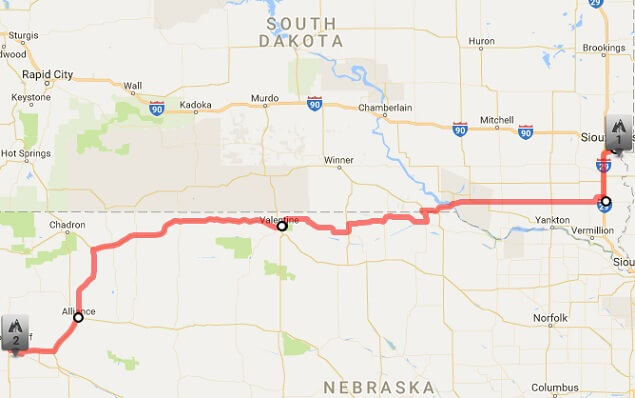
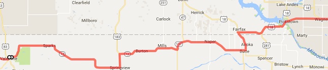
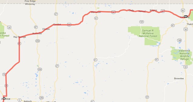
Our first planned stop, however, was Wagner, SD for gas. Wagner was roughly 120 miles away. Our bikes can go much farther than that on a tank of gas, but after Wagner there wasn't a whole lot of fuel options until we reached our lunchtime destination so I decided it would be good to top off while we had the chance.
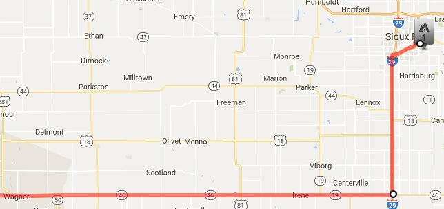
We headed south on I-29. This 30 mile stretch would be the only portion of today's ride that would utilize interstate. The remainder of the day would be two lane highways. The speed limit on I-29 is 80 mph, but I held steady around 75 mph. I did this for two reasons: first, the faster my bike goes the more fuel it drinks. Second, I've learned it's much more enjoyable to relax and let others pass you than to constantly be trying to pass others.
In Beresford, SD we exited the interstate and headed west on highway 46. Sure enough as I predicted, I was in need of a restroom. I pulled over at Truck Towne, a familiar truck stop.
After using the bathroom, I purchased a soda to drink on the road. I also noted that they had neck pillows for sale. I had seen these five years previous on my 2011 trip to Arkansas, and considered buying one then. I didn't at the time, but had been thinking about it ever since. When we pulled up I had it in the back of my mind that if they still had them for sale I was going to buy one. Well, they did still have them so I upheld my part of the decision and purchased one for $15.
Now, my reason for purchasing this neck pillow wasn't for the traditional reason. I didn't plan on wearing it around my neck. As I have mentioned many times on my previous trip blogs, after riding long distances my left shoulder starts to hurt pretty bad, the result of a dislocation I suffered in a motorcycle accident about 15 years prior. I've discovered I can stave off the pain for much longer if on long straight stretches I ride one handed and let my left arm rest in my lap.
When my arm is in this rested position, though, my lap is low enough that my arm hangs just slightly unsupported. I've often thought while riding, "It would be great if I had a little pillow to put under my elbow." So this was the pillow that I was wishing for. I wasn't sure if it would work or not, but decided I've spent $15 in more risky manners.
Plus, it was soft and I like soft things. I figured if it didn't work to soothe my shoulder pain I could at least hug it. But only when Jon wasn't looking, of course. Gotta keep that big burly biker illusion intact.
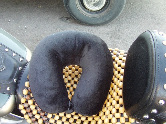
As it turned out, the pillow worked pretty well. I rarely had much shoulder pain on the trip, and what I did have was far more manageable than that which I've experienced in the past. This pillow had a couple of snaps that fasten the small edge together. I would run the snaps through a belt loop on my pants so that when I did lift my arm the pillow would remain on my lap. I pretty much rode with it the rest of the trip, except for the times when I was wearing my rain gear. In those instances I put the pillow in my saddle bag so it wouldn't get soaking wet.
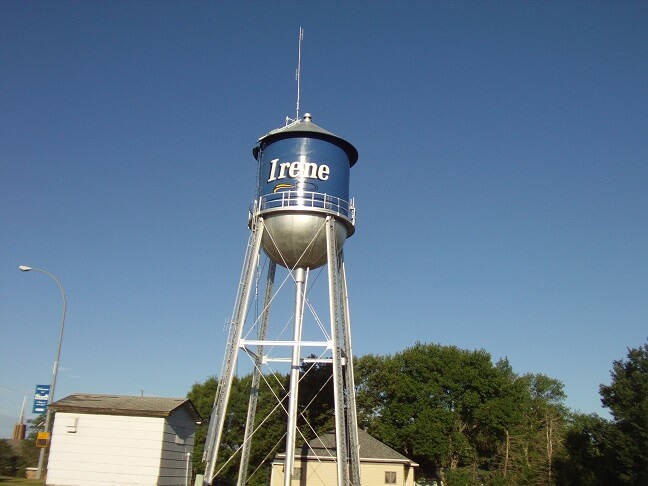
We continued west for about 14 miles. Jon forgot to put in his earplugs when we left Truck Towne so he pulled over to insert them. That became a running joke on the trip as it happened numerous times and I got in the habit of asking, "earplugs?" before we pulled out from any stop. While I was waiting I snapped a picture of the water tower. Jon reminisced about getting run out of the town of Irene one night as a rambunctious teen.
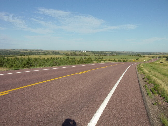
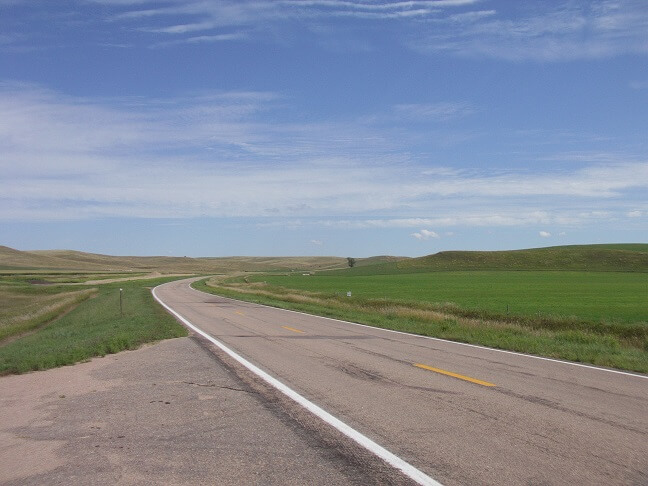
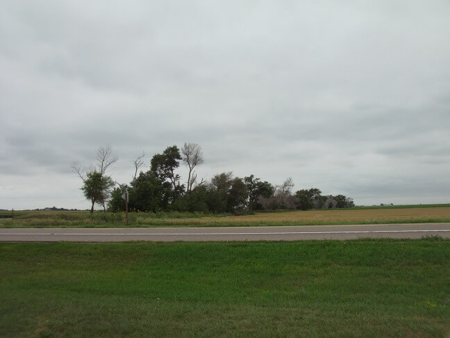
Further down the road we reached the James River valley. This is one of the more picturesque parts of the first leg of the journey, so I stopped to snap a picture. After we came out of the valley there was 50 miles of dull until we got to Wagner.
On the west side of Wagner (not that Wagner is a large enough town to really warrant an "east" or "west" side) we stopped for our first gas fill of the day. I pulled in and started refueling, and as commonly happens I found that after I stood up for a minute that suddenly I needed the restroom in a most urgent way. Unfortunately I'd already started pumping gas, so I had to finish filling the tank. Watching the fuel nozzle dispense its liquid contents into my motorcycle didn't help.
I finished topping off the tank and then ran inside for some much needed relief. Thankfully there wasn't anyone ahead of me so I got right into the men's room.
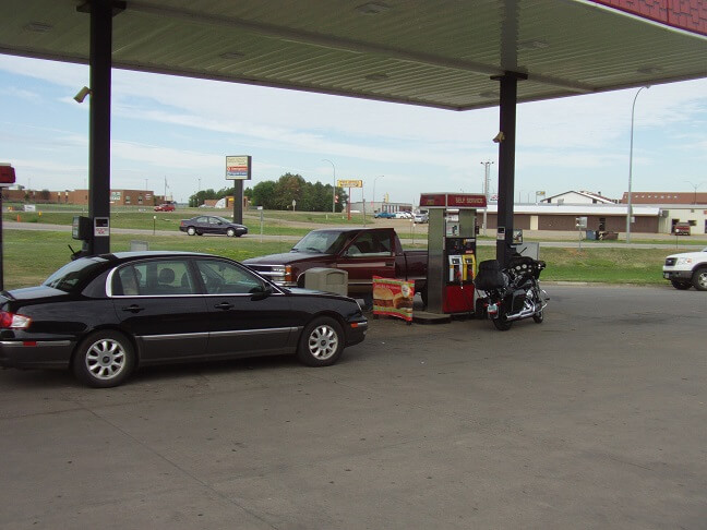
We'd only come 115 miles since leaving Sioux Falls, and had stopped in both Beresford and Irene. As a result we weren't yet feeling the rigors of the road so this gas stop was brief. 14 minutes after we pulled in we were back on highway 46 heading west.
About fifteen minutes later we passed through Pickstown, SD, which is unremarkable except for an Indian casino and the location where highway 46 turns into highway 18.
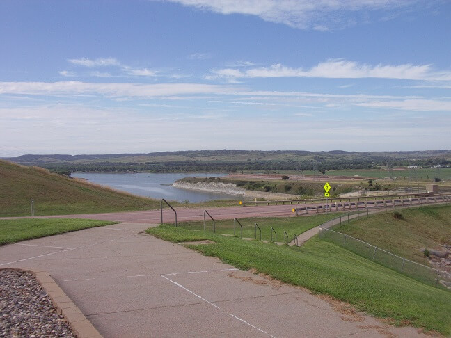
A couple miles past Pickstown, though, we crossed the Fort Randall Dam over the Missouri river.
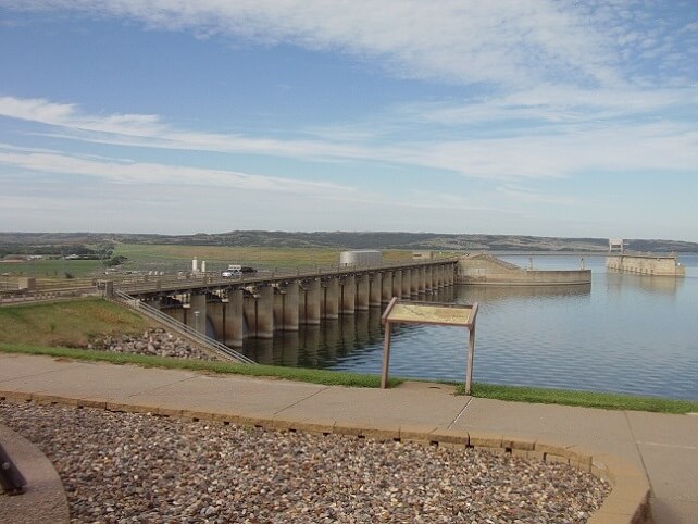
Fort Randall is one of four dams on the Missouri River in South Dakota. It is named for an old military fort that was located there prior to South Dakota becoming a state. If you travel down below the base of the dam there are still some ruins of the old fort. The dam itself forms Lake Francis Case.
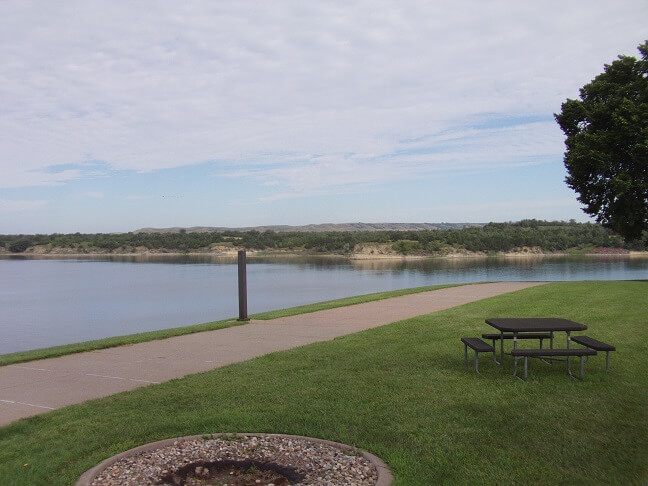
The foothills one travels through a couple miles on either side of the river are quite scenic. Especially compared to the vast flatness that comprises a good chunk of this portion of the state.
Across the dam and over the foothills we had about 20 miles until our turn. The road had straightened out. During this stretch we had another group of bikers come up behind us.
This day was August 6th, which also correlated with the first day of the infamous Sturgis motorcycle rally. Throughout our trip we passed many groups of riders either traveling to, or coming from Sturgis. It seems like any time we stopped people asked if we were heading to the rally. Our standard response was, "We're from South Dakota, so during Sturgis we head in the opposite direction." Not entirely true, but it's good for a laugh.
In any event, I'm suspecting this group of riders behind us was likely traveling to Sturgis. We were going right at the speed limit at 65 mph. They were traveling slightly faster. There was a steady stream of oncoming traffic that was hindering their ability to pass. At some point, one of the riders must have gotten impatient because suddenly he blasted by both of us on the left side of our lane while there was an oncoming car in the other lane. Idiot.
Thankfully the rest of the guy's group displayed a little more patience. About 30 seconds later there was a break in traffic and they were able to safely pass in the normal manner. They sped off ahead of us and I was fine with having some distance between us and that reckless moron.
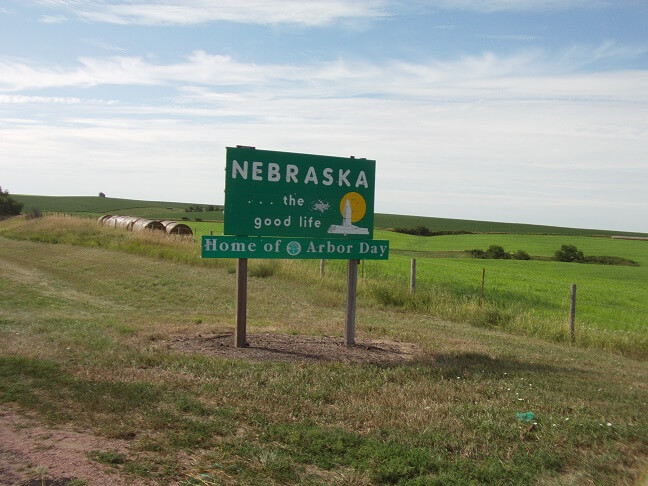
The highway ran about a mile outside of Fairfax, SD, which is where we turned south and headed into Nebraska. I'm quite familiar with Fairfax, as our family farm was located three miles northeast. I had visited the farm during two previous motorcycle trips. I say "was" located because we had just sold the farm eight months prior. Nobody had lived there for at least fifteen years. While my father was still alive he would travel out every couple weeks to mow the lawn and maintain the house. After his passing that responsibility fell to my uncle. However our family finally decided that, as difficult a decision as it was, it was finally time to sell the land. The farmer who had rented it from us for many, many years bought it.
We took highway 11 into Nebraska, but only for about 4 miles. In the town of Butte we headed west on highway 12.
The next hour or so was uneventful riding. There's a whole lot of nothing in this area of the country. When we would encounter a car the passengers would always wave enthusiastically, mainly because I think seeing another person is quite an anomaly.
Despite being uninhabited, the area was actually rather pretty in its own simple way. There were just enough little hills and mounds that were jutting up to keep the terrain interesting. Obviously it wasn't as breathtaking as some of the scenery we would be seeing later on in the trip, but it certainly had more character than miles and miles of corn.
After we had ridden about an hour into Nebraska I pulled over to check my map and take a stretch break. Before we left that morning I had announced my intentions on taking more stretch breaks on this trip, even if they were only a couple minutes long. I thought that might help lessen some of the "intensity" of long mileage days. My intentions were noble, but after the first day I wasn't as good about actually doing it.
In any event, we did stop for about 5 minutes to stretch. I walked a couple hundred yards into a field and used the natural facilities. As I walked back, a farmer came through a grove of trees and waved to us. We waved back. He may not have been as friendly had he seen me about 30 seconds earlier.
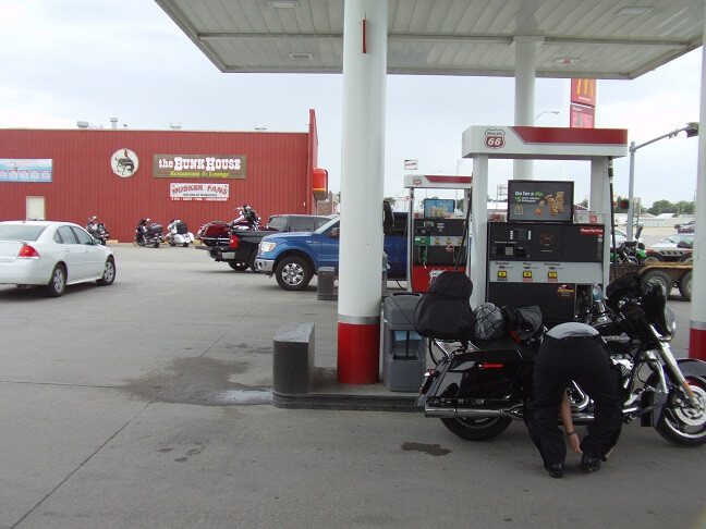
We pressed onward toward our lunchtime goal of Valentine, NE. There was a restaurant there called the Bunkhouse that I had eaten at four years prior, and I thought it would be a good stop for today's journey. What impressed me most during my last visit was I had gotten the best piece of blueberry pie of my life. I was hoping for a repeat performance.
I was getting quite hungry. My 6 AM bowl of oatmeal had long since worn off, and my tummy was growling loudly. I'm surprised Jon didn't hear it over the rumble of our pipes.
For quite a while, I had been seeing dark clouds looming in the south east. It looked like rain was inevitable, but the question was only a matter of "when." We were getting closer and closer to Valentine and I thought maybe we would make it before the rain hit. Unfortunately, about five miles out it started coming down. Not torrential, but more than a shower. It seemed pointless though to stop and take ten minutes to put on rain gear when we were just five miles from town. So we pressed on. By the time we pulled up at the restaurant we were pretty wet.
We went inside and ordered. We both got burgers. Being wet from the rain, I felt a little chilly as we sat and waited for our food. The service wasn't unusually quick. In fact, our server disappeared for quite a while.
Finally our food arrived. Jon's burger looked better than mine, and larger too despite mine costing $2 more. It was OK, but nothing to write home about. After we finished our main meal we both ordered pie.
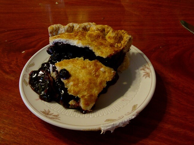
I got the blueberry pie again. I don't remember what kind Jon ordered. Mine was good, but not as good as what I remembered. Either I had an absolutely phenomenal slice four years prior, or my memories had inflated that pie to legendary levels with which no reality could hope to compete.
We paid for our meals and had a good chat with the lady behind the register, who was very nice. Back outside the rain had passed for the time, but still looked like there was more in store for us as we headed west. There was a gas station next to the restaurant so we rolled over and filled up our tanks. I used the bathroom and decided that if there was a "nastiest restroom award," the one at this gas station would be a title contender.
Before we pulled out we were debating on whether or not to put on our raingear. Jon was lobbying towards putting them on now, but I was leaning towards waiting until we actually hit rain. My reasoning was that if we don't hit rain for an hour we'll need a stretch break anyway, and the fact that my rain gear is much like wearing a cheap home improvement store tarp. Something inside of me said to just agree with Jon put on the rain gear now, so we did.
From Valentine, we continued west on highway 20. Well, Jon's hunch proved to be prophetic as not five minutes outside of town we hit rain. For the next few hours we would hit varying amounts. Sometimes it would come down hard, at other times just sprinkles, other times we'd get a reprieve for a few minutes. But I wound up not removing my rain gear until we reached the hotel that evening.
After about an hour of riding we pulled over in Merriman, NE. I wanted to make a couple of adjustments and stretch. Jon used the stop to visit the men's room. At the moment the road was dry, but we could tell more rain was in store.
We continued our travels west on highway 20, passing through periods of rain and other periods of dry. One particular downpour was fairly heavy and I dropped my speed slightly. I wasn't overly confident in my worn tires on wet pavement. Thankfully that cloudburst only lasted about 10 miles and there were no slipping issue with my tires.
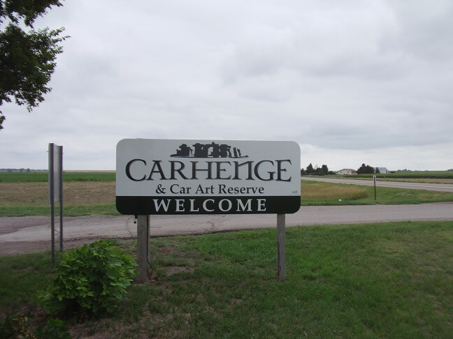
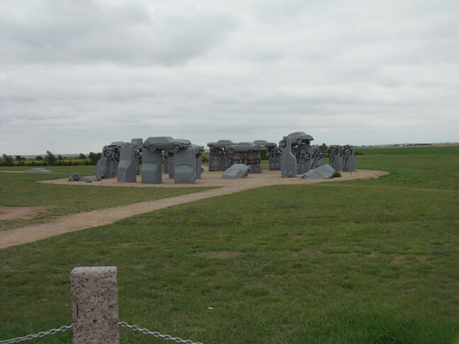
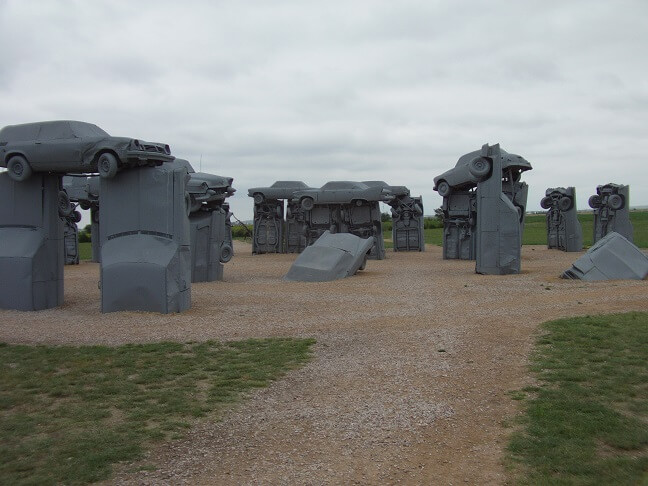
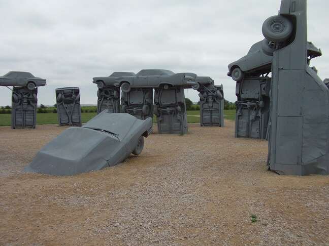
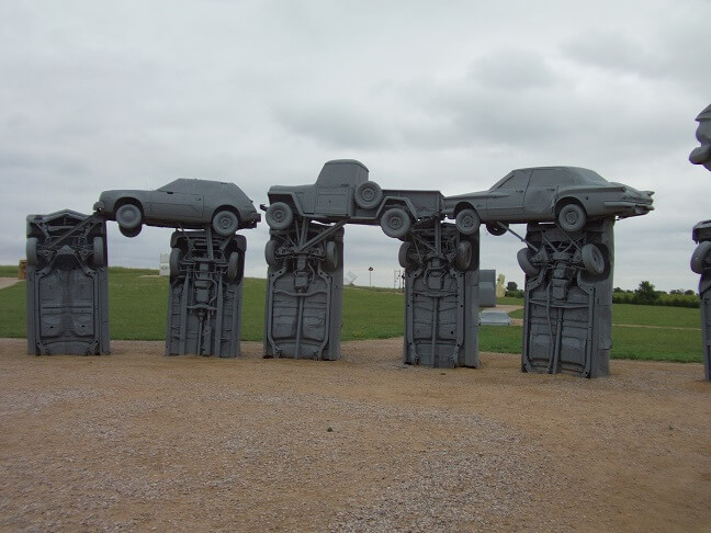
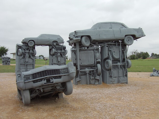
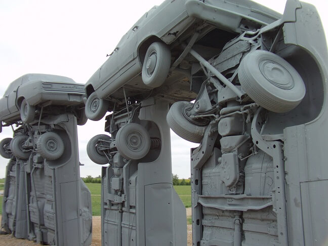
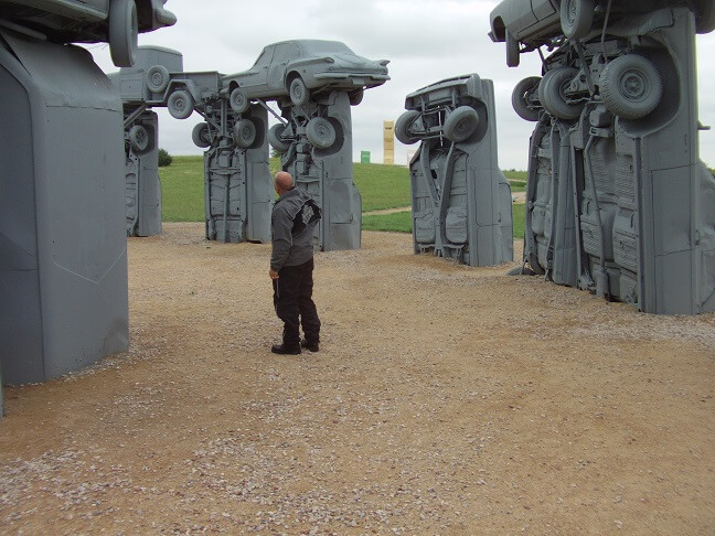
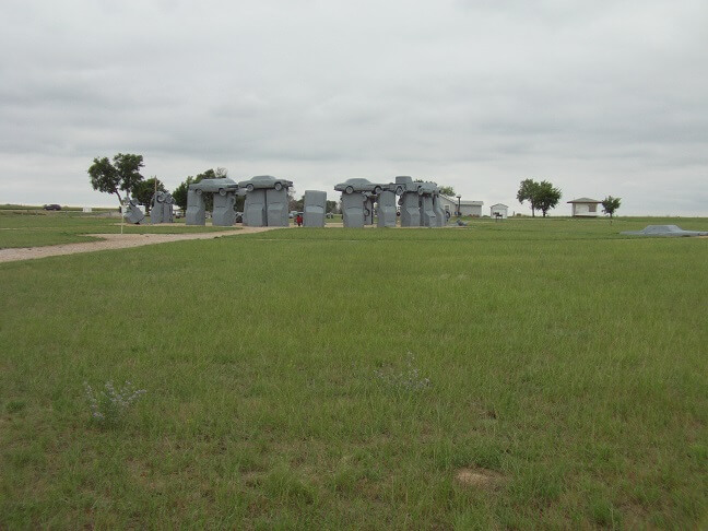
After what seemed like forever, we reached highway 87 and headed south towards Alliance, NE. Also, about 40 miles after we made our turn onto this highway was the world famous Carhenge. I had visited Carhenge four years previous, and found it entertaining. Jon had never heard of it. I figured as long as we were (quite literally) going right by it we should at least stop.
We spent a few minutes walking around and taking pictures. Most of the photos speak for themselves. At some point a local farmer decided to build a scale replica of Stonehenge, only using old cars instead of rocks. Now it's turned into an offbeat tourist destination.
After we looked around, we went into the visitor center/gift shop. I used the restroom and Jon struck up a conversation with the woman running the place. She was very friendly and chatty.
We had gone about 160 miles since our last gas stop. We probably had about 70 more in front of us. Both of our gas gauges were sitting pretty good and we thought about just leaving Carhenge and riding straight through to Scottsbluff. It looked like we had the range to make it. However, from my 2012 trip I remembered that once you leave Alliance, there is pretty much nowhere to get gas until Scottsbluff. Yes, we likely had the range to make it. However the consequences of being wrong would be pretty steep. We opted to play it safe and take the extra 15 minutes for a gas stop in Alliance.
From Carhenge to Alliance is only about four miles. I didn't even bother putting in ear plugs. Once we were in town I found a gas station that looked suitable and pulled over.
We topped off our tanks as planned. The rain seemed to be holding off, but the wind had picked up. I opted to leave my rain gear on as while it wasn't currently raining, the clouds weren't looking much different than they had most of the afternoon when it was wet.
I gave my tires a check. The tread seemed to be looking OK for now, but I was going to keep an eye on it throughout the whole trip. Actually, as you will soon read I became more and more paranoid about it as the trip progressed.
I was thirsty and thought a soda sounded good, but was dismayed to find that this particular gas station didn't sell anything for less than $2. I decided I wasn't thirsty enough to drink a $2 bottle of soda and opted to wait until we got to our hotel.
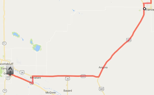
Back on the road we headed south on highway 385. The wind was really blowing now, and I was glad we didn't have too much farther to go. We got stuck behind a slow moving RV for about 10 miles, and oncoming traffic was steady enough that there wasn't a good way to pass.
At the intersection of 62A we headed west. The RV also turned west ahead of us, but thankfully right after we made the turn the road ahead was clear and we were able to easily pass. We were heading straight into the wind now.
A few miles down the road it merged with highway 26. Then a few miles further down we turned left on 79E to cut over to highway 92. Our motel was actually in Gering which is a sister-city with Scottsbluff, and this little jog was the fastest way to get there. Right after we turned onto 26 we were briefly delayed by a train. This thing was moving extremely fast though, so we didn't have to wait long.
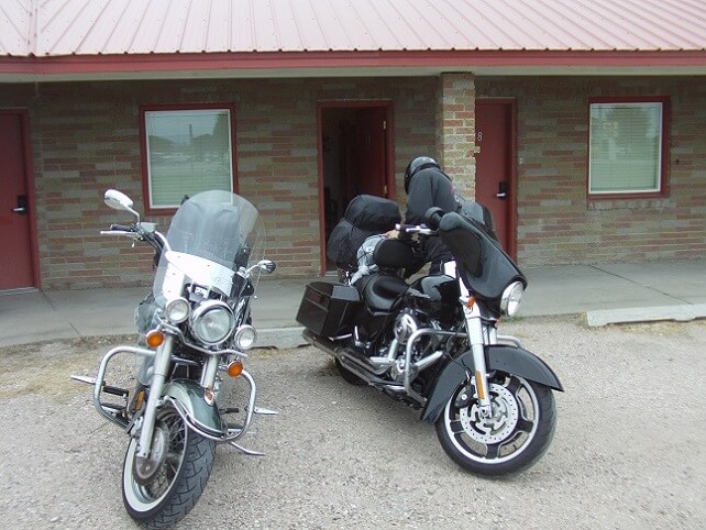
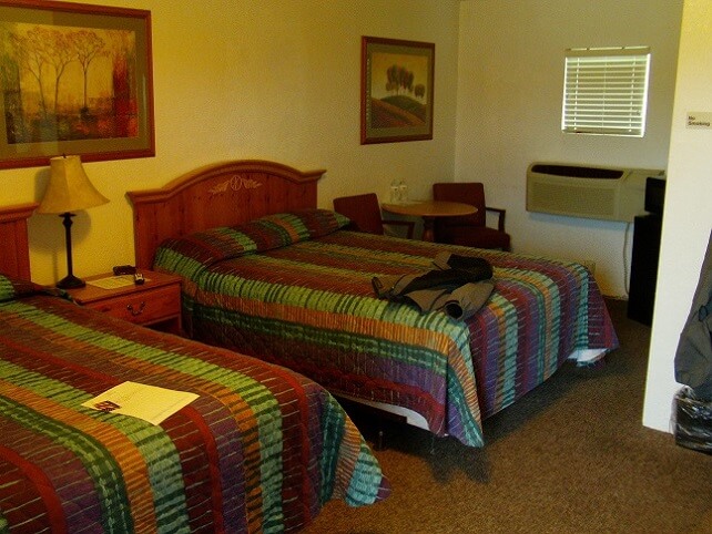
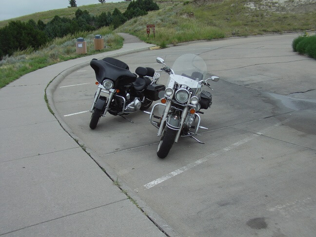
Nearly 500 miles after we left Sioux Falls, we arrived at our motel: the Circle S Lodge. I have to admit, when we pulled in I thought it looked a bit sketchy. Jon later said that he was even more skeptical than I. However, we only needed a place to sleep so as long as there weren't parasites it would do. As it turned out, though, once we were in our room in we found it actually to be quite nice, especially for the low room rate.
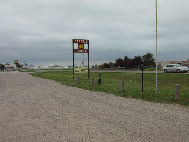
We went into the office and checked in. The woman behind the desk was very friendly. The motel had recently taken on new ownership, and she had only been working there a couple of days so she was still a bit iffy about the process and where things on the desk were located. Once she got all of my payment information, she then turned to Jon and said, "Do you have reservations too?"
I had a brief moment of panic that I had mistakenly reserved a single occupancy room. However the confusion turned out to be on her end. Our room did have two beds. As I joked with the woman, "Jon and I are close, but not that close!"
We moved our bikes down to the room. The manager told us we could park on the concrete up under the overhang of the roof, as it may rain and she didn't want our bikes to sink in the wet gravel parking lot. There wasn't anyone staying in the room next to us so she said it wouldn't be a problem if we blocked the door.
We stated that we would probably take her up on the offer later that night after we returned from getting something to eat. We were both pretty hungry.
We spent about 1/2 an hour unpacking, removing rain gear and getting situated. I tried to connect to the motel's WI-FI but wasn't successful. The manager told me that other people had been having problems with it and they needed to get someone to look at the issue. Curiously enough, my phone also wouldn't connect via data either. I wrote it off to poor cell service and didn't think much of it at the time.
Having gotten to the hotel a little after 5 PM local time, we had the whole evening in front of us. I suggested we go explore the national monument that was just a couple miles away, and then go find something to eat. I think Jon was more interested in the getting something to eat part, but agreed to humor me.
The rain looked like it was going to hold off, but the temp was a bit on the cool side. Actually, I don't know that the temp was all that cold (a local bank sign said 63) but the wind was really gusting hard and that made it seem colder than it was. I swapped out to my heavy jacket, but left the rain gear in the hotel room.
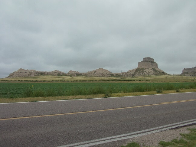
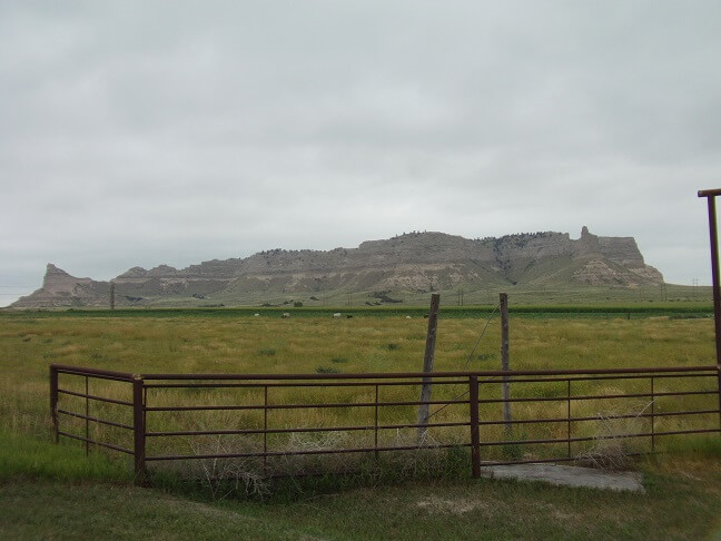
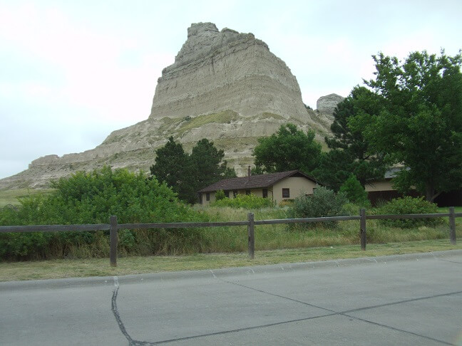
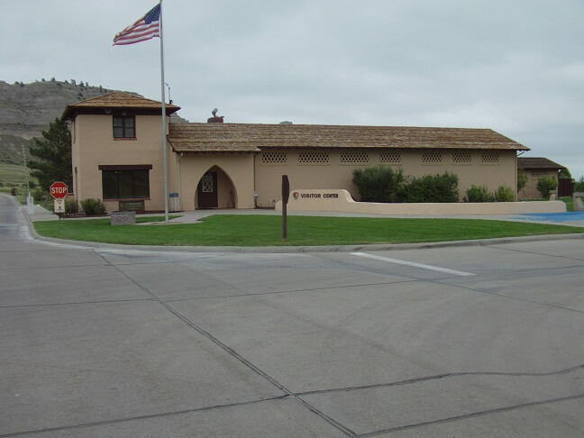
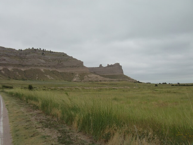
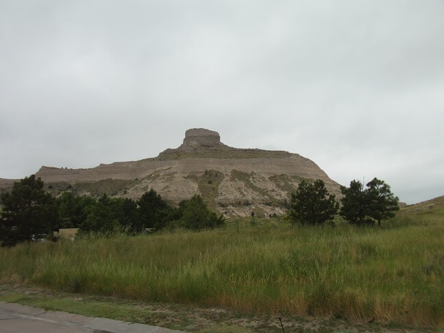
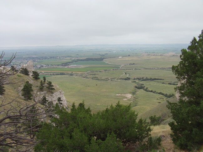
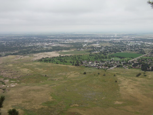
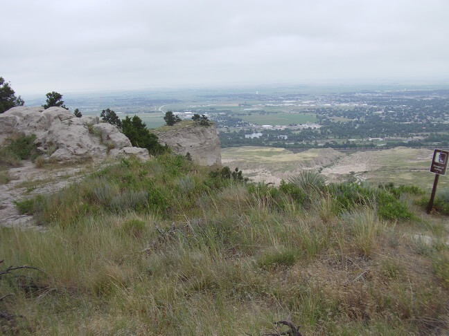
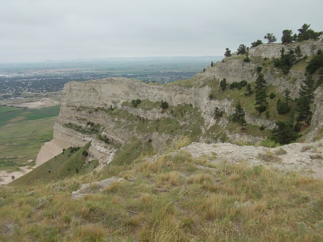
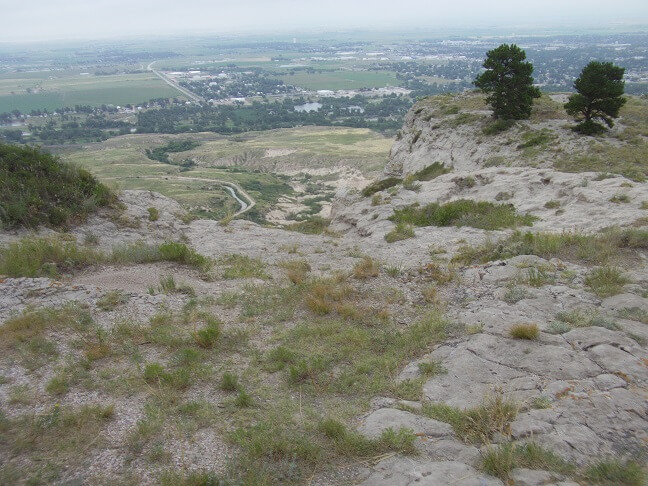
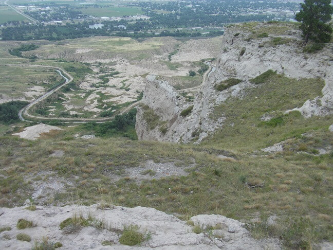
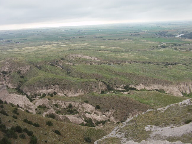
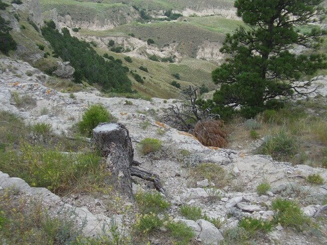
On the west side of Gering is the Scottsbluff National Monument. There are mountains in Nebraska. Who would have thunk it?
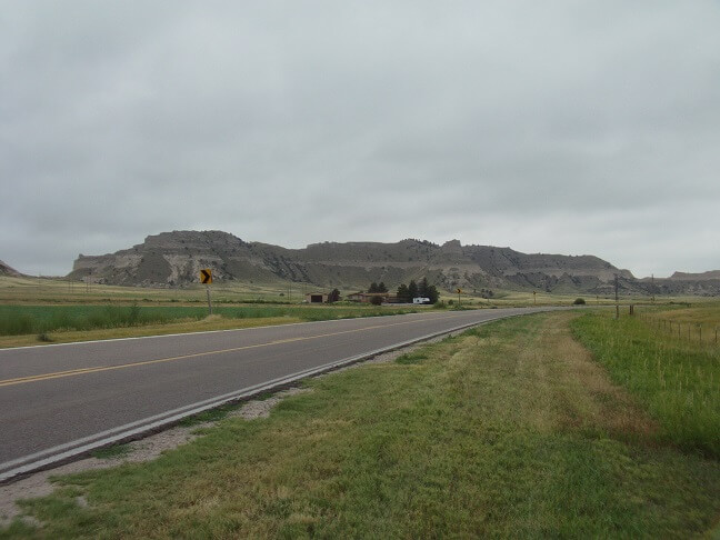
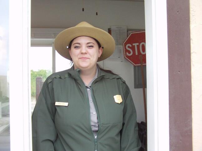
We pulled into the entrance road and stopped at the gate. It was $3 for each motorcycle to enter. I decided that was a fair price. The girl running the gate said that they close at dusk, which tonight was going to be about 7 PM so as long as we were heading back down the mountain by that time we would be fine. I told her we were quite hungry so there was little danger in us staying past dark.
On a whim I decided to snap a picture of her. She laughed and said it was the second time that day someone had taken her photo.
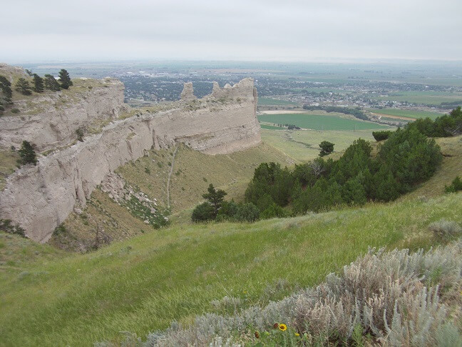
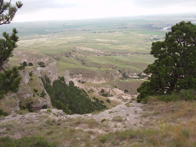
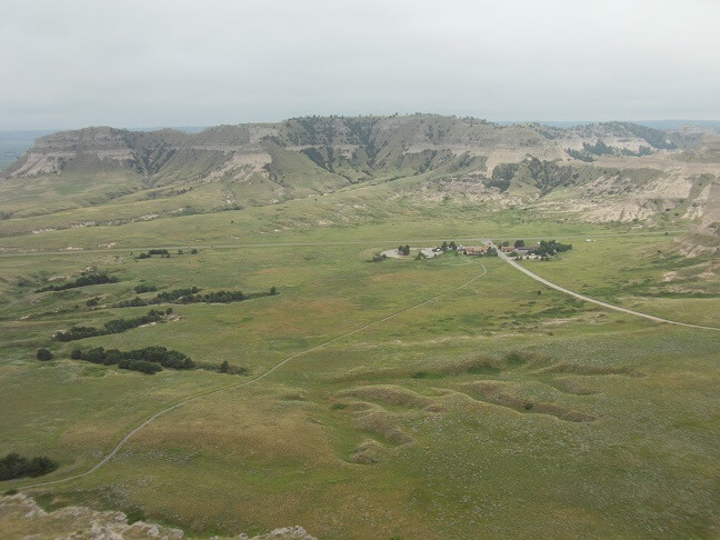
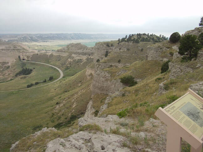
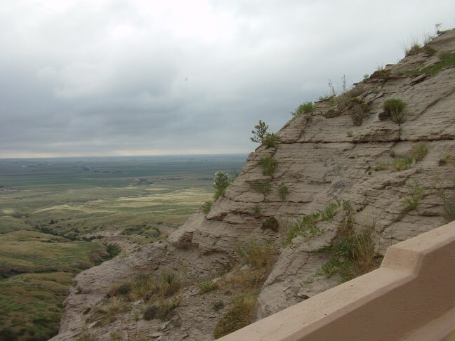
We rode into the park. Very, very pretty. My limited vocabulary won't do it justice, so I'll let the pictures do most of the talking.
The road up the mountain was very twisty and scenic. We weren't trying to break any speed records, just putting along and enjoying the scenery. I came around one corner to discover a car heading down the mountain who was well into my lane. Lucky for me I wasn't hugging the center line and was able to swerve to the rightmost side of the road and avoid a head-on collision. Goofball.
At the top of the mountain was a small parking lot. From there various hiking trails would allow visitors to explore the park.
We decided to walk around a bit and snap some photos. When we started there was one other family that was just leaving. So we pretty much had the whole mountain to ourselves. Not that this was a big deal, as there was plenty of mountain to share.
There were some trails that were miles long, but we picked one that was only about half mile in distance. As hard as the wind had been blowing at the bottom, up on the top of the mountain it was at least twice that speed. At times the wind almost felt like it was going to pick us up and blow us off the mountain. I am happy to report there were no casualties.
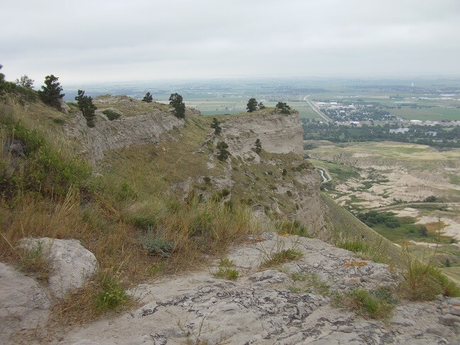
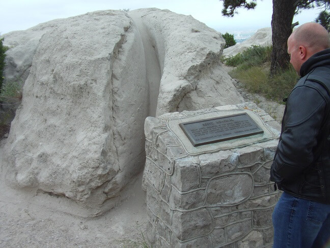
Apparently the monument was named after Hiram Scott, a fur trader who died in 1828. At the top there was a small plaque commemorating the bluff upon which he died.
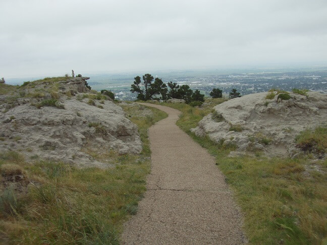
The trail eventually led us back to the parking lot. There was another trail on the other side of the lot that said it was only 1/4 mile long. I suggested we explore it, and once again Jon agreed. I at the time think he was just appeasing me, but in the end he was probably glad to have seen the view.
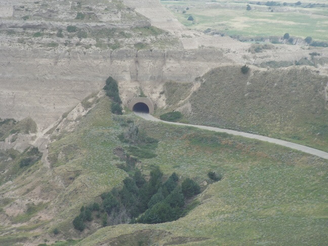
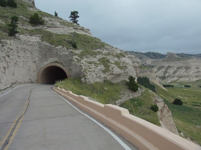
The road up the monument featured several tunnels. From the top I was able to get a close-up of one.
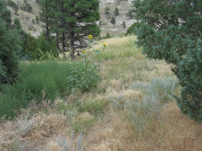
Wild sunflowers were in abundance. In fact, we passed several sunflower farms as we crossed Nebraska that day.
Dusk was approaching so we decided to make our way back down the mountain and find something to eat.
We waved to the ranger as we left the park to let her know we weren't still roaming around up there, and then headed back to town to find some supper. Jon was wanting chicken. I had located a KFC in the city of Scottsbluff, so we rode that direction. I'm not a huge KFC fan, but at this point I was hungry too so I wasn't going to argue. Besides, Jon had humored me about hiking around the mountain so this was the least I could do.
The KFC was found and we pulled in. At this point Jon stated that he may not get anything to eat. During this summer he had been assigned the night shift at work. He swapped his sleep schedule around for this trip and was starting to feel the effects of it. He wasn't sure if he was hungry or just bone tired. He told me if I wanted to find somewhere else to eat, he'd be fine with that. I didn't know where else to go and wasn't in the mood for anything in particular, so I decided I'd just be fine with eating here. Besides, this KFC was combined with a Long John Silver's so if the chicken didn't look good I could have fish.
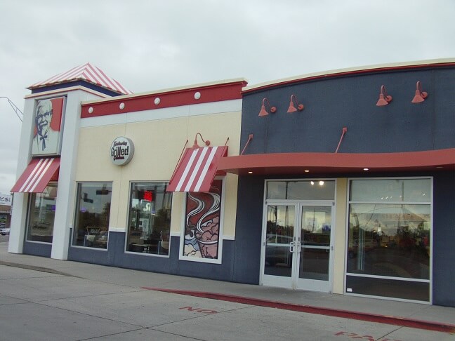
We went in and ordered. Jon did decide to try and eat something. None of the fish items looked that appealing so I ordered a 3 piece combo. I did find it interesting that the prices here were noticeably higher than back at home. In fact, their "$5 Fill Up" meal was $6.99.
We sat, ate and talked for at least an hour. I realized I had ordered too big of a meal. Then Jon decided he didn't want his biscuit or his cookie, so he gave them to me. Because I'm a pig I ate everything, and left feeling a bit overstuffed. I like to say all my fat comes from sin; it's a sin to throw food out, so I eat it.
We climbed back on our bikes and headed back to the motel. It was getting pretty dark at this point. I was feeling so stuffed from the chicken that I didn't even have the energy to dig my clear glasses out of my windshield bag, so I decided to ride back wearing my shades. Bad choice. I could barely see anything.
Back at the hotel there was a gas station right next door. We topped off our tanks so our bikes would be ready to go in the morning. Then we rolled over to our motel room and pulled them up under the overhang.
We took turns showering and preparing for bed. The shower was notable as it had more water pressure than any other I've experienced in recent memory.
I attempted to call my wife, but every time I dialed it would disconnect immediately. I finally tried texting her and that worked. I explained the phone situation and that I would try and call the next night. As it turns out, she had an extremely bad day and had I been able to call I would have gotten an earful. It was probably better that the phone didn't work.
I spent some time translating the Google map instructions for the next day's route into to Tundra English. Google maps is very helpful, but when it comes to turn-by-turn directions I think they fall short in two ways.
First, they're too detailed. My logic says "turn right on highway X and follow it for Y miles." Their directions will be "turn right heading north on highway X for Y miles. Bear right. Follow highway X for Z miles. Stay on highway X/W for U miles." Both versions are correct, but my version is a lot easier to glance at and figure out while riding a motorcycle.
The second is in creating maps with multiple destinations. For example the next day's route had us leaving Gering and riding to Fort Collins, CO as our first top, then going northwest to Steamboat Springs for our second stop. Google's directions will take us through various streets in Fort Collins until we reach the geographical center of town. While I did tell it that Fort Collins was a destination, we didn't need to go to the middle of town. So my directions remove all that "noise" and just told me what highway to take to get through Fort Collins.
I did this translation every night for the following day's trek. I had printed out the maps/directions for each day in six "packets" I stapled together, along with our hotel information for that evening. I would fold the packet in thirds so it would fit in my vest pocket, and jotted my notes on one of the sides so that I could easily pull it out and read the next step. It took about 20 minutes per day but paid back in dividends in time savings versus having to pull over and decipher what the Google directions were actually saying.
Around 9:30 we turned out the lights. We were now on Mountain Time, so our bodies were telling us it was actually 10:30. Couple that with the 500+ miles of riding we'd done, and it felt good to fall asleep.
I slept pretty well. Jon had a hard time sleeping despite how tired he was because his body was still on a night shift schedule.
Return To The Main Motorcycle Gallery
This page last updated on 06/28/2018